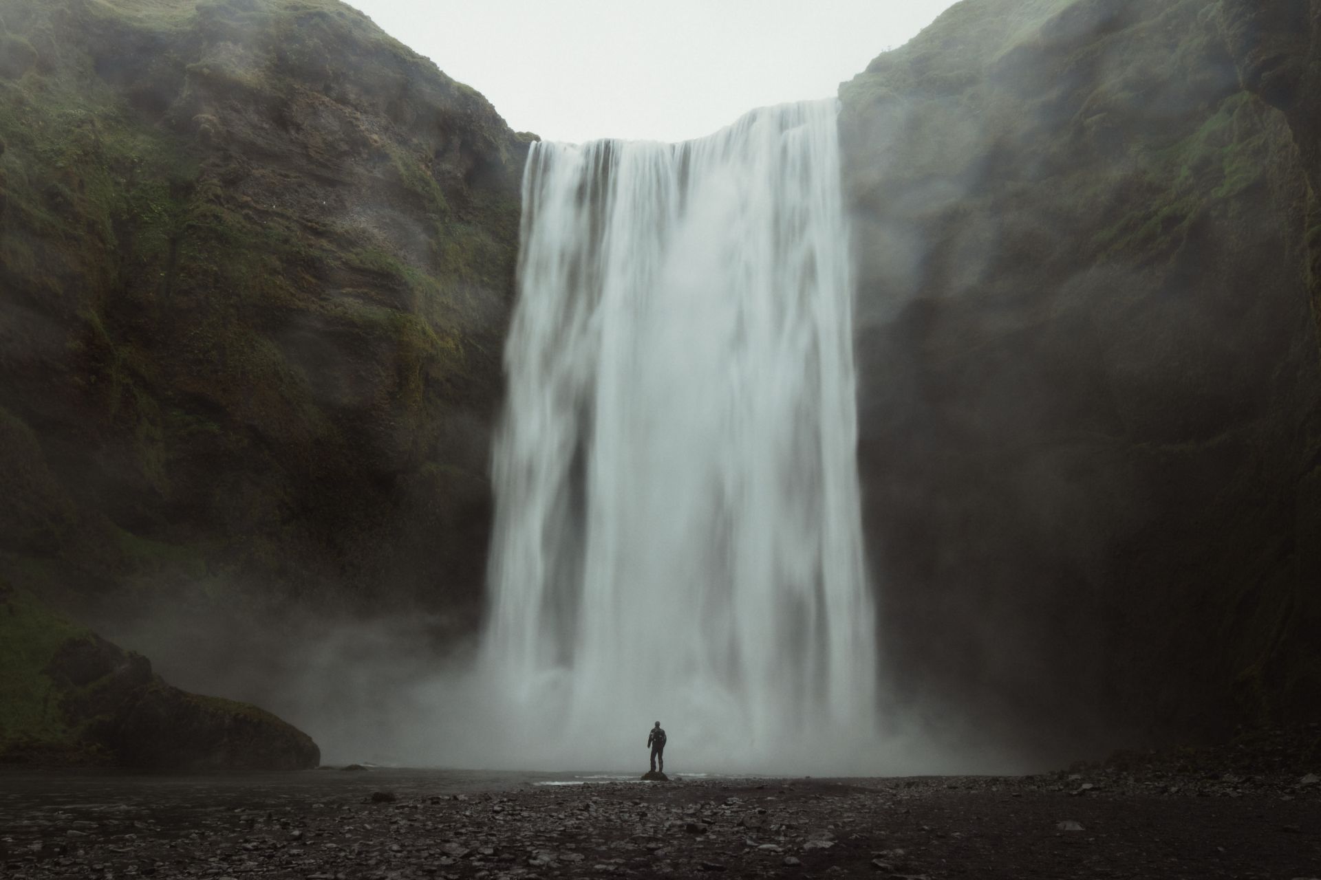
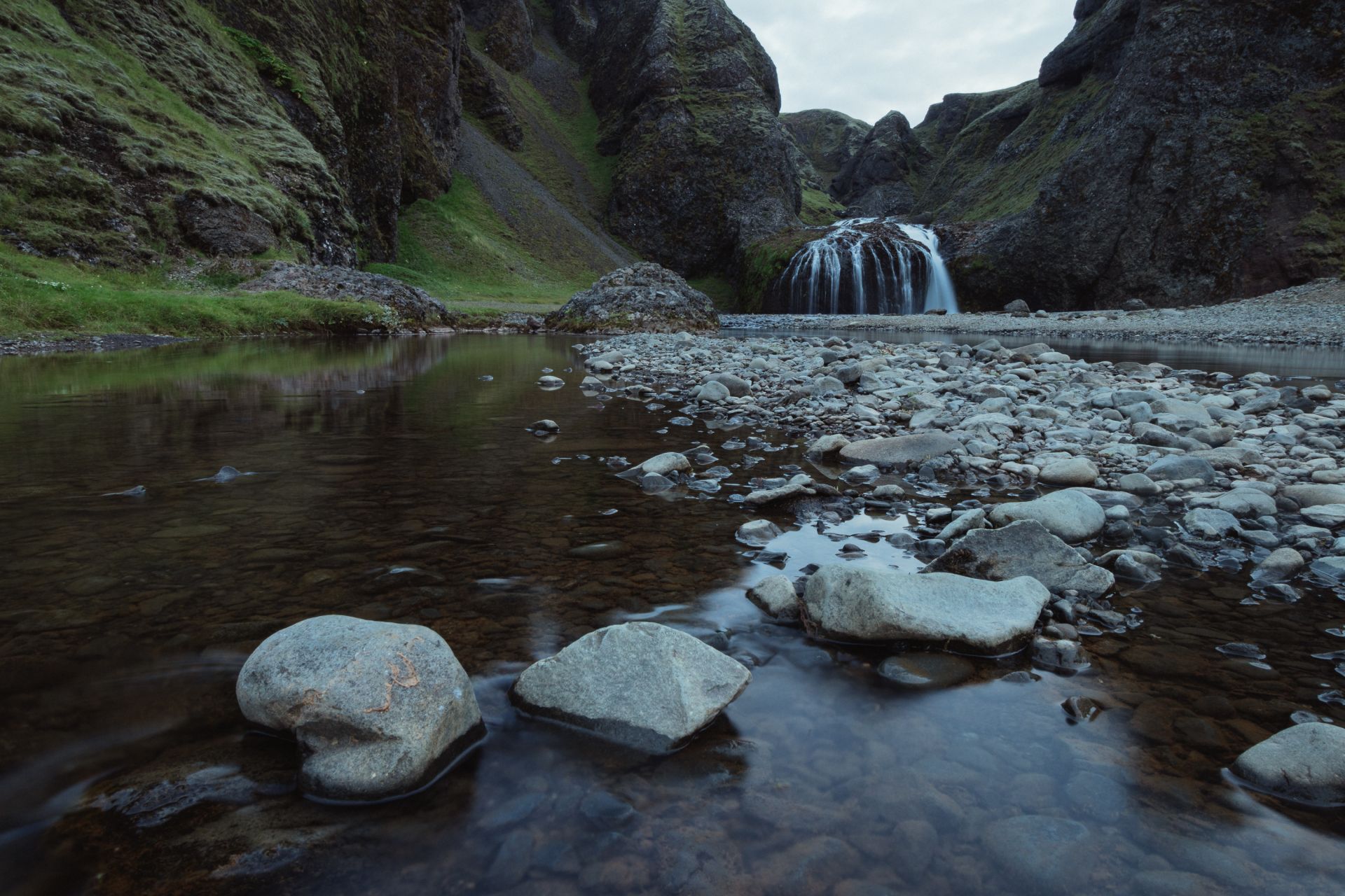
Skógafoss waterfall
Somehow, I manage to get myself up before 6 am and, finally, I have the waterfall all to myself. Skógafoss really makes an impression. The water drops 62 metres and is 15 metres wide.
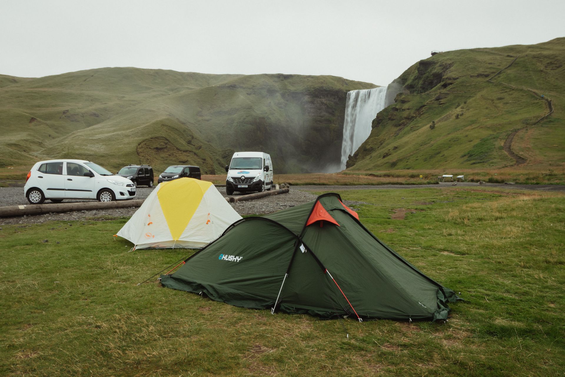
Skógafoss waterfall
Somehow, I manage to get myself up before 6 am and, finally, I have the waterfall all to myself. Skógafoss really makes an impression. The water drops 62 metres and is 15 metres wide.
After an hour of taking photos, I crawl back into my warm sleeping bag and sleep for a few more hours. It's past 2 pm when I wake up, so it's definitely time to get moving.
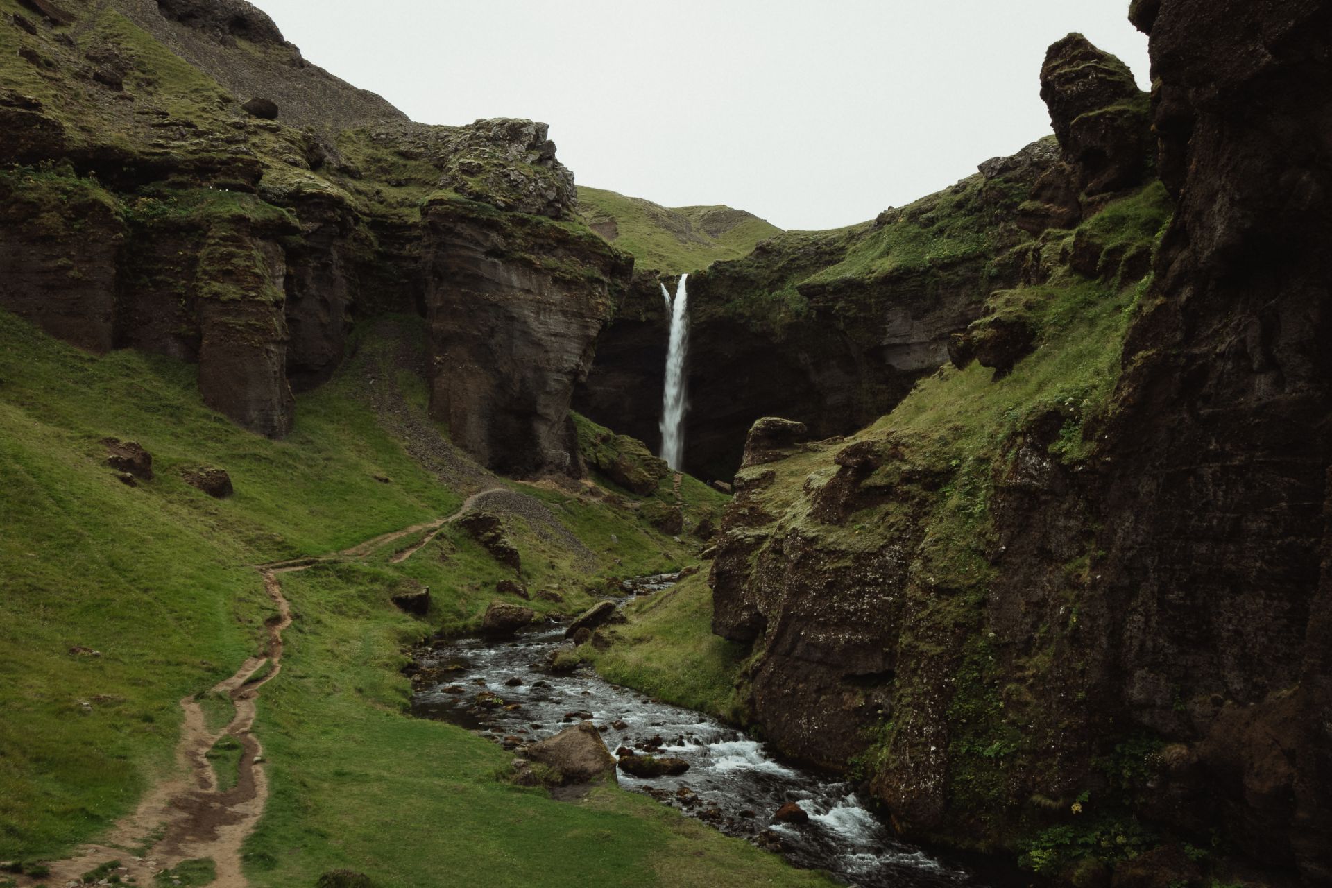
Kvernufoss waterfall
This one’s just 1.5 km from Skógafoss. You can reach it via a short trail along the river valley.
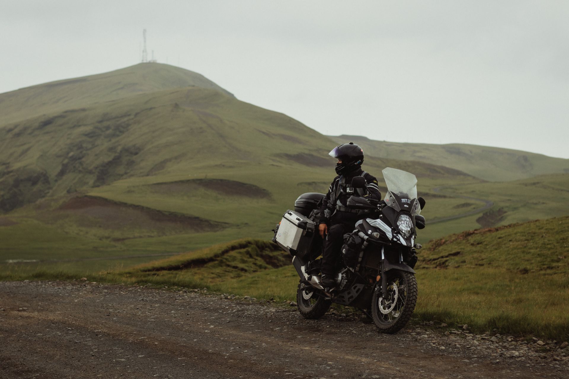
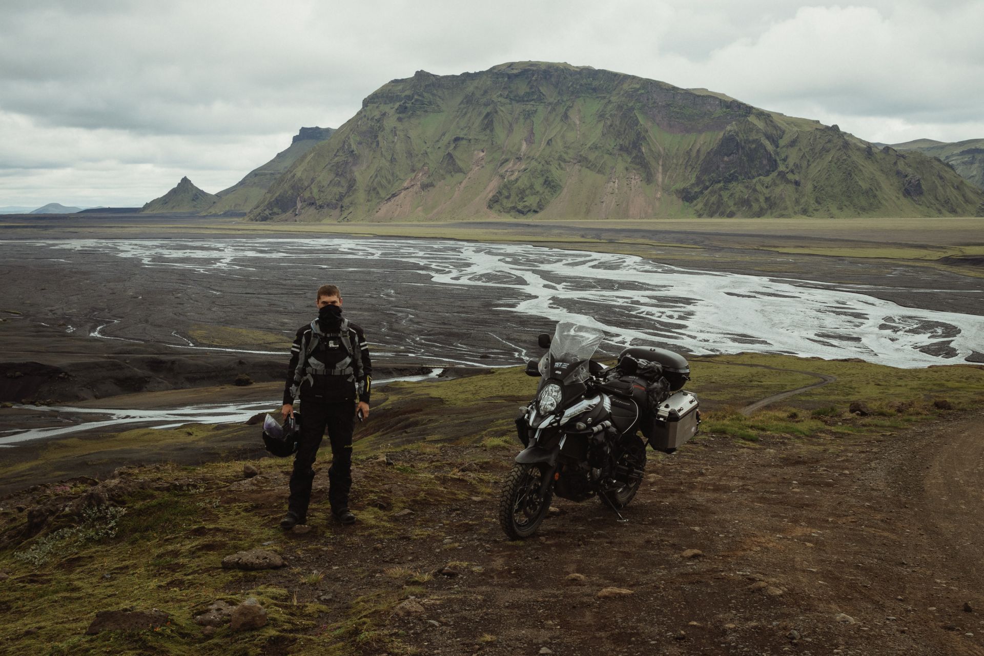
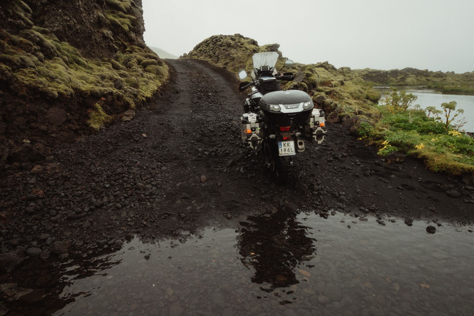
I ride to Vík to fill up the bike and stock up on supplies. About 5 km east of Vík, I turn north towards the Þakgil canyon.
Road to Þakgil
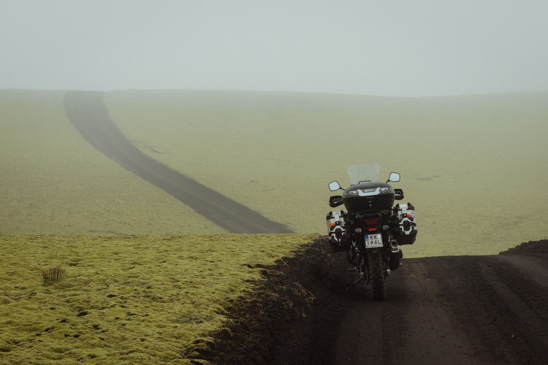
The next dozen or so kilometres are exactly the kind of Iceland I came here for — narrow gravel roads, hillocks covered in yellow-green moss, and wide river deltas. Even though it’s 10 pm and starting to get dark, I’m not rushing to the campsite. I’m just enjoying the stunning scenery. It’s absolutely worth coming here.
Two kilometres before the Þakgil campsite, I turn right and reach the point where the road ends and the hiking trail begins.
I arrive at the campsite at twenty past midnight.
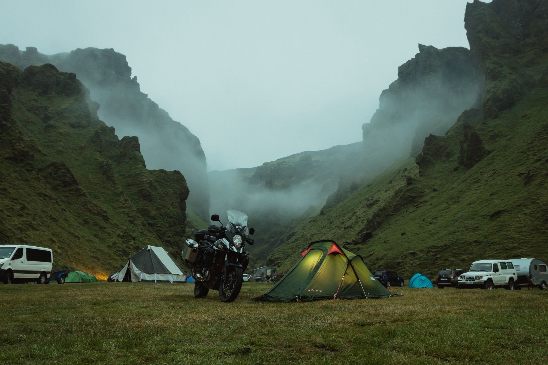
Þakgil
The campsite is surrounded by rugged hills. Unfortunately, there are no other bikers here, but quite a few tourists — most of them still up and about.
After breakfast, I take a short walk to a small waterfall around 400 metres north of the campsite. It’s an easy walk, even in motorcycle gear.
Around 2 pm, I leave the campsite and head back to the Ring Road. I stop a few times for photos, so it takes me two hours to cover this 12-kilometre stretch.
Back in Vík, I grab lunch and pick up some groceries. The waitress tells me that all the staff at the shopping centre are Polish — except for one girl from Venezuela. After lunch, I continue heading east.
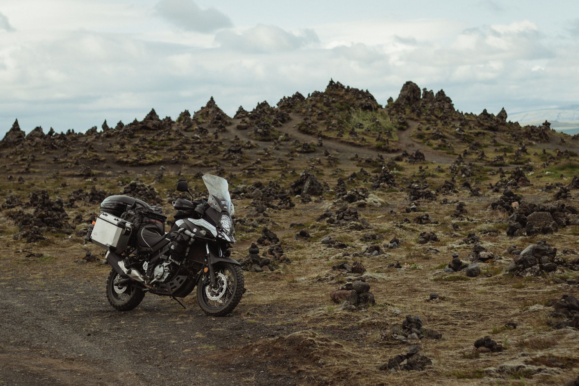
Laufskálavarða
A lava field just off the Ring Road, filled with small stone cairns.
Around 8 pm, I arrive in Kirkjubæjarklaustur. There are two campsites here — one doesn’t allow motorbikes, and it has no kitchen or laundry facilities, so I head to the other one.
The second site, Tjaldstæðið Kirkjubær II, is much better equipped. It's 1800 ISK per night, plus 300 ISK for a shower and 1600 ISK for washing and drying clothes. I start the laundry and ride out to explore.
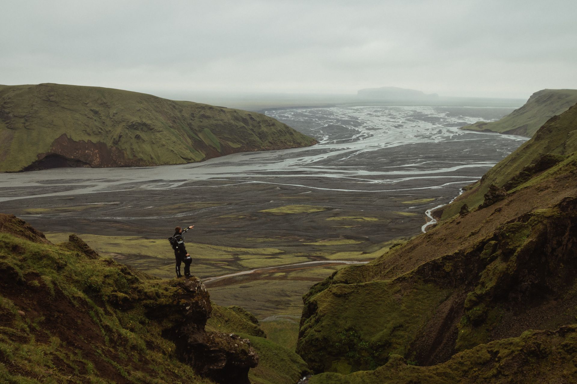
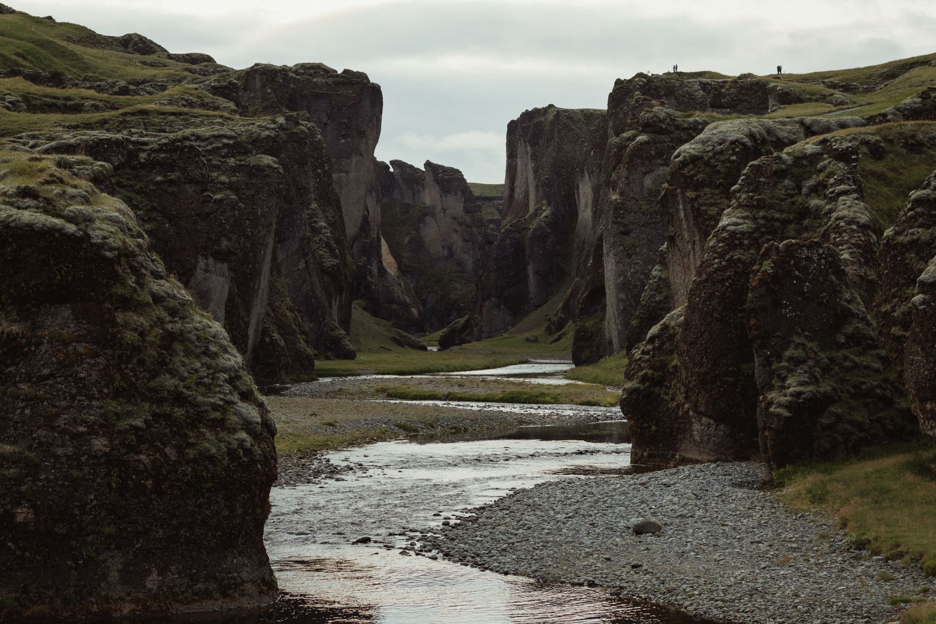
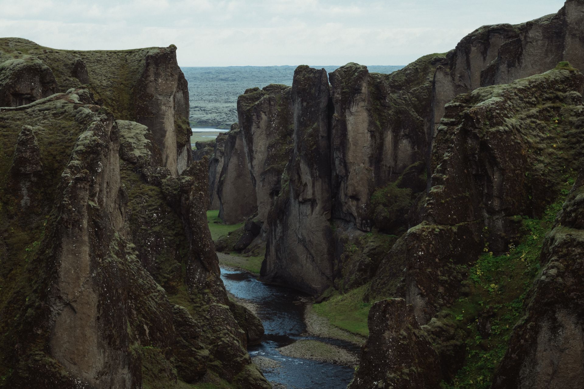
Fjaðrárgljúfur
A 2-kilometre long canyon, about 100 metres deep. There’s a viewpoint and a small waterfall, just 400 metres from the car park. Definitely worth a visit.
Stjórnarfoss waterfall
This waterfall is just next to the other campsite (the one without facilities). It’s not tall — about 10–15 metres — but very picturesque.
By 11:30 pm, I take a few photos, head back to my campsite, collect my laundry and call it a night.
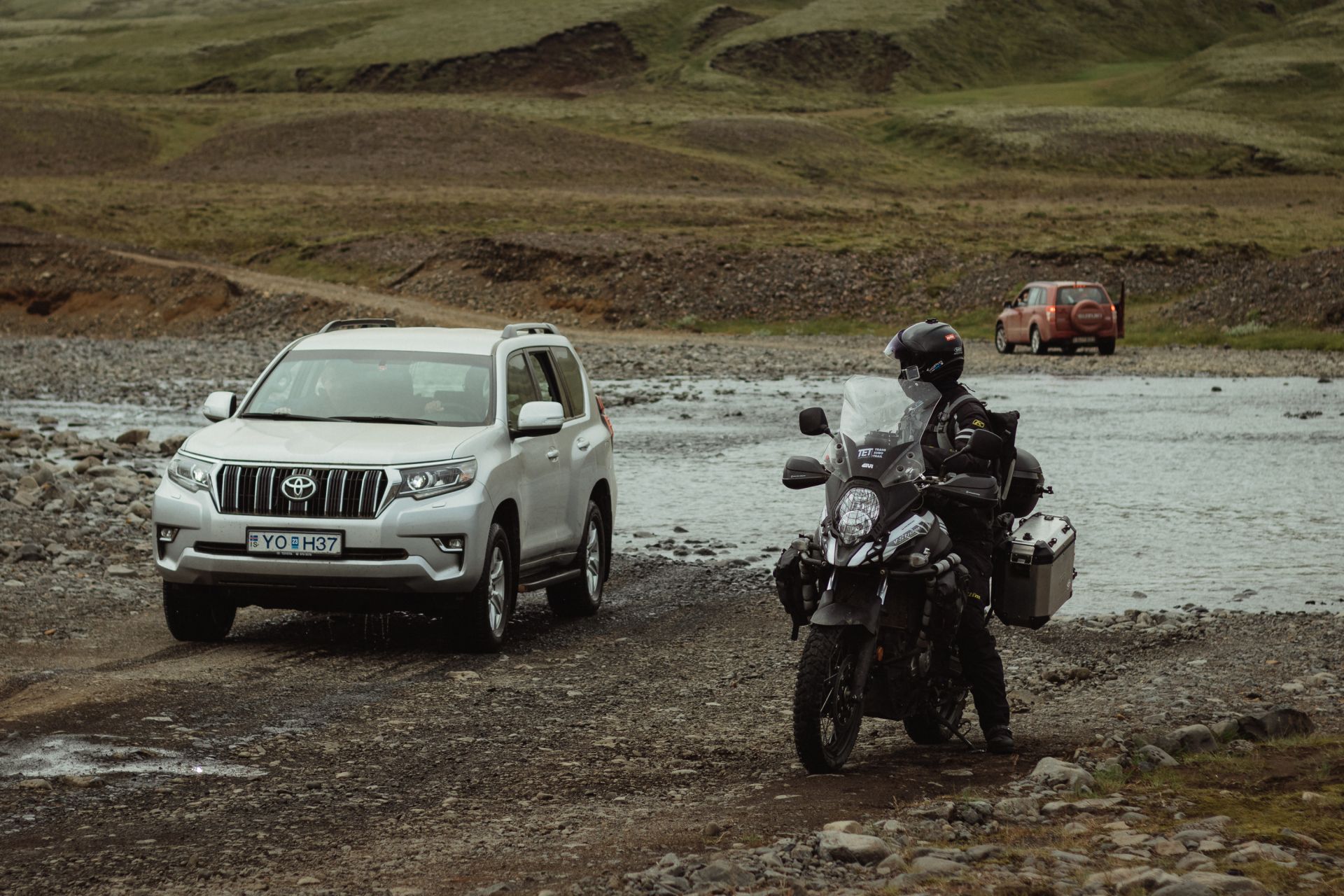
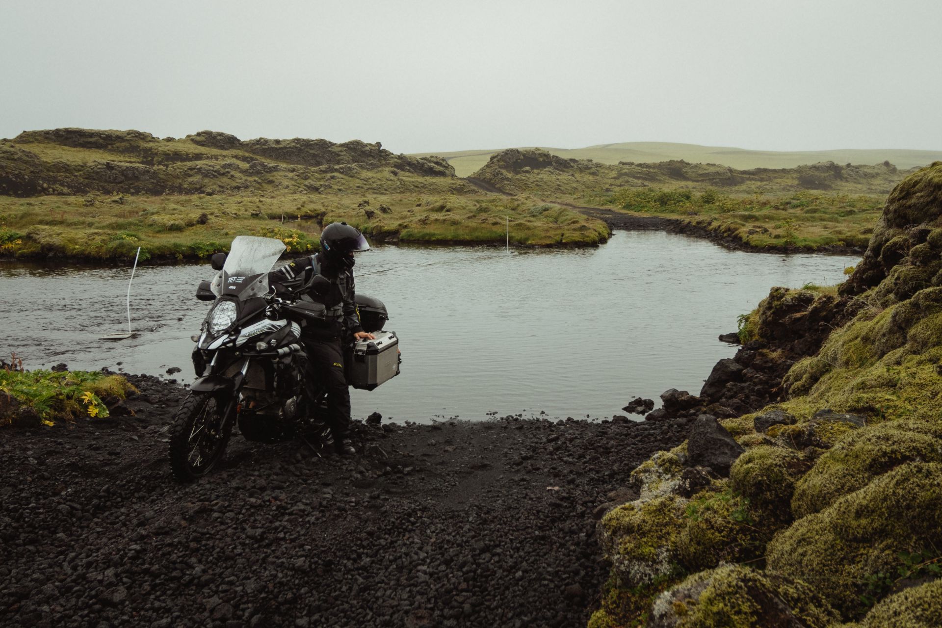
At the tourist information office in Kirkjubæjarklaustur, I ask how to reach the Lakagígar craters, about 30 km north. The road is tricky to find, and it’s not shown on Google Maps. The lady at the office gives me directions, but warns that I’ll have to cross three deep rivers — and recent heavy rainfall has raised the water levels.
Route F206
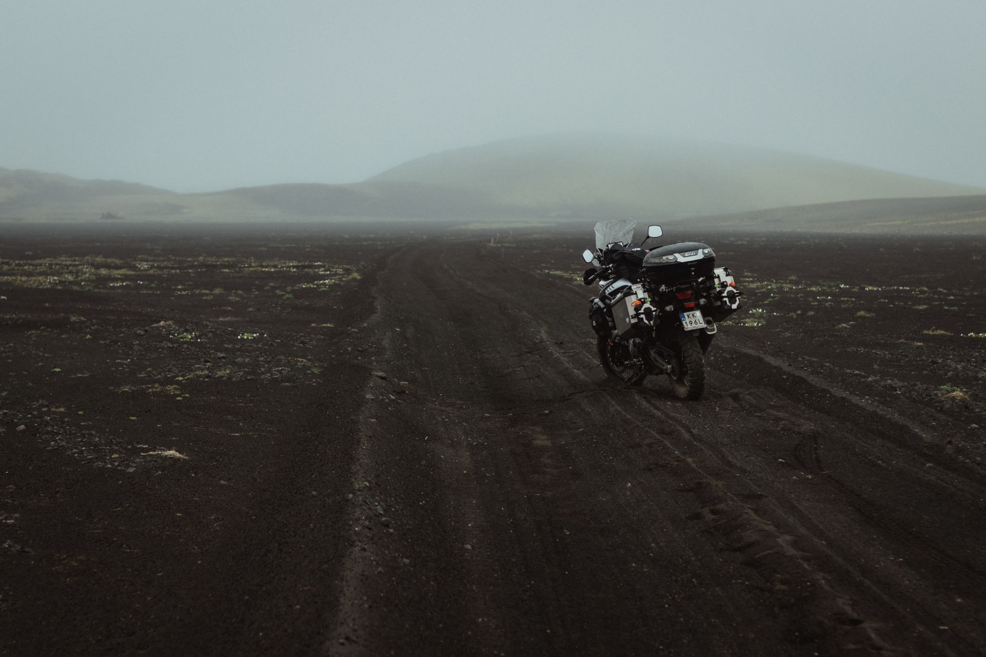
I ride to Fjaðrárgljúfur canyon, then head north on route F206. It’s roughly 30 km of gravel road to Lakagígar.
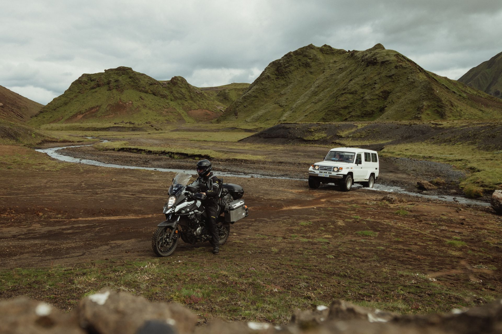
The first river crossing isn’t too deep — I get through without trouble. Cars manage it fine, too.
The second one is noticeably deeper. I watch a few vehicles attempt it. Two tourists in a Dacia Duster turn back — too deep for them. I follow the poles on the left side and manage to reach the other bank.
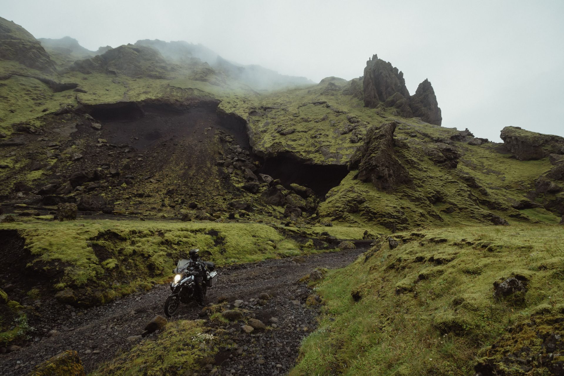
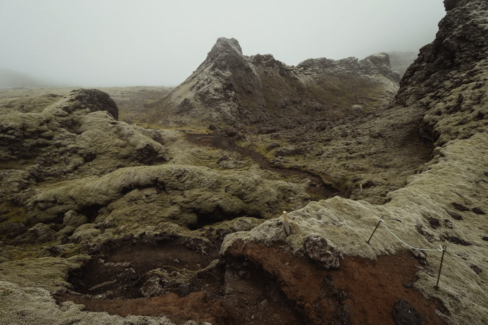
Lakagígar
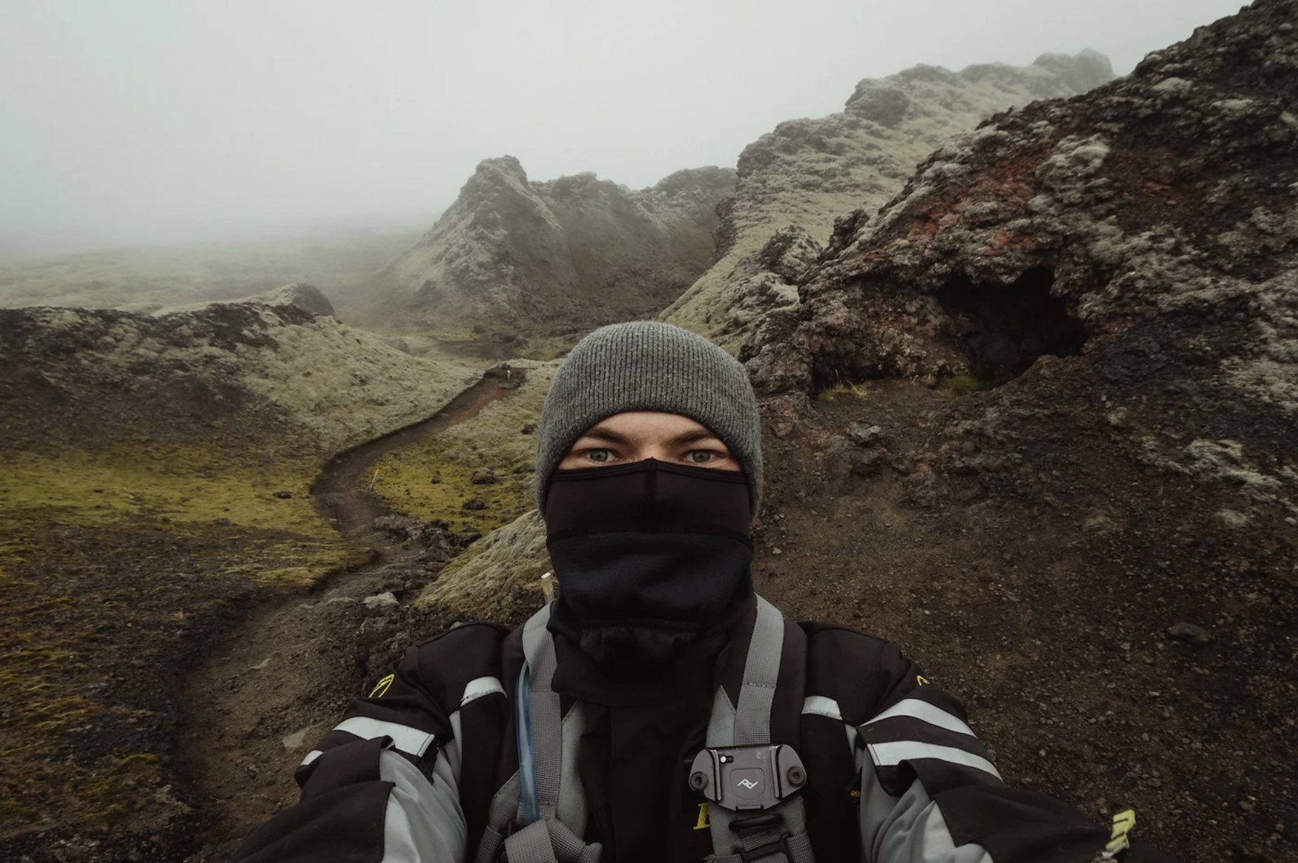
Unfortunately, as soon as I arrive, the weather turns and thick fog rolls in. There’s a small tourist hut next to the car park. The lady inside says there’s no point climbing Laki — visibility’s too poor — and suggests the short loop trail through the craters at the foot of the mountain instead.
The trail takes about 15 minutes, but it's really interesting. Volcanic rocks on both sides of the trail are covered in moss, and the thick fog adds to the experience.
I continue on route F207, which loops back to F206 around the craters.
Tjarnargígur crater
About 5 km west lies the water-filled Tjarnargígur crater.
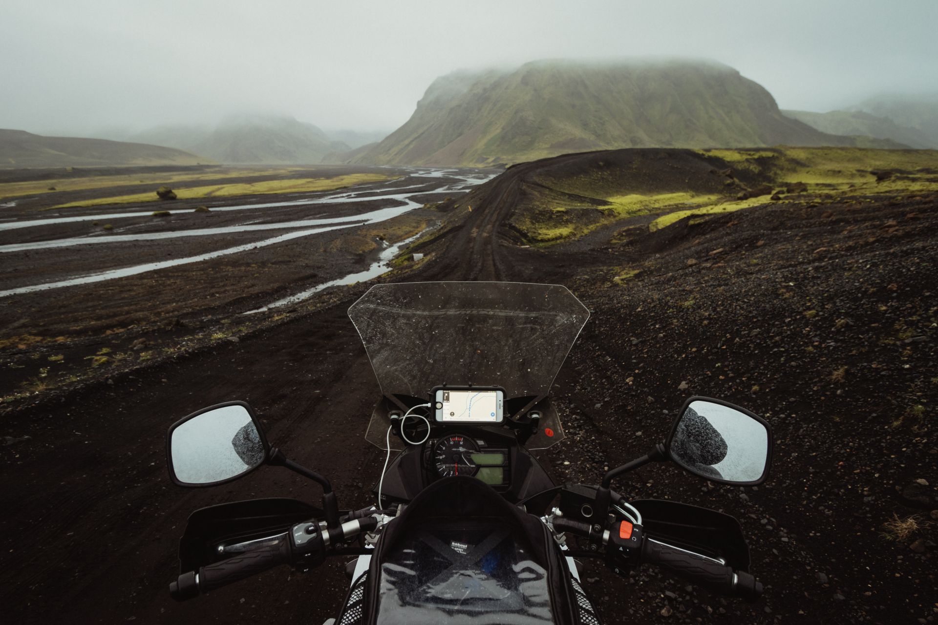
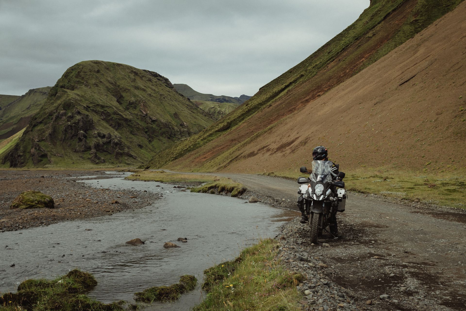
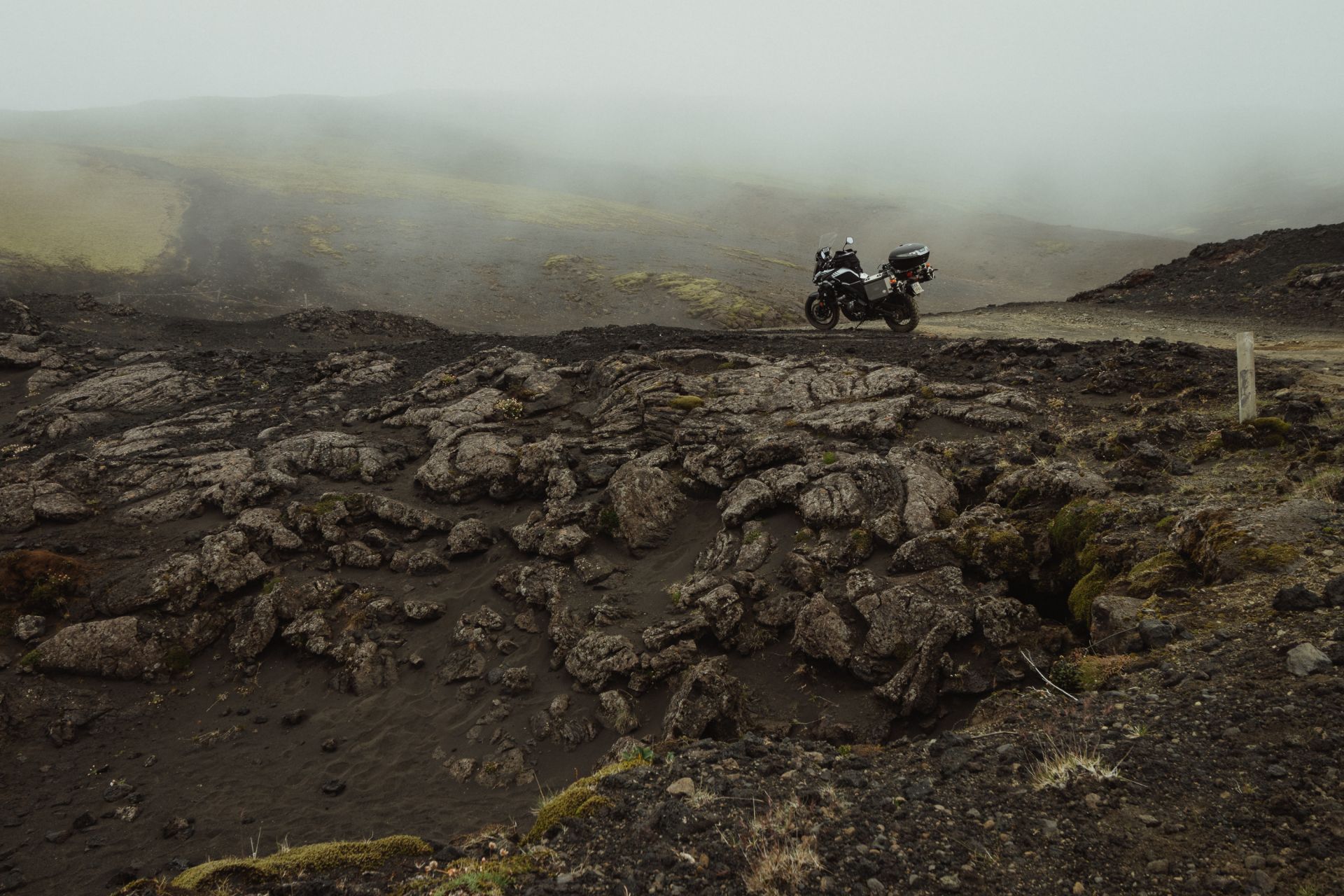
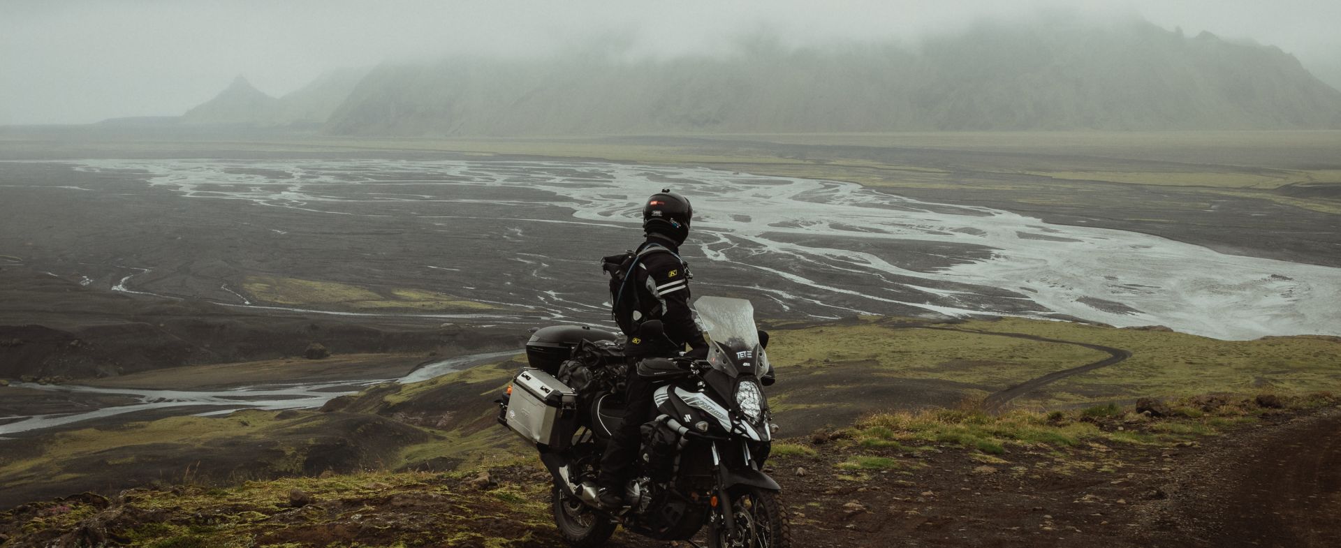
Route F207
The next 10 km take me through a black sand desert, with patches of green moss. The weather gets worse — down to 7°C — with fog and rain reducing visibility. I ride with the visor up; my face is cold and soaked, but at least I can see where I’m going.
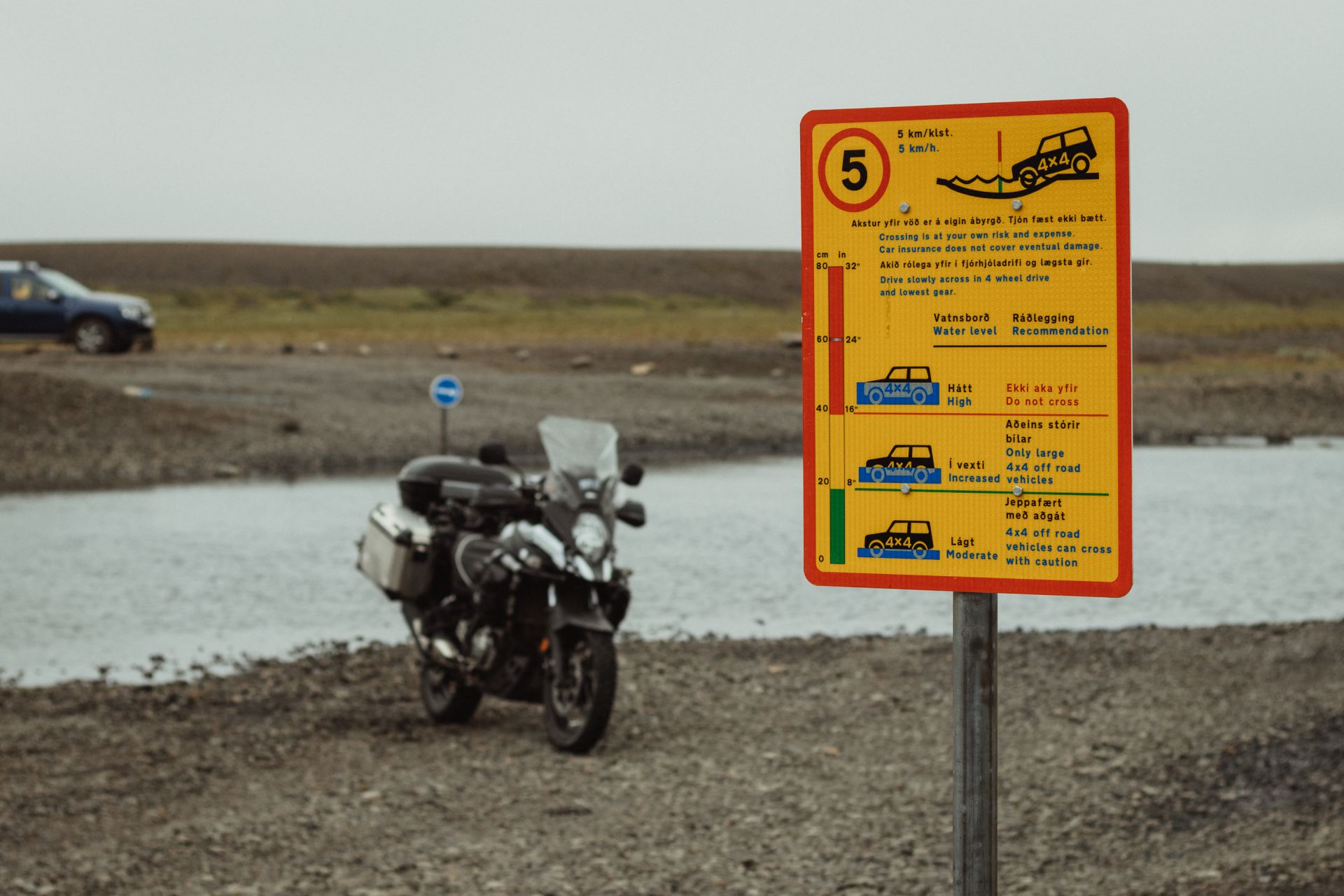
Then comes the final river. It’s deep enough to make me consider turning back. But it’s 8:30 pm, and crossing will save a lot of time. On the right side of the ford are poles marking the route, but the riverbed is uneven. I drift a little left, into deeper water, and it starts to seep into my boots. The climb out is too steep to manage in one go. I head back into the river, find a flatter stretch, build up speed, and finally make it up. Risky — but I got through
Back on F206, I retrace my route to the campsite in Kirkjubæjarklaustur. I arrive around 9 pm, soaked and frozen. I hang up my wet clothes and plug in the electric boot dryers — brought exactly for moments like this.
Words & Photography: Damian Watracz