For me, they’re usually just small blips on the road. As a custom motorcycle builder, I maintain my bikes so that breakdowns happen very rarely, but an occasional flat tire just isn’t something you can avoid entirely. And a flat tire in a tiny nameless Peruvian village was precisely what made me stop and chat to local kids on a school break as I was fixing my punctured tube.
RTWPaul: The Heart of the Peruvian Andes - A Road into the Mountains
Motorcycle Diaries
The one thing that new riders fear the most, and that experienced riders appreciate the most as the best way to really make a connection with the land and the people, is motorcycle breakdowns.
Peru is an adventure riding paradise, but because this country is so vast and so diverse, riders tend to stick to the coastal Pan American Highway all the way to Lima and only venture inland to see Cuzco or Arequipa in the South. For me, it’s all about getting off the beaten path, so I turned eastward much earlier heading for the Ancash Department, Peru’s best kept secret.
After visiting the majestic Huascaran National Park, a must-see for any adventure rider worth their salt, I continued riding South and deeper into the rugged mountain country that lie ahead. Ancash is among the least touristy territories in Peru, and while on the Western side, you’ll find countless white sand beaches and charming little towns on the Pacific Coast, the rest of the land is rough and remote. Two major Andean mountain ranges, the Cordillera Blanca in the east and the Cordillera Negra in the west, meet here forming a wild and rugged landscape of deep canyons and valleys corralled by glacier-capped mountain peaks. Legend has it, Ancash got its name from an ancient Quechua word “anka” meaning “eagle”, and it’s easy to see why: this is a land of eagles and condors, and humans are but temporary guests.
Once home to the mighty Inca, Ancash was soon discovered by the Spanish conquistadors following the countless veins of silver extending into the mineral-rich Cordillera Negra and Cordillera Blanca. Centuries later, Simon Bolivar turned Huaraz into his headquarters during his campaign to liberate Peru from the Spaniards. And while today, Huaraz is becoming increasingly popular among mountaineers and hikers, the rest of Ancash remains cut off from the world holding its millennia-old secrets buried deep in the mountains and gorges.
The Coloured Mountains of Ancash
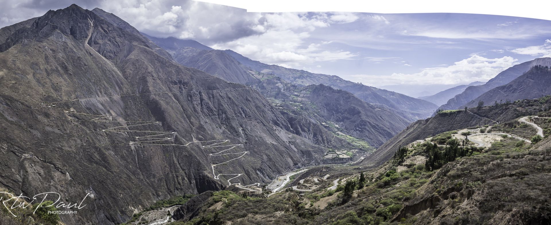
Traveling South from Huaraz is where Ancash begins to truly reveal its majestic mountain views. If you take RN3 (Ruta Nacional 3) from Huaraz and head South, jump on Route 16 in Conococha and look for a dirt trail shooting off the main road on your left. There is a green road sign indicating the distance to Ticllos marking the beginning of the dirt trail. Take the dirt trail, and it will lead you into a region so surreal you may start thinking you’ve just landed on some distant, Mars-like planet where the mountains are so ancient and rugged by millions of years of erosion that the blue, purple, and violet hues of the geological layers appear to have been painted by Salvador Dali himself.
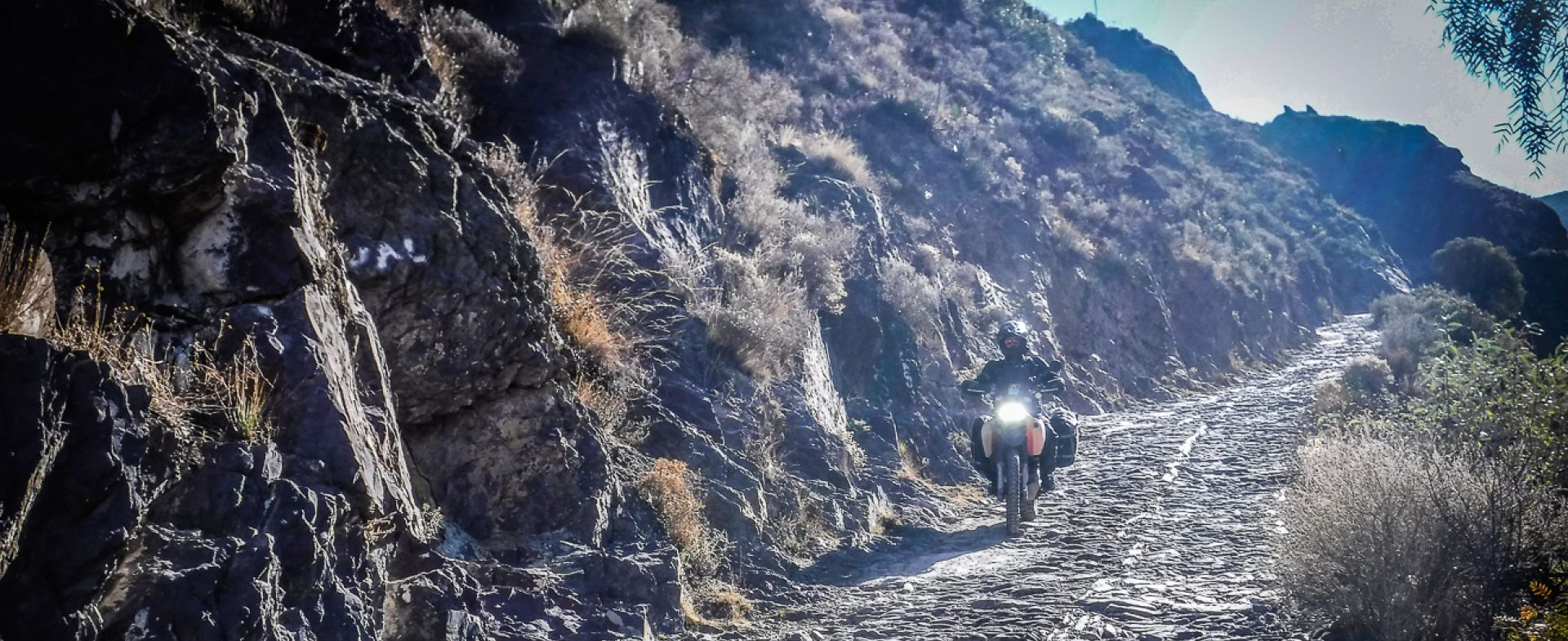
The dirt road to Ticllos and Llipa is not to be taken lightly. There will be no gas and no food along the way, and when I rode there, the main bridge over a raging white water river in the canyon was washed away leaving me with no choice but to go deeper into the mountain country to look for a way around it. Some of the roads here aren’t even on the map, and they are so narrow in places two cars would not be able to pass each other. Some of the switchbacks can be treacherous, and the sheer drops (with nothing but sparse mountain grasses for guardrails) are vertigo-inducing.
Ease off the throttle here because while the region is extremely remote, these ancient dirt trails are still used by the local indigenous people, and there may be an old pick up truck rattling towards you from the opposite direction. They brake for no one, so hug the mountainside on this road regardless whether you’re climbing or descending and watch your speed because some of the cliff edges are so precarious one small mistake might cost you everything.
Faces of the Peruvian Andes
As luck would have it, Ancash was where I got the flat tire, and as I stopped to get it repaired, I was immediately surrounded by a swarm of local kids curious about this two-wheeled stranger. I happened to stop near a school, and during the break, the kids ran over to see what was going on. I shared some lollipops I carry with me for just such an occasion, and the kids got a little braver crowding around the motorcycle and asking me where I was from. The boys wanted to know what my favourite football player was and how fast could my motorcycle go, whereas the girls seemed to be interested in my electronics the most. “What’s this?”, one little girl asked, pointing at my Garmin. I explained to her it was an electronic map of sorts, and she asked if she could see her little village on it. I zoomed out, pointing at the little pin where we were. “And this is Lima, right here”, I pointed, so the girl could see the scale. “And this is all of Peru… And South America”, I continued, zooming the map out as the girl’s eyes grew wider and wider. “And the world”.
“So this is where we are… in the world?”, the little girl whispered, her face filled with wonder. I nodded. “And will you tell the world about us?”, she wanted to know. “Will you remember us?”.
I do. I’d forgotten the name of that tiny village, or perhaps it had no name at all, as some of the small indigenous settlements are so cut off from the rest of the country they aren’t on any Google Map, and no paved roads lead there. But I will always remember Ancash, its coloured mountains, and its curious kids who wanted the world to know about them and their little village.


