Five dirt roads through the Alps

If the road to hell is paved with good intentions, why not turn those good intentions into action and choose the non-paved one? It might just lead you to motorcycle heaven…

Colle delle Finestre - Assietta ( Italy, 53 km)

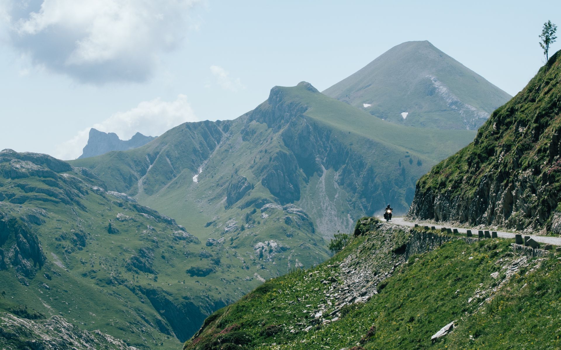
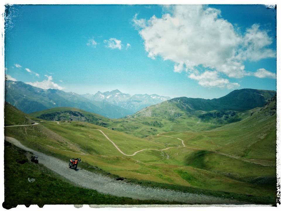
A first rocky stairway to heaven can be found on the Strada dell’Assietta - also known as the SP173: it’s 34 kilometers long, and curls almost entirely above 2.000 altimeters. Because of the high altitude, it’s only open from June 1st to October 31st.

The road itself runs along the ridge that separates the Val Chisone and Susa valley and passes several mountain passes between both valleys including Colle dell'Assietta (2.474 m), Colle Blegier (2.381 m), Colle Costa Piana (2.313 m), Colle Bourget ( 2.299 m) and Col Basset (2.424 m) - all of them potential preys for you to devour on the back of your bike.

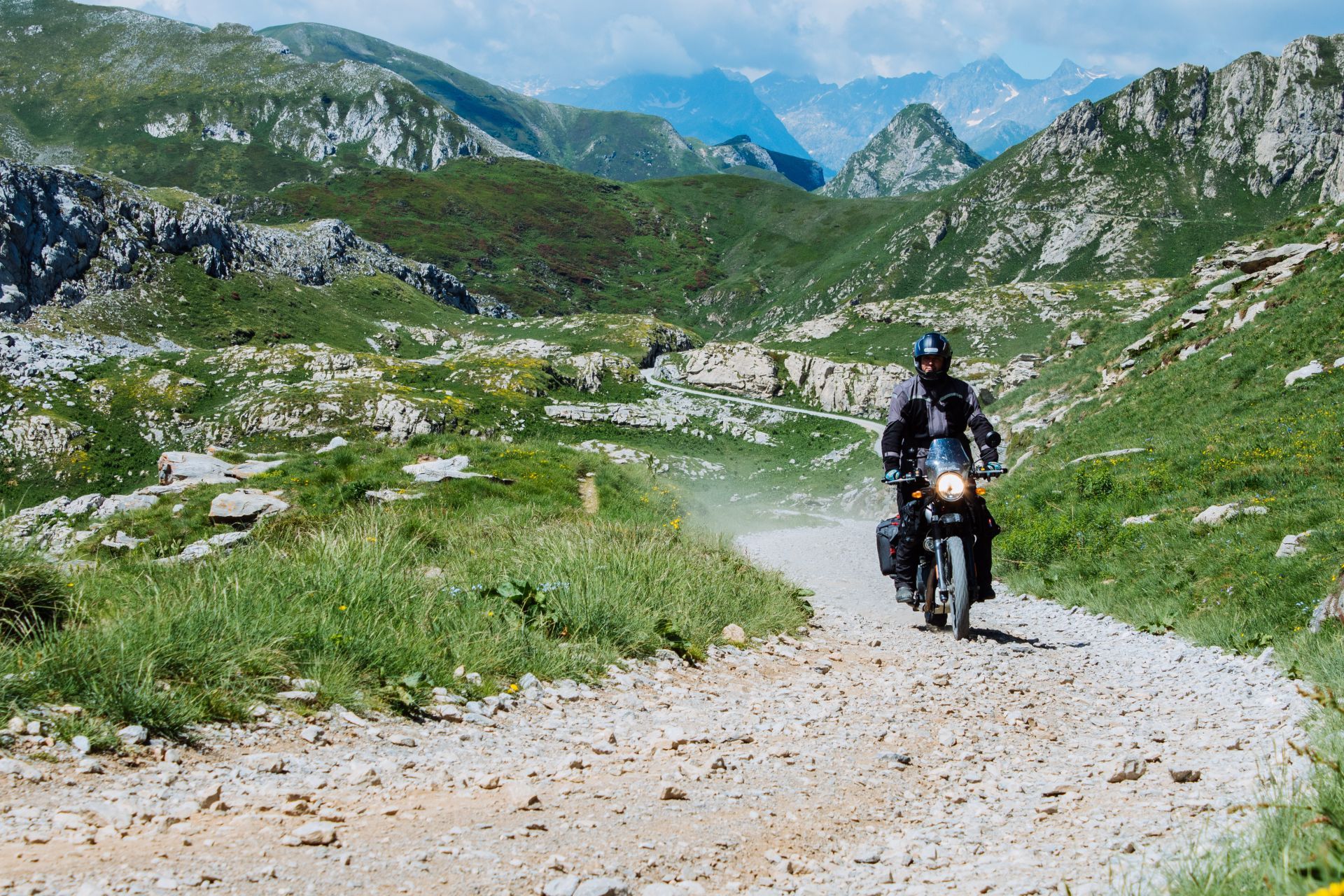
As a direction of travel, we’d suggest you to start off in the north and make your way towards the south: while the northern ramp does not only surprise you with innumerable bends, it also is a gravel-only road, whereas the south ramp is narrow but completely paved - which might be an easier descent if you aren’t riding on knobbies.

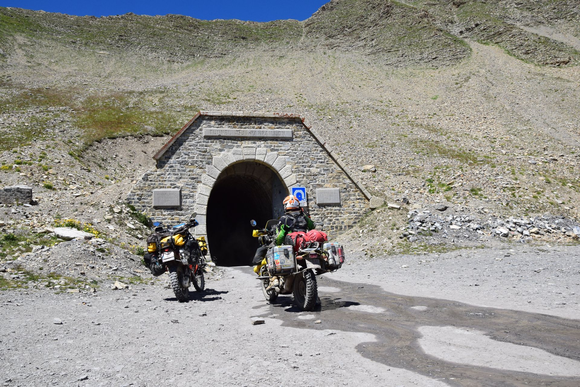
As the road was constructed for military use during the 1800’s, you won’t be surprised to spot a few fortifications along the way. On the south side for instance, the road takes you past a few of them, sadly most of them have a blocked entrance. But rest assured, even from the street you’ll have plenty of insights into the military history and the architecture of past centuries.

By far the most interesting structure is the immense Forte di Fenestrelle complex, which rises from the valley for about three kilometers along the southern slope of the Valle del Chisone, overcoming a difference in altitude of almost 600 meters. A huge complex, well worth a visit. Just take your time…

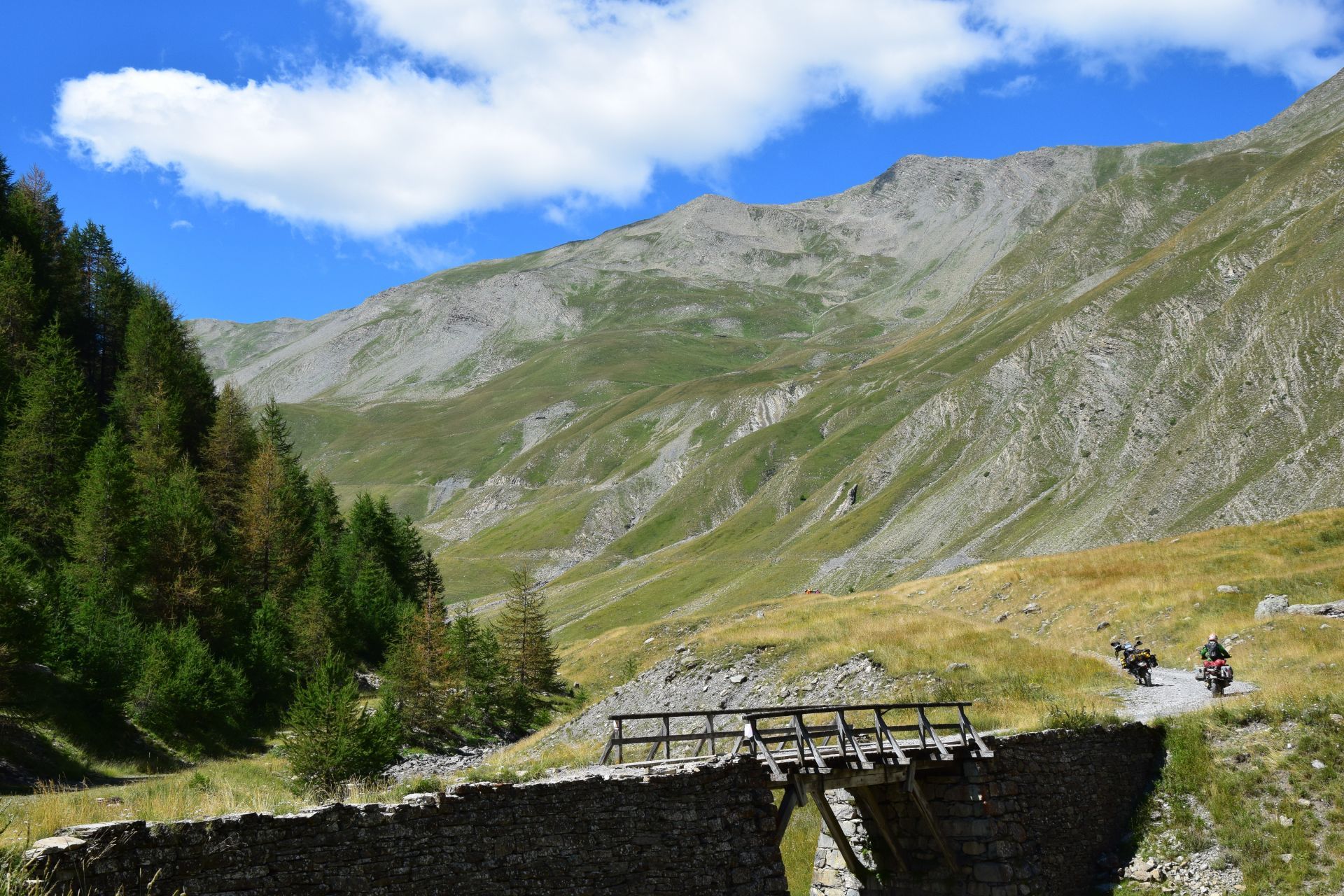
Once you’ve devoured this section, make sure to turn left onto the Strada del Colle delle Finestre (read SP172), which will first drag you over a narrow but paved road, which afterwards turns into an equally tight, but gravelly road. Delicious stuff. However, be careful if the forecasts predict rain: the surface gets very slippery in wet conditions.

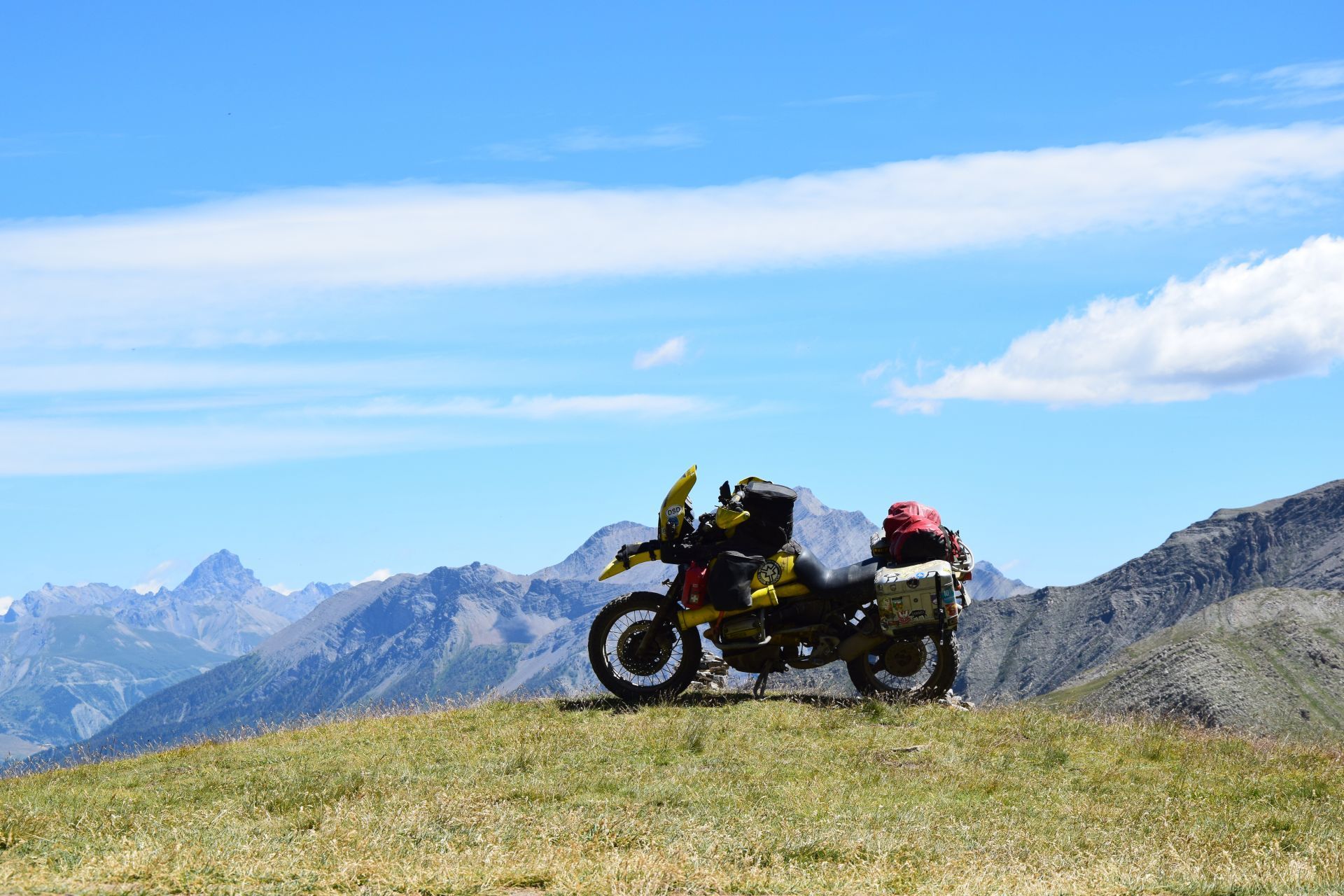
Although not for the faint of heart, both the SP173 as the SP172 are rather doable to ride on a normal streetbike - if you have the proper experience, that is. Just beware: the road is closed for motorbikes on wednesdays and saturdays, so plan your trip ahead. You wouldn’t want to miss out on these ones.

See the road from Colle delle Finestre to Assietta.

Col du Parpaillon (France, 26 km)

The mostly unpaved route over the Col du Parpaillon connects Châtelard in the southeastern Ubaye Valley with Embrun in the Durance Valley in the northwest. This offroad mountain road in the French part of the Alps will give you the chills: the views are breathtaking, and it will confront you with a choice.

Either you take on the col which will take you up to 2.780 meter above sea level, or you can opt to take the famous Parpaillon tunnel. That handcrafted tunnel is located at an altitude of 2.637 meter, and is a whooping 520 meters long. Needless to say, it has given many bikers moments to remember. Just beware: the notorious crest tunnel of the Col du Parpaillon is prone to have it all: visit the tunnel in early spring and the water will be greeting you till the knees and if you're lucky you'll even find some very frosty slippery surface inside.

During winter months or if forecasts predict heavy weather, the tunnel will be closed by shutting its metal doors. Not that you’ll be able to check it out during that period, as the non-paved access road is also closed during winter months.

And as we’ve got your attention, be evenly cautious if you choose to ride the Col: the subsoil of the non-edge secured route consists partly of loamy ground and will have you sliding in the blink of an eye in rainy weather. A man warned…

See the Col du Parpaillon.


Col de Sommeiller (Italy, 19 km)

The Col de Sommeiller has a rather interesting story: the unpaved road dates from the 1950’s, when there was still a summer ski area on the Sommeiller. After an avalanche and the decline of the Sommeiller glacier, is was left abandoned. The remnants of the facilities on both sides of the border, which remain here and there, are gradually disappearing as part of various projects.

Whatever the history, at this moment, the Col de Sommeiller is a high mountain pass at an elevation of 2.993 meters above the sea level, located in the Alpi Cozie between the Italian and French border. It's on of the 25 highest mountain roads in Europe. This beautiful 26 kilometre climb above Bardonecchia has it all: hairpins, alpine dams, a lake at the summit, and views to die for.

The journey begins in Bardonecchia and leads - initially paved for around 6 kilometers - to the small town of Rochemolles. Shortly thereafter, the unpaved part of the route kicks off, but that part is still easy to ride. Continue on past the Lago di Rochmolles reservoir and into the high valley until you reach the Rifugio Scarfiotti at the head of the valley. Then the track becomes both coarser and narrower.

Over 16 bends the step to the very barren Pian dei Morti is overcome. Once you have passed the rocky plateau, another ascent over several hairpin bends leads up to an area designed as a hiking car park. A very challenging but equally satisfying piece of riding.

Be careful, though: avalanches, heavy snowfalls and landslides can occur anytime and can sometimes block some sections of the road, being extremely dangerous due to frequent patches of ice.

The higher you get the runway becomes worse but it stays continuously rideable. Well, not exaclty continuously, to be honest: the track is closed for motor vehicles every thursday from 15 July to 30 September. On other days, you can ride the Col from 9 am to 5 pm. Because of the snow which thaws slowly on the western slope, it is often only possible to ride in late summer or early autumn.

See the Col de Sommeiller.


Via del Sale (Italy, 11 km)

The Via del Sale, also known as Route du Marguareis, is a track built in the Middle Ages to transport salt from Ventimiglia to Limone Piemonte and from there to Turin. As a result, the road has been widened at specific points and many sections were magnified and transformed into military roads to connect the numerous forts located along the border between Italy and France.

Today, it is a wonderful dirt road which is (almost) impossible to drive in a car, but so much the more rideable on your motorcycle. It runs along the ridges of the Maritime Alps on the border between Italy and France, in a wild landscape and stunning views of the sea and the mountains.

From the Tenda Pass on, the route leads on through dry and barely overgrown mountain roads, such as the Colle del Lago dei Signori and the Colle delle Selle Vecchie, from where the road descends quickly through the Regional Valley of Valle Pesio and Tanaro. The asphalted road to Monesi starts at Piaggia.

Here one can choose to ride the even less passable road to the 2.042 meter high Passo di Tanarello, which is close to the Sacarello mountain (2.200 meters). The latter is adorned with a huge jesus image. The panorama of it extends on clear days to the Mediterranean Sea. If that doesn’t tick some of the boxes on your bucket list, we’re not sure what will.

Riding the road and the connecting tracks takes the best part of a day, and there are a couple of chalet type cafes to take a break at along the way. Sounds like a perfect day of riding.

See the Cia del Sale.


Monte Jafferau (Italy, 16 km)

The Monte Jafferau is a mountain in the Hautes Alpes,with a highest peak of 2.805 m. The gravel road to the top includes several hairpins, and unfolds for over 20 km, almost entirely over 2.000 meters above the sea level - crowning it as one of the highest mountain roads of Europe.

There are some fairly rocky sections, which make it a bit harder to ride it on street tyres: it is however possible, but you sure need good ground clearance. Read: do not try to conquer it on a normal streetbike.

The last section towards the summit of Forte Jafferau is a rather rough patch, preferably not one to try on your own. The slope of the road is less than 12%, and the width is around 3 meters. After rain, even a single rainfall, conditions of the road can be challenging. Thunderstorm activity can quickly change unpaved roads into proper enduro condition or render them even impassable.

The trail is prone to rock falls, so it can and will be tricky in places. Further on, remember that the road from Gleise, via Hotel Jafferau and the ski slope (maintenance road) is closed for all motorized traffic! The road going from Salbertrand to Monte Jafferau is possible, but you have to pass the (officially closed) tunnel. You can pass it, but need good ground clearance and you can't do it on your own ! It’s open from May to October.

See the Monte Jafferau


Your turn!

Do you know other dirt roads in the Alps?! Share those with us and enter the monthly competition to have a chance to win one of out partner's prize

Where next?

Explore the best roads & POI's around and plan your next trip based on those roads.


Más historias

RTWPaul: Riding 48 States - Utter Ridiculousness With 8hp Part 1 of 2

RTWPaul: Riding 48 States - Utter Ridiculousness With 8hp Part 1 of 2

Iceland, Part V

Iceland, Part V

A sparkling adventure ride

A sparkling adventure ride