Seven scenic (but lesser known) roads in Switzerland
Motorcycle Diaries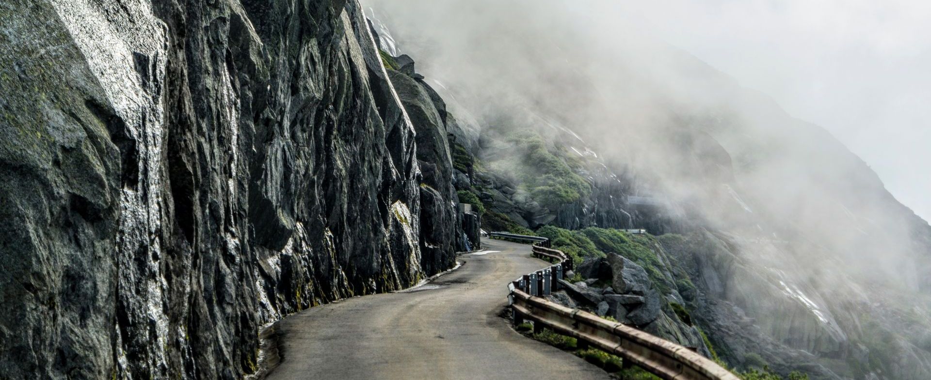
Not in the least because of the ever-present Alps, with no less than 17 passes exceeding 2.000 meters in altitude. Of course, you could plan your trip around the Furka, Albula, Klausen, Grimsel, Susten, San Bernardino and Umbrail Pass - but what if we told you there are less famous, less crowded alternatives? Care to join us?
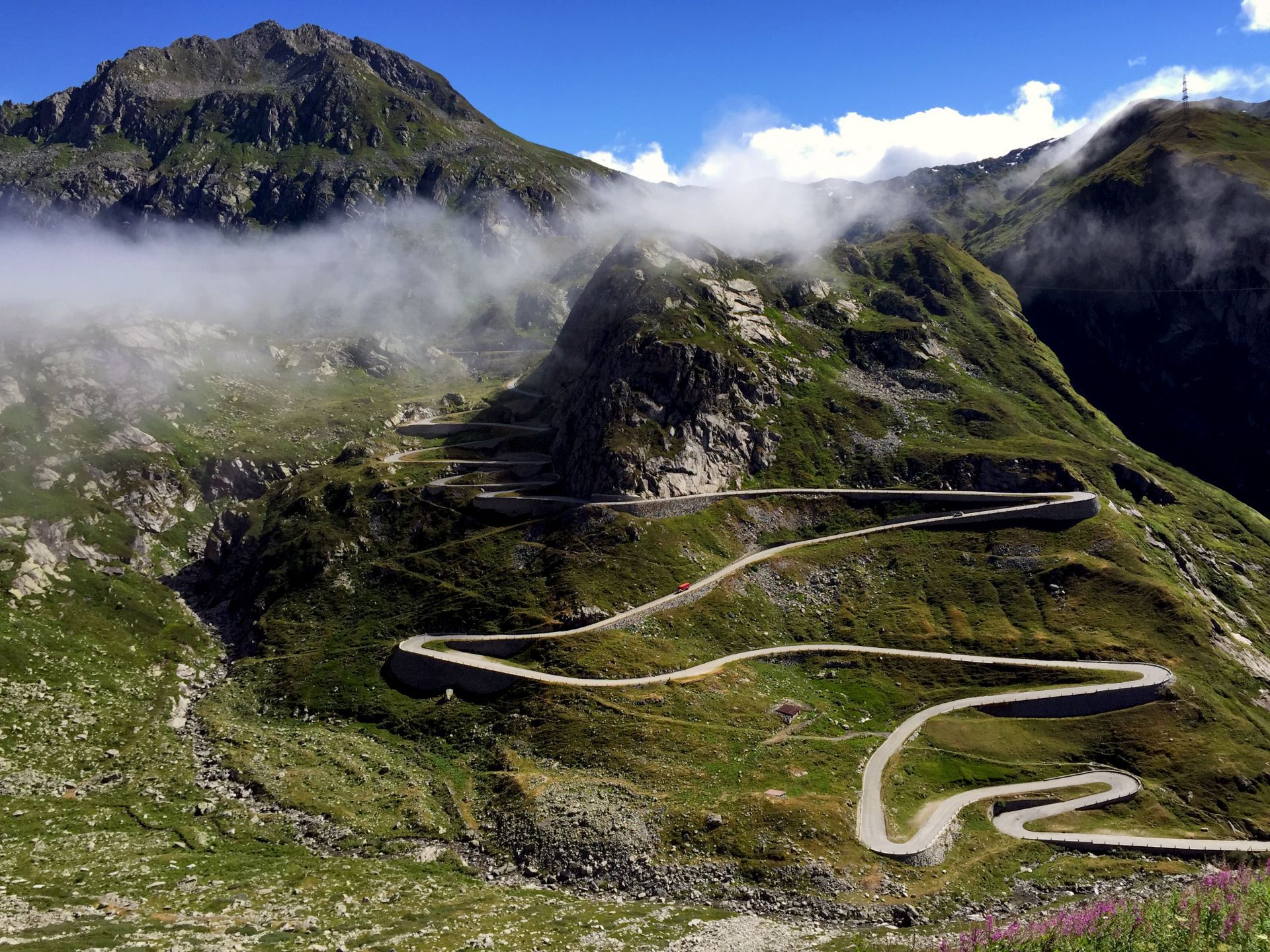
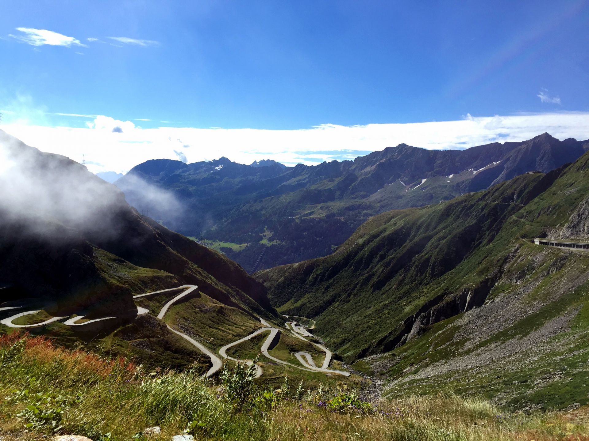
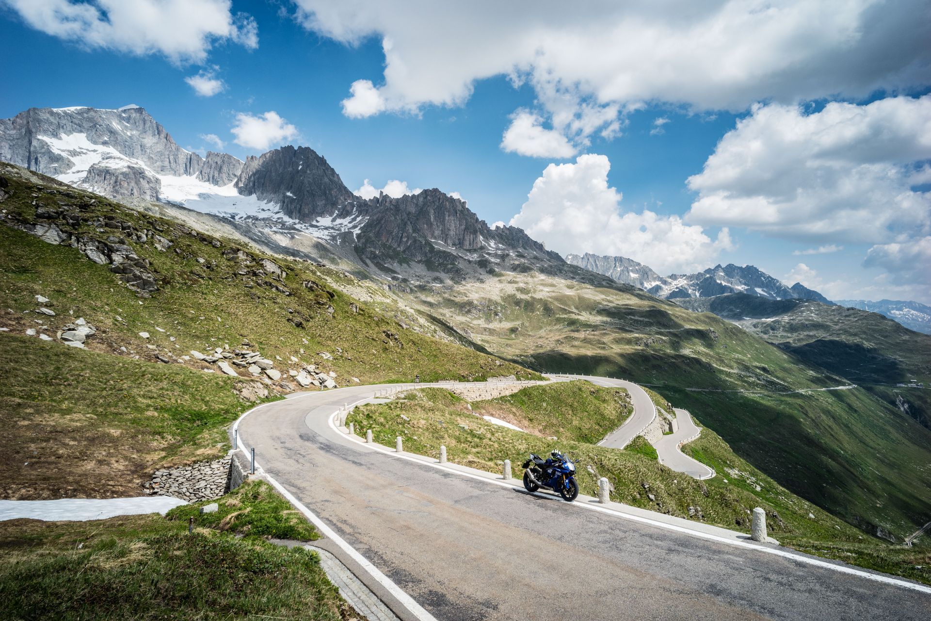
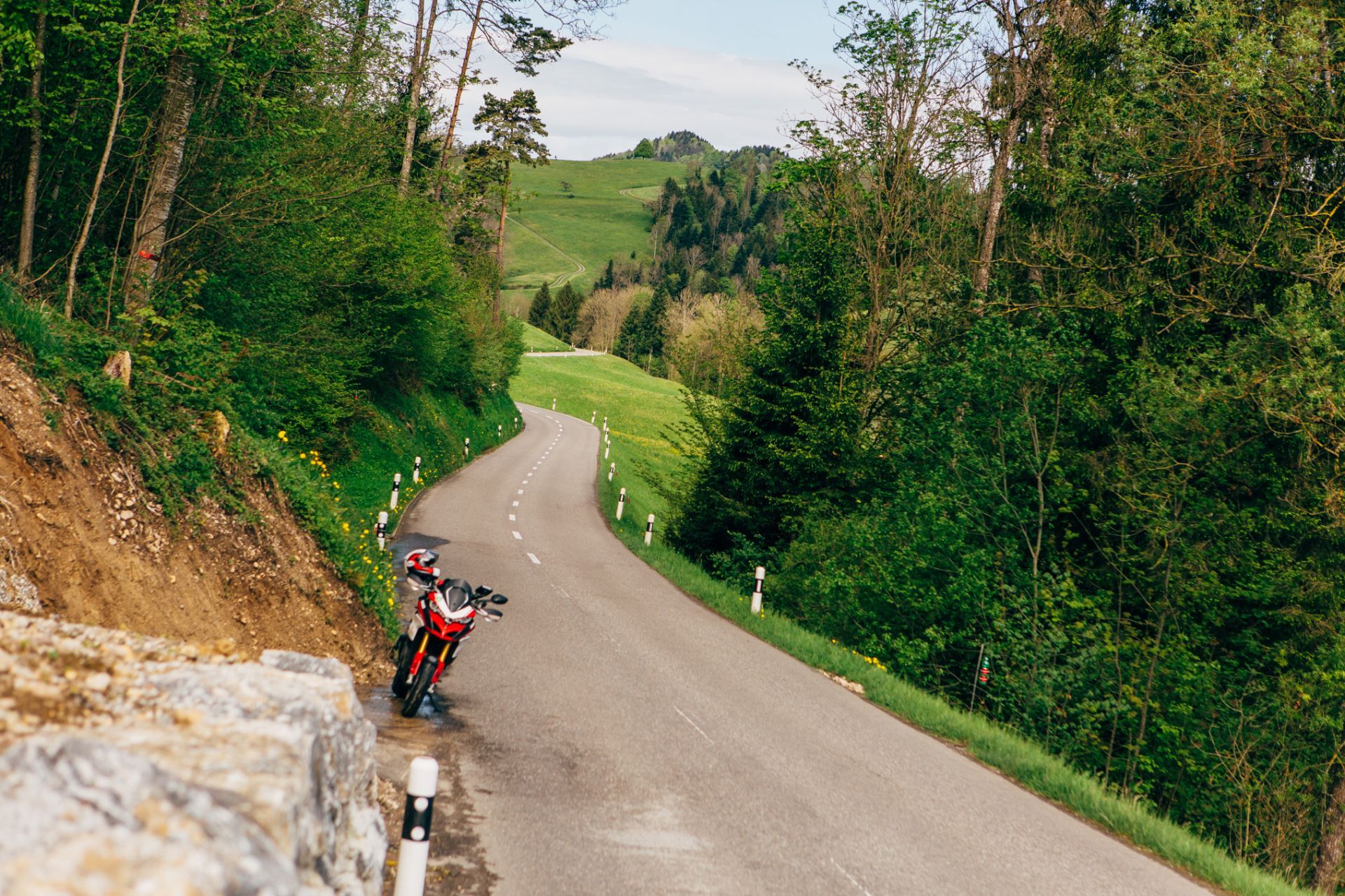
Tremola Pass
View: 5/5
Surface: 2/5
Pleasure: 4/5
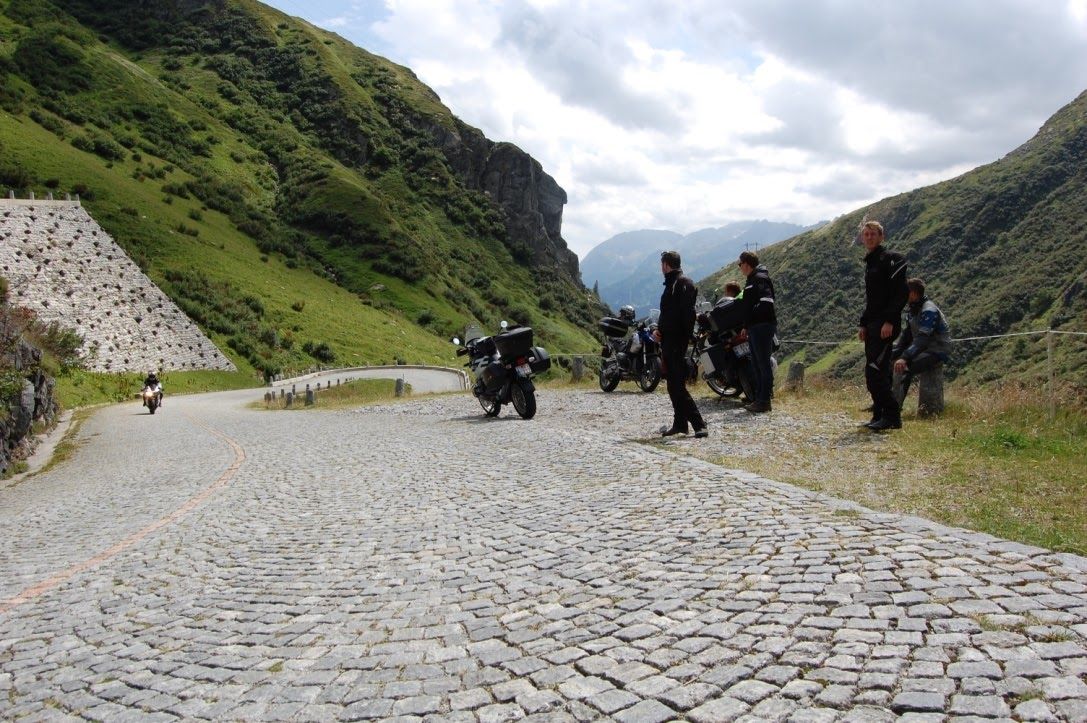
Well, the first is rather well-known - some even call it the king of the Alpine roads, but it’s less crowded than all of the other crowned ones for sure. The ride across the Tremola on the southern side of the Gotthard Pass is breathtaking.
The Tremola takes you in hairpin turns and serpentine curves from the peak of the pass to Airolo and is considered to be Switzerland's longest historical monument. The ‘historic’ part is far from far-fetched: its cobbles (!) sweep riders back to an age when motorcycles were still called horses.
And even better: because of the famous Gotthard highway tunnel - which was built about a century after its predecessor for trains - most of the traffic is being led underneath the mountain, which transforms the Tremola into an almost traffic-free zone. Needless to say, you will be missing something well worth experiencing if you do take the tunnel.
Take a break at the bridge near the foot of the Tremola and enjoy the view upwards, as a waterfall thunders its way down aside the ever twisting cobble road.

Col du Sanetsch
View: 5/5
Surface: 2/5
Pleasure: 5/5
Brace yourselves for one of the finest passes you’ve probably never heard of: the Col du Sanetsch, a high mountain pass across the western Bernese Alps, connecting Gsteig in the canton of Berne and the canton of Valais. Largely twenty-six kilometers in length and rise of 1.690 meters, the mountain road kicks off in Sion and could arguably set foot beside the famous Stelvio Pass, albeit with a lot less traffic.
The real ascending part starts in the Rhone valley and meanders through the vineyards - with the Valais being Switzerland’s largest wine-producing canton by volume - before diving into woodlands, and a challenging series of hairpins which will you past pastures and towards the summit at 2.252m, near the Tsanfleuron glacier.
After that, the journey continues through the 800 meters long lit tunnel, just two kilometers before the summit of the Sanetsch pass, and stops at de majestic Lac de Sénin. So, a quick rest and descend all the way back down, then? Well, that’s one possibility - the other is parking your bike safely and taking a ride in an aerial cable car and go down to Gsteig near Gstaad, a full kilometer further down.
From thereon there’s plenty of scenic walks and stunning views. If you plan on taking the cable car, just take a quick peek at the calendar: the Sanetsch-Gsteig aerial cableway only operates between June and October! A quick tip: don’t forget to bring an extra layer of warm clothes, even if the forecast looks promising - temperatures tend to drop more than 15 degrees during the ascent towards Sanetsch…


Moosalp Pass
View: 5/5
Surface: 3/5
Pleasure: 5/5
Moosalp - the name might not ring a bell right away, but the pass is definitely worth the detour. From Stalden, the countless hairpins and magnificent views from this sun-soaked southern slope will amaze any motorcyclist who dares to clamber up this 1.400-meter mount.
Our road over the pass is about 16 kilometers long paved all the way - but rather narrow - and is divided into two parts: a rather rocky scenery during the steep climb and a rural backdrop as you reach the top: there are green forests, lush meadows, mountains and hills, dairy farms, cows, sheep and goats to be encountered every step of the way.
We’d suggest you kick it off from Visp, in the valley that’ll lead you towards Zermatt and the Saas valley along the river Vispa. Along the way, you’ll pass the small village of Ackersand that - nomen est omen - is known to be the driest place in Switzerland. Not even a gas station to be seen. But we’re getting off the subject.
Just before Stalden, the road starts to steepen and as you leave the village, you turn right towards Törbel and the Moosalp pass. As you climb higher and higher up this whirling, rock-faced road, the views over the Valais Alps and the Rhone Valley go from stunning to grandiose and back. If you don’t mind a suggestion: combine this trip with a detour over the Simplon Pass and then take the road via Centovalli to Ticino. Stunning combo!


Lac de Tseuzier
View: 4/5
Surface: 2/5
Pleasure: 3/5
This one is the perfect one for a lunch break - provided you’ve made your sandwiches and filled a thermos with soup or coffee for the road. As you might or might not know, high up in the mountains of the Canton of Valais, the Swiss have hidden several huge alpine dams in plain sight - and with them some of the most stunning mountain roads we’ve ever witnessed.
The ten-kilometer stretch we’ve selected for you starts off in Saint-Leonard and offers a great climb right from the very start: the Valais is the biggest wine-producing region in Switzerland, so prepare for some overgrown slopes along the road. While many climbs take a while to show off their goods, this one slaps you in the face right from the first uphill meter: vineyards as far as the eye reaches during the first five or so kilometers!
As the grapes disappear in the rear-view mirrors, the route passes through a couple of villages, and one very, very steep stretch before leaving the civilized world behind. The higher you ride, the more interesting this one becomes, with hairpins galore and even a few tunnels!
Normally we’d prefer the long way round, but this couple of underpasses are a true thrill to ride through - some being rather long (up to 800 meters) but luckily lit as well, for a pleasant, gloomy atmosphere. As the dark makes way for light again, you’ll arrive at the ‘icing on the cake’: the majestic Tseuzier Dam and its bright blue contents. Enjoy!


Oberaar Panoramastrasse
View: 5/5
Surface: 3/5
Pleasure: 5/5
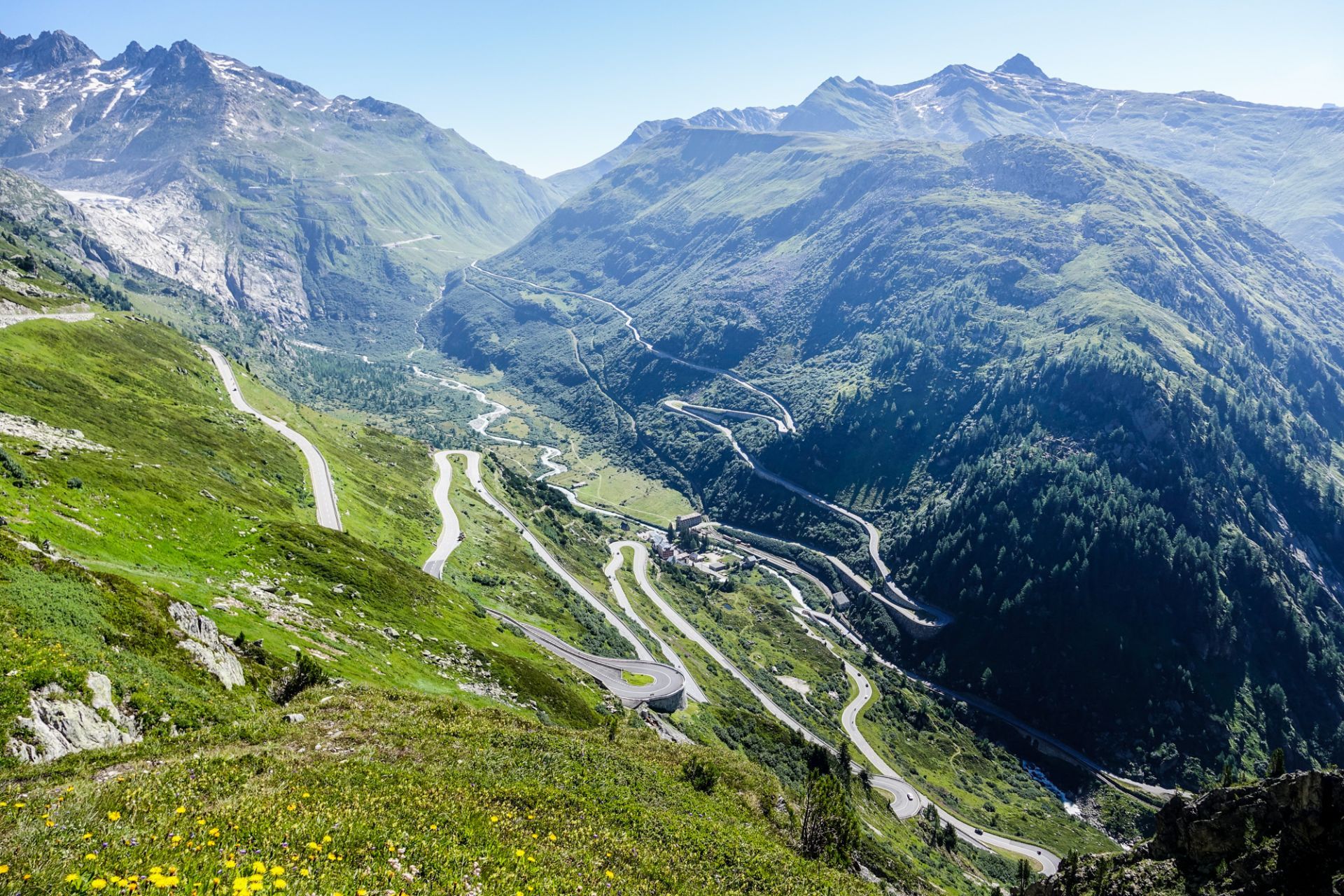
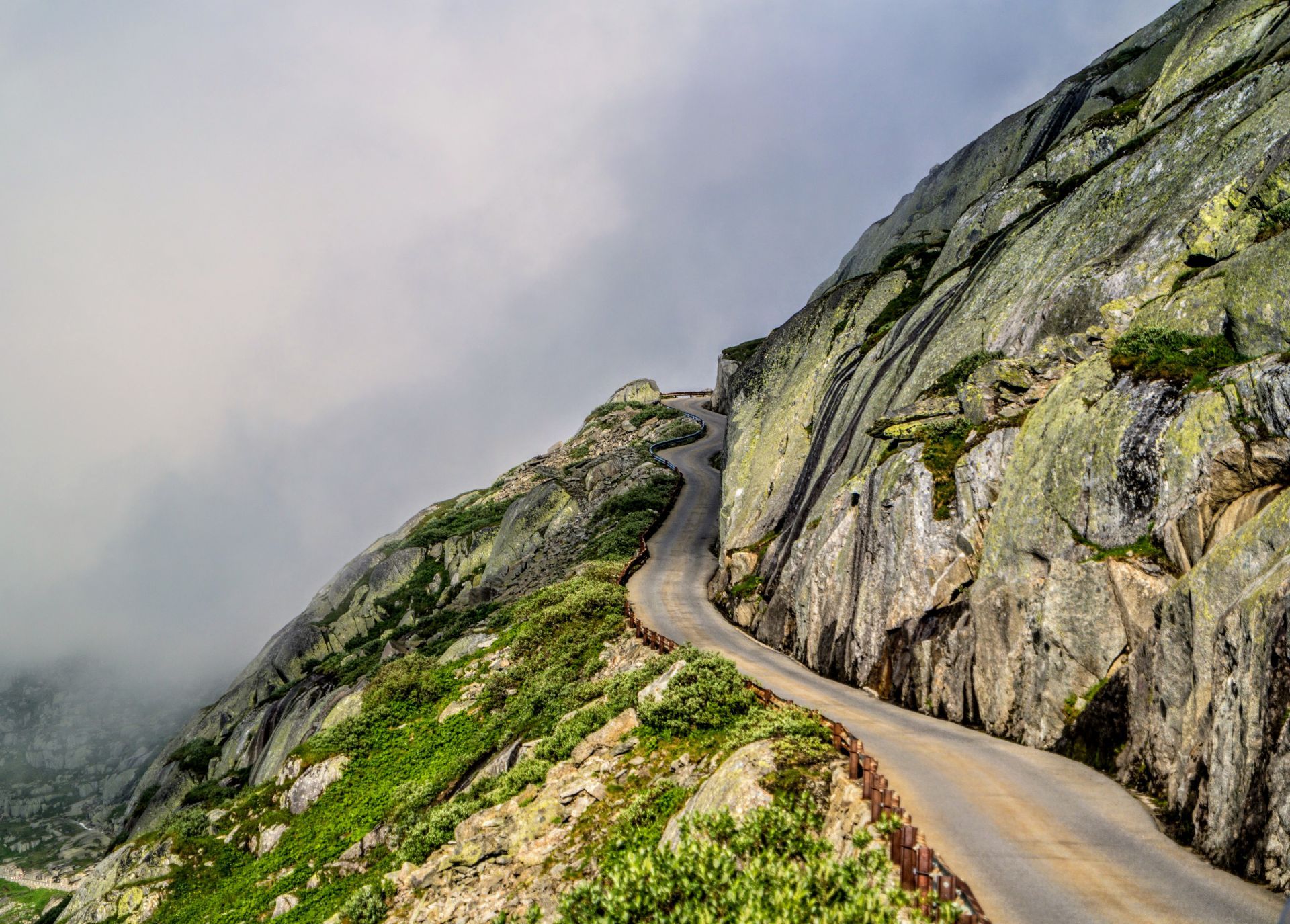
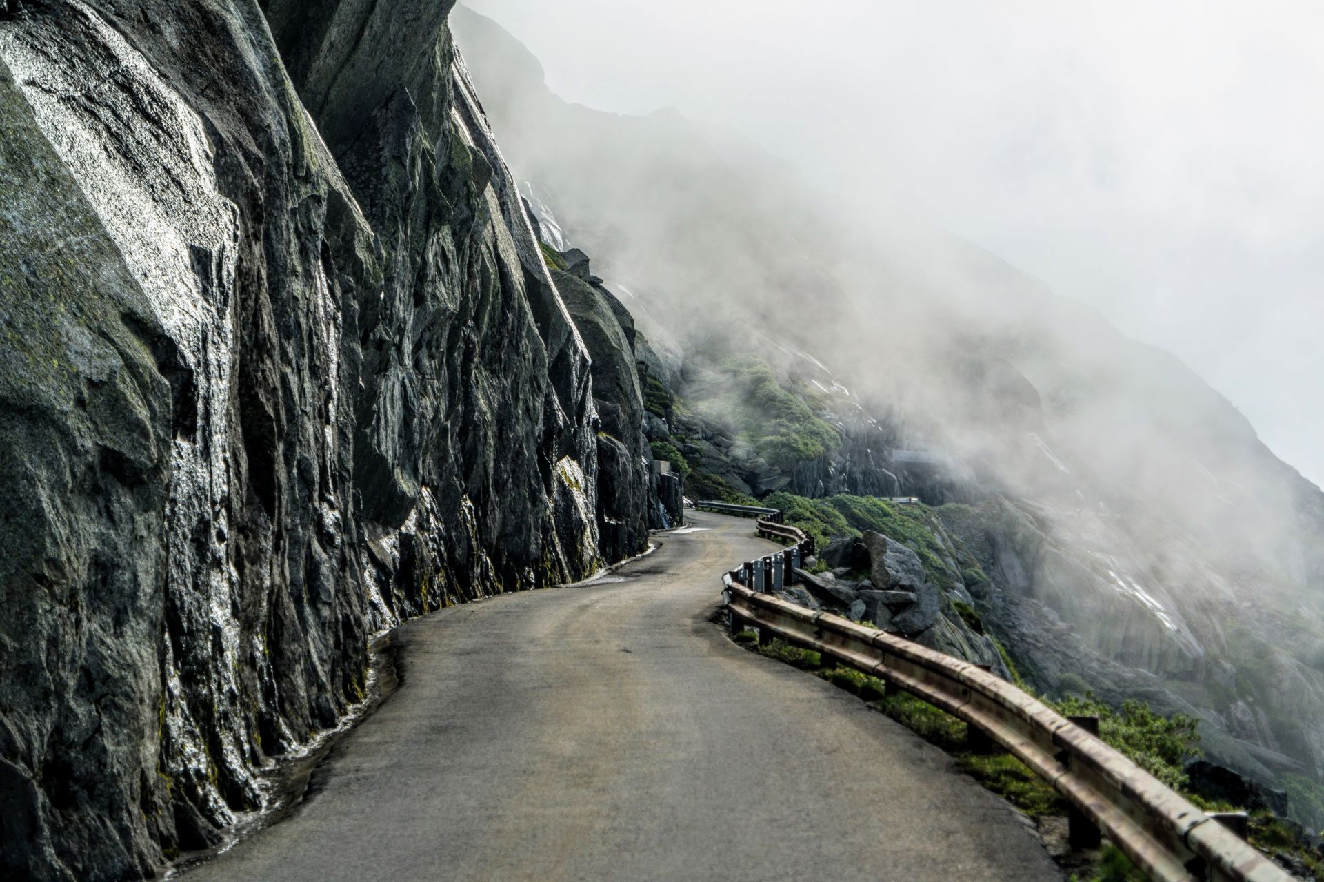
Deep in the Bernese Oberland, the Swiss have hidden Grimselworld - which doesn’t only offer the immaculate but usually very busy Grimsel Pass or nearby Furka Pass, but also the lesser-known and often neglected Oberaar Panoramastrasse. What’s in a name.
Although it is just six kilometers long, and it has a dead-end at the Oberaarsee, it’s well worth a detour any time of the day as the views along the way are stupendous. To get to it, you’ll need to conquer a part of the Grimsel Pass, as this road kicks off just at the top corner of its northern ramp.
From thereon, the asphalt curls its way along the rugged mountainside, up towards the south bank of the Oberaarstausee - a very impressive sight, as you quite literally cling the foot of the mighty Unteraar Glacier. Furthermore, the road is in excellent condition and paved throughout, but… There’s a catch.
The Panoramastrasse is so incredibly narrow, that it can only be ridden in one direction - traffic is regulated with a stoplight on both sides, so you might have to wait up to 30 minutes. From the Grimsel to Oberaar, the road is open every hour from .00 to .10 o’clock. If you wish to get back, make sure you have your engine roaring at Obersee between .30 and .40, every hour of the day. Quite a wait, we know, but you won’t regret it. Look at it as an extra half an hour of escaping the rat race. The Panoramastrasse Oberaar opens in July and usually stays open until the end of September, depending on the weather.
Hulftegg Pass
View: 4/5
Surface: 3/5
Pleasure: 4/5
While some well-informed travelers have known of the existence of the Hulftegg Pass crossing since it became an official road back in 1866 - pilgrims on the road of St. James had already discovered it hundreds of years earlier.
The asphalt was poured into their footsteps, so to speak. Today, the pass is the starting point for many hikes - for instance up to the Hörnli or Schnebelhorn, the latter being the highest mountain in the Canton of Zurich with its 1.292 meters of altitude - but it is the backdrop for an amazing motorcycle ride as well.
The part we’ve selected runs from Mosnang towards Steg im Tösstal. A thirteen-kilometer ride, crinkling violently as it ascents and descents the Hulftegg while spoiling you with panoramic views over the Zürcher Oberland, the rolling landscape of Appenzellerland, Zürichsee and Greifensee to the west and Toggenburg to the east. Stunning stuff. You might find road conditions that leave a lot to wish for at times, but the stunning views make it really worth the ride.
Riders who don’t like to drag a backpack or panniers along will be relieved that there are more than enough possibilities to keep an inner man well catered along the way. There’s even a restaurant right on the summit (953 meters), providing you with equally stunning views - and the option to let your bike rest for a while, while you laugh your socks off during a 20-minute Witz-Rundweg - a Joke Path. We’re not even, eh, joking.
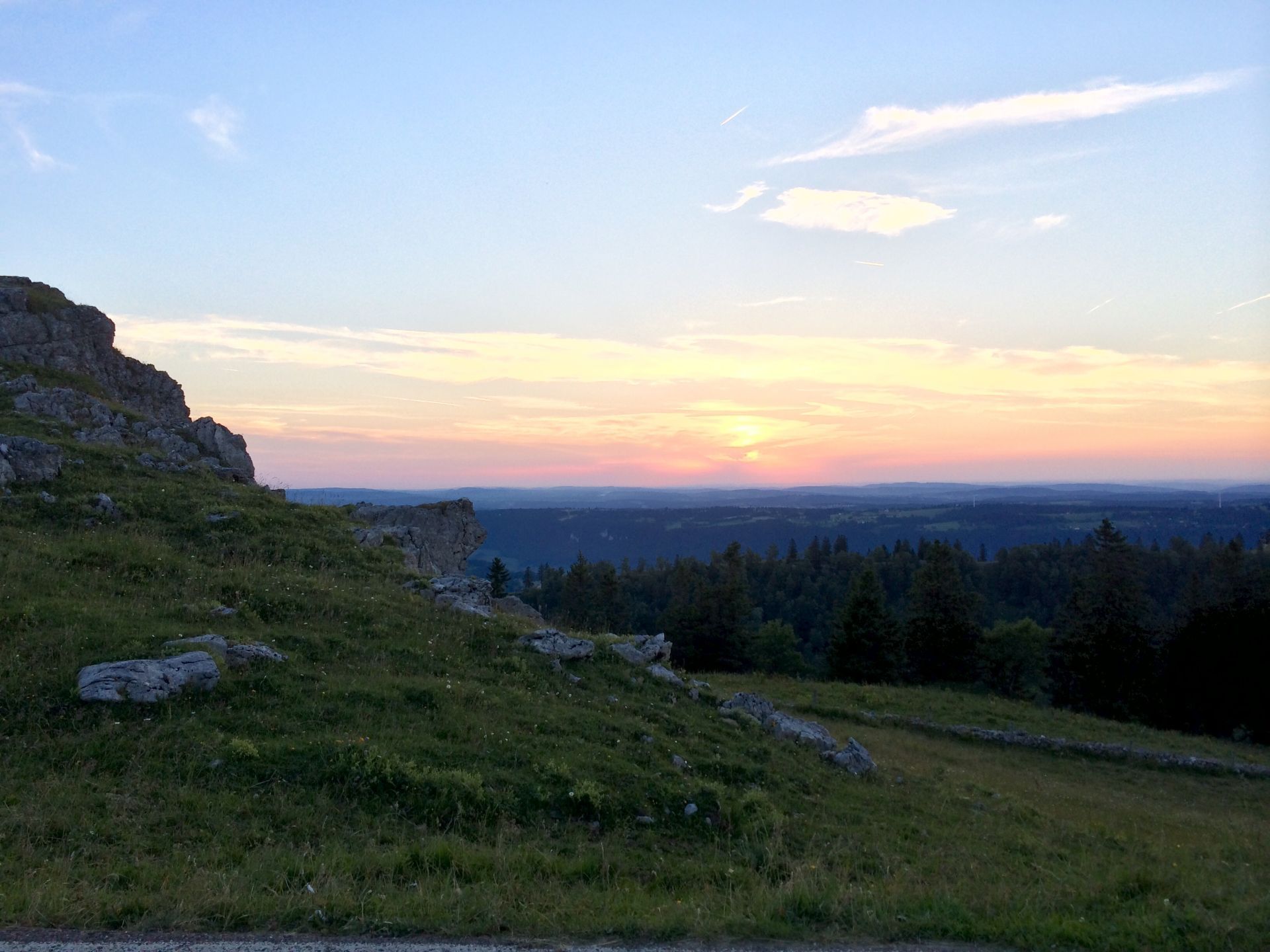
Col Du Chasseral
View: 4/5
Surface: 2/5
Pleasure: 4/5
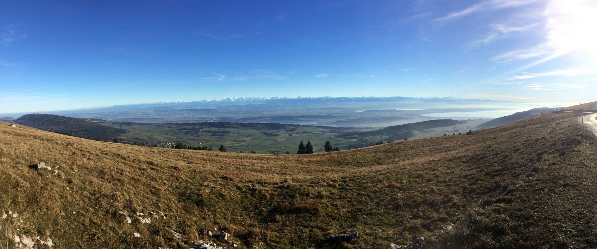
The last pearl in this crown is situated in the triangle between Neuchâtel, La Chaux-de-Fonds, and Bienne, in the northwest of Switzerland, where the summit of the Chasseral is both the epicenter and the highest point of the nature park.
The 27-kilometer long road towards the top has a rather twisty character - and is getting bumpier as you approach the summit - but it smashes any critic with its view over the three lakes and the Swiss Alps in front. A stunning panorama: on its own, the Chasseral serves as an unofficial observation deck of the Swiss Jura, from which you can feast your eyes over the sheer endless vineyards, meadows, plateaus, gorges, and valleys. Truly stunning vista, in any direction you might look.
The reserve covers nearly 400 square kilometers - otherwise said: one percent of the surface area of Switzerland – and is home to a total of no less than twenty-one municipalities, and an endless stream of local products. This is the world of cheese, chocolate and – on the flanks of the hills closing in Lake Biel (another name for Bienne) – also wine.
As you’ve probably left your motorcycle at the hotel, hostel or tent by now, we’d suggest taking a walk along the vine-growing trail - to discover (and taste) what the region has to offer. If the ride itself didn’t quite thrill you enough, don’t hesitate to set out on the ridge walk - this one will take you to the foot of the ornament visible from afar: the immense telecommunication tower - eh - towering over the surroundings, and nothing less than a symbol for the close ties between technology and tradition of the Chasseral region. A must-do!


Want more?
See our other episodes about Scenic roads here.