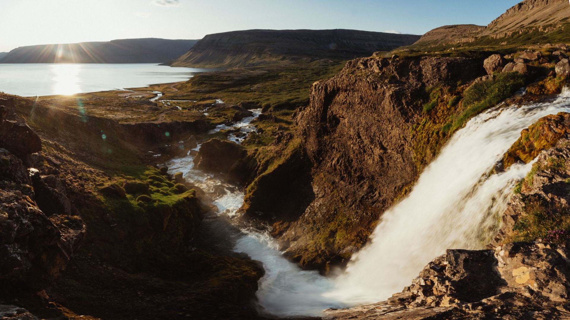
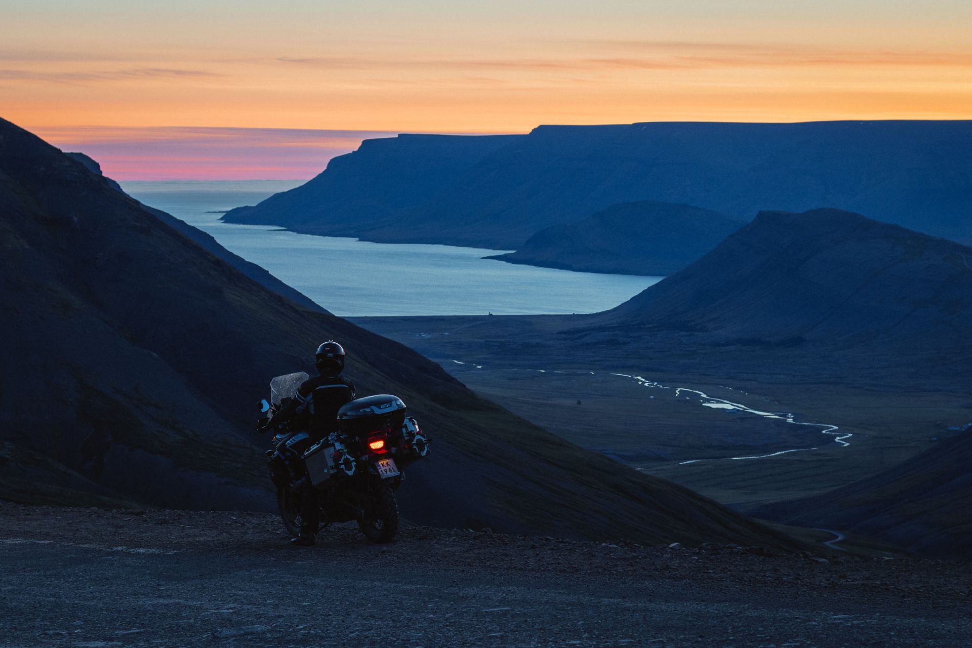
After breakfast I set out from Tálknafjördur, going north-east towards the Dynjandi waterfall (a.k.a. Fjallfoss). On the way I pass the Fossa waterfall, right by the main road.
Iceland, Part V
Motorcycle Diaries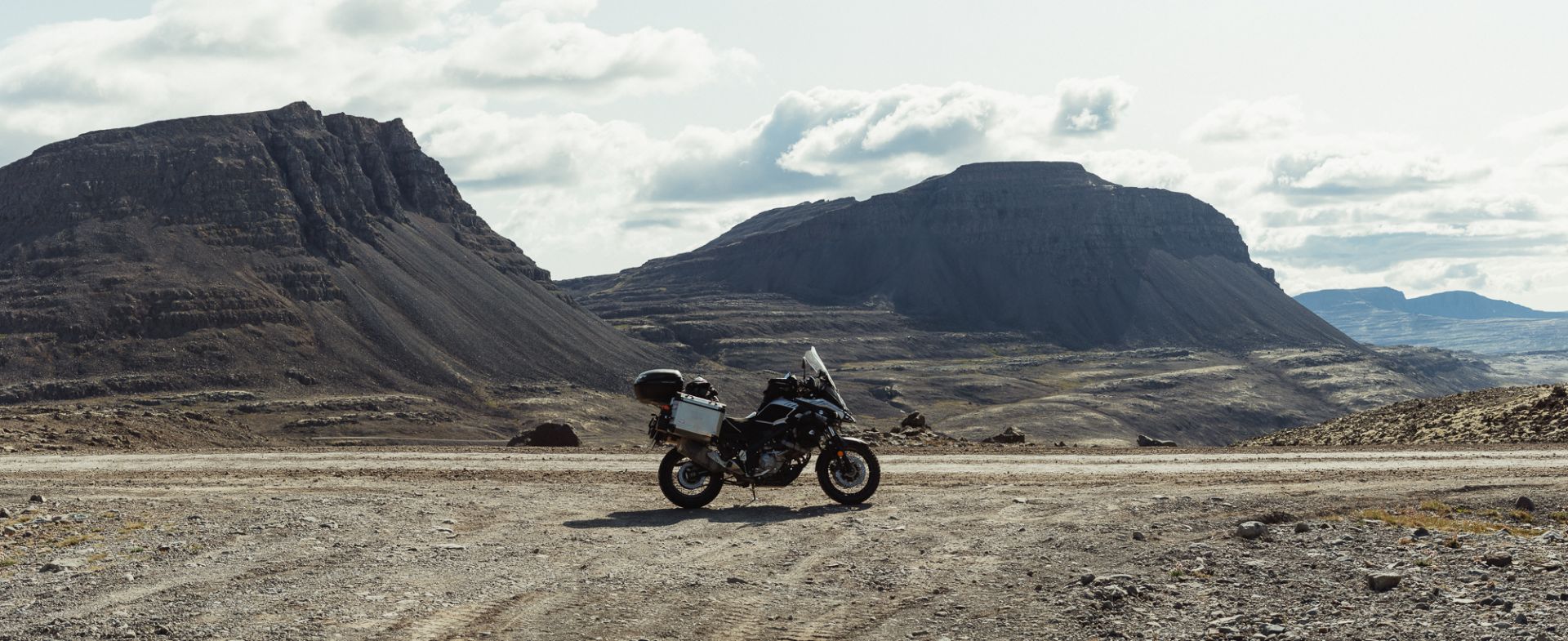
Day 18: Tálknafjördur, Þingeyri, Dynjandi waterfall

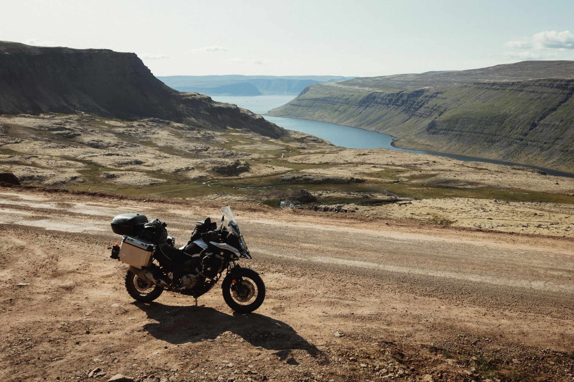
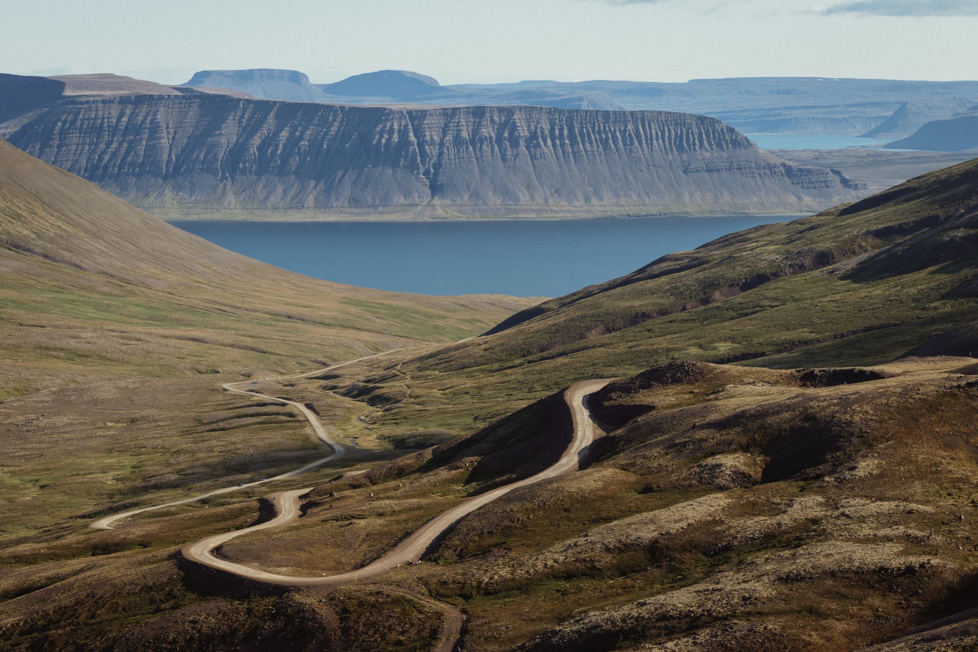
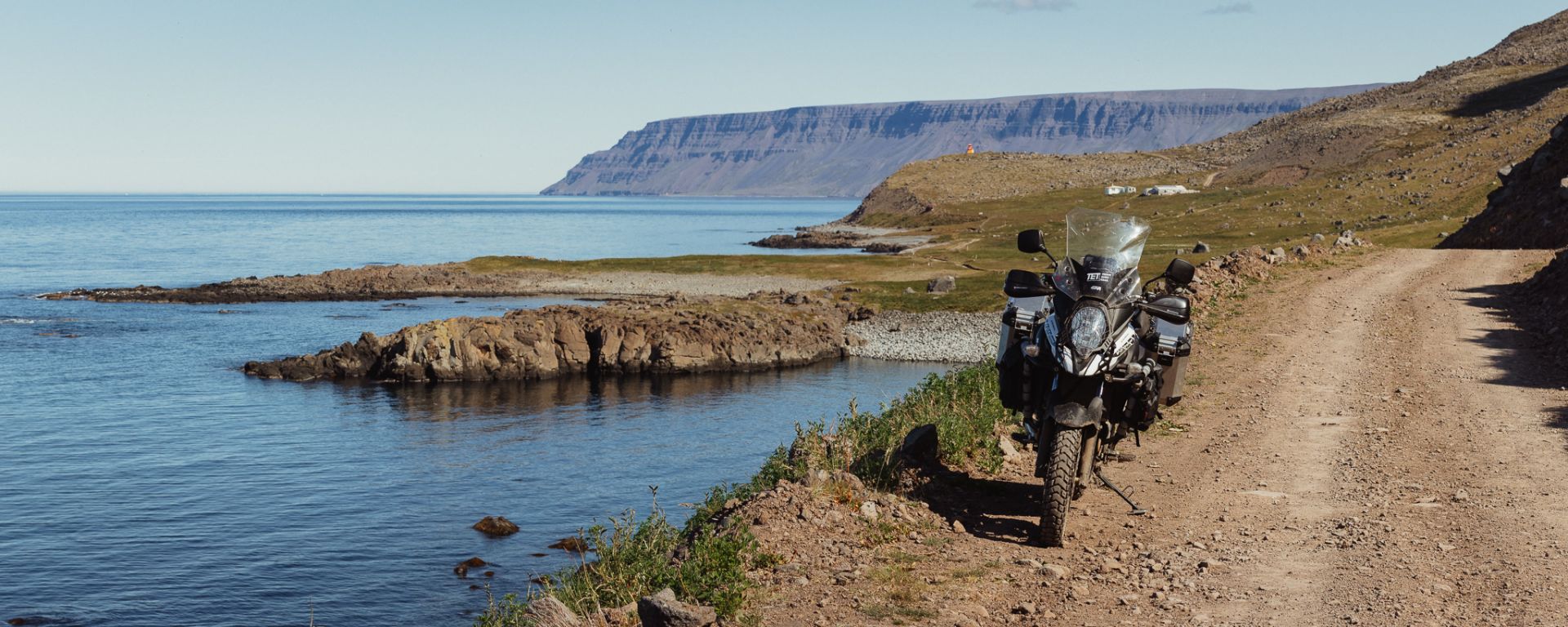
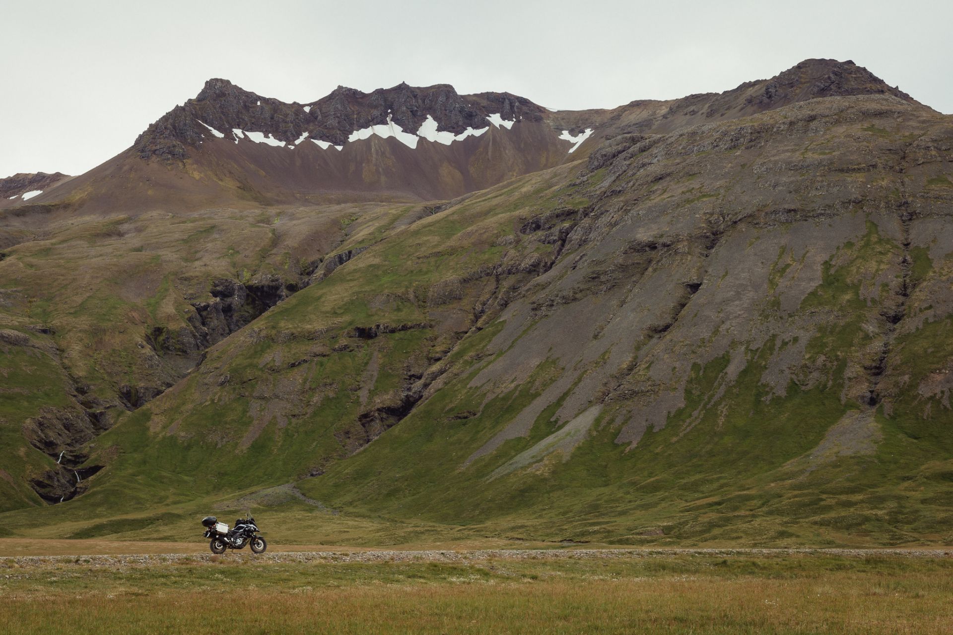
The route from Tálknafjördur to Þingeyri guides me via a paved road along the sea, and through the F60 gravel road over the mountains, with a couple of great views on a few small lakes. I reach Þingeyri a little past 8 pm. I set up my tent next to the pool at a campsite in the northern part of the village (2,033 ISK) and after supper I hike to the Dynjandi waterfall.
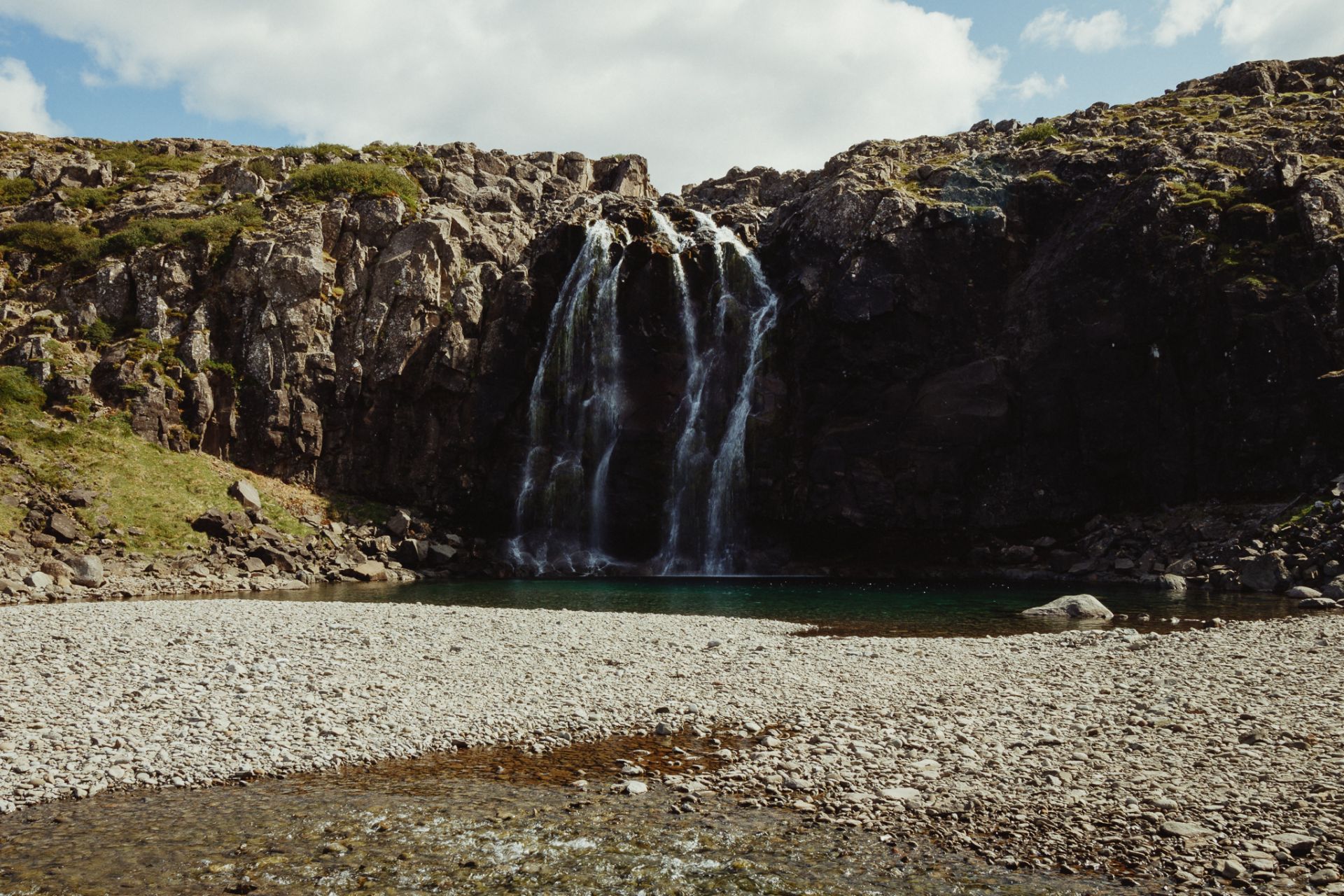
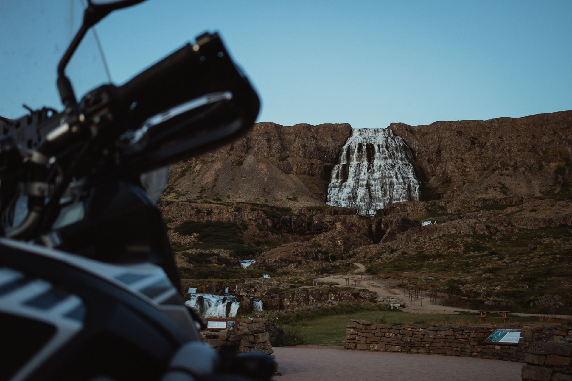
Dynjandi waterfall
I reach the waterfall at 10 p.m. Fairly late. At the parking lot a tourist asks me about travelling on a motorcycle, but since I don’t have a lot of time to take pictures I tell him te bare minimum. I don’t want to miss the setting sun that is already hiding behind the fjords.
As I look around for interesting compositions I try to find out from which angles the photos were taken that I’ve seen earlier on the web. Most of the trails that lead to those places are closed due to flora protection.
The sun sets at midnight. Since most tourist leave, I have the waterfall to myself. A few final shots and it’s back to Þingeyri for me.
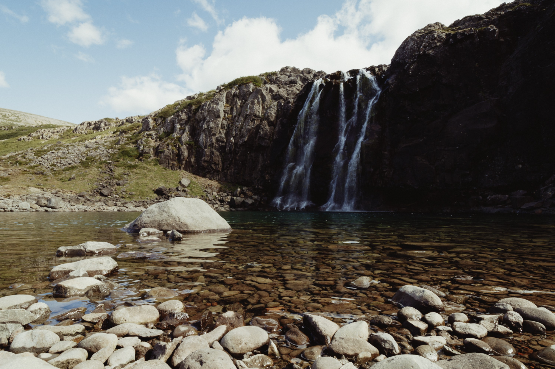
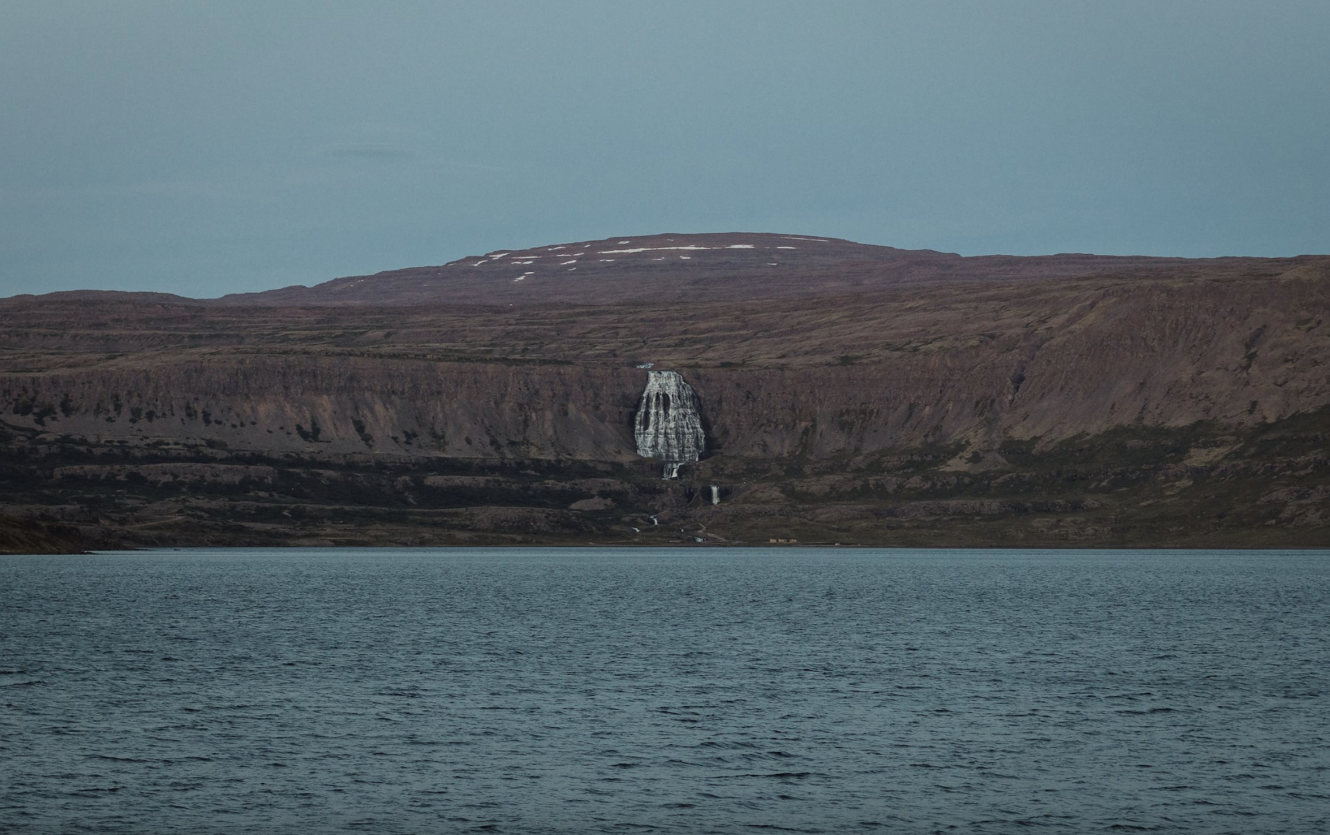
And this is what Dynjandi looks like from the other side of the bay, some 5 km away in a straight line.
Day 19: Route F622, Hólmavík, Grundarfjörður
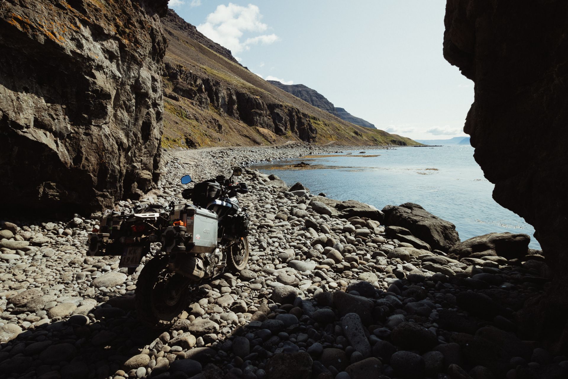
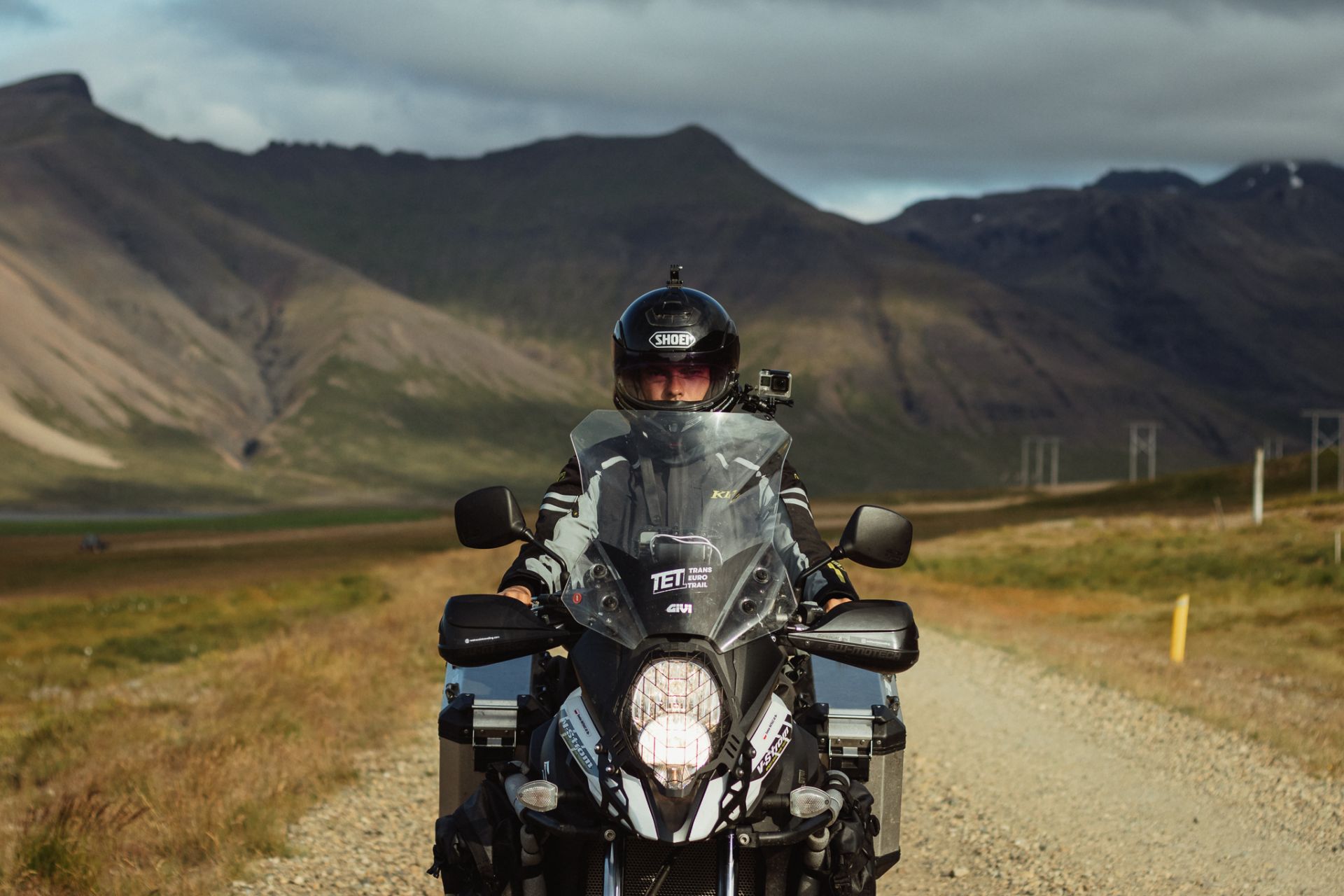
The plan for today is to tackle route F622, which is said to be one of the most dangerous routes in Iceland. It starts in Þingeyri and goes over gravel to Lokinhamar, 30 km away. Part of the route is at sea level and is impassable at high tide. Of course, it’s not an attraction I would like to miss during my trip.
I leave the tent and the top case at the camp site to make the bike as light as possible. I reduce the tire pressure to 1.8 bar and I leave around 10:30 am. It’s a warm, calm day. Perfect conditions to take on a hard ride.
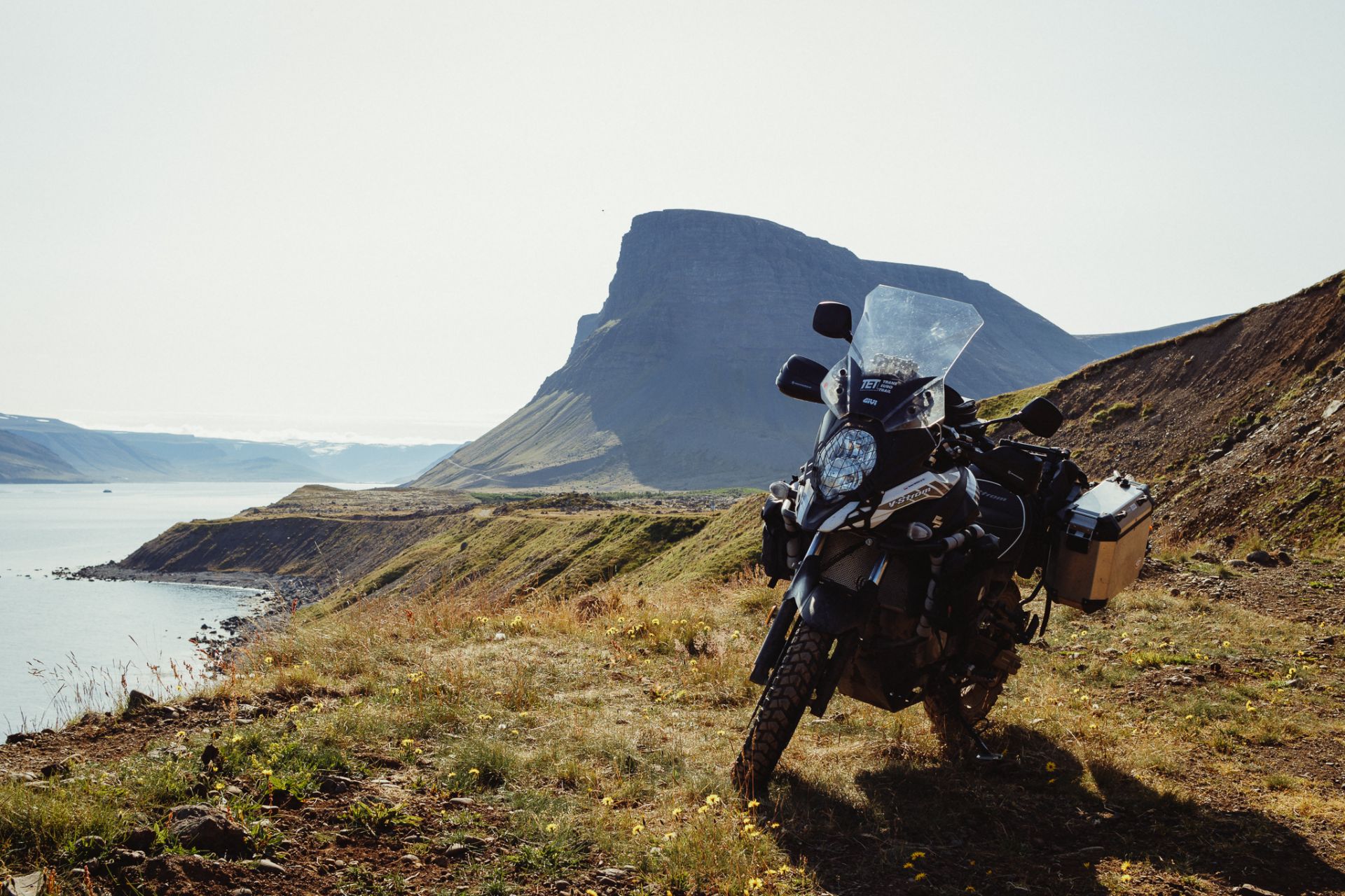
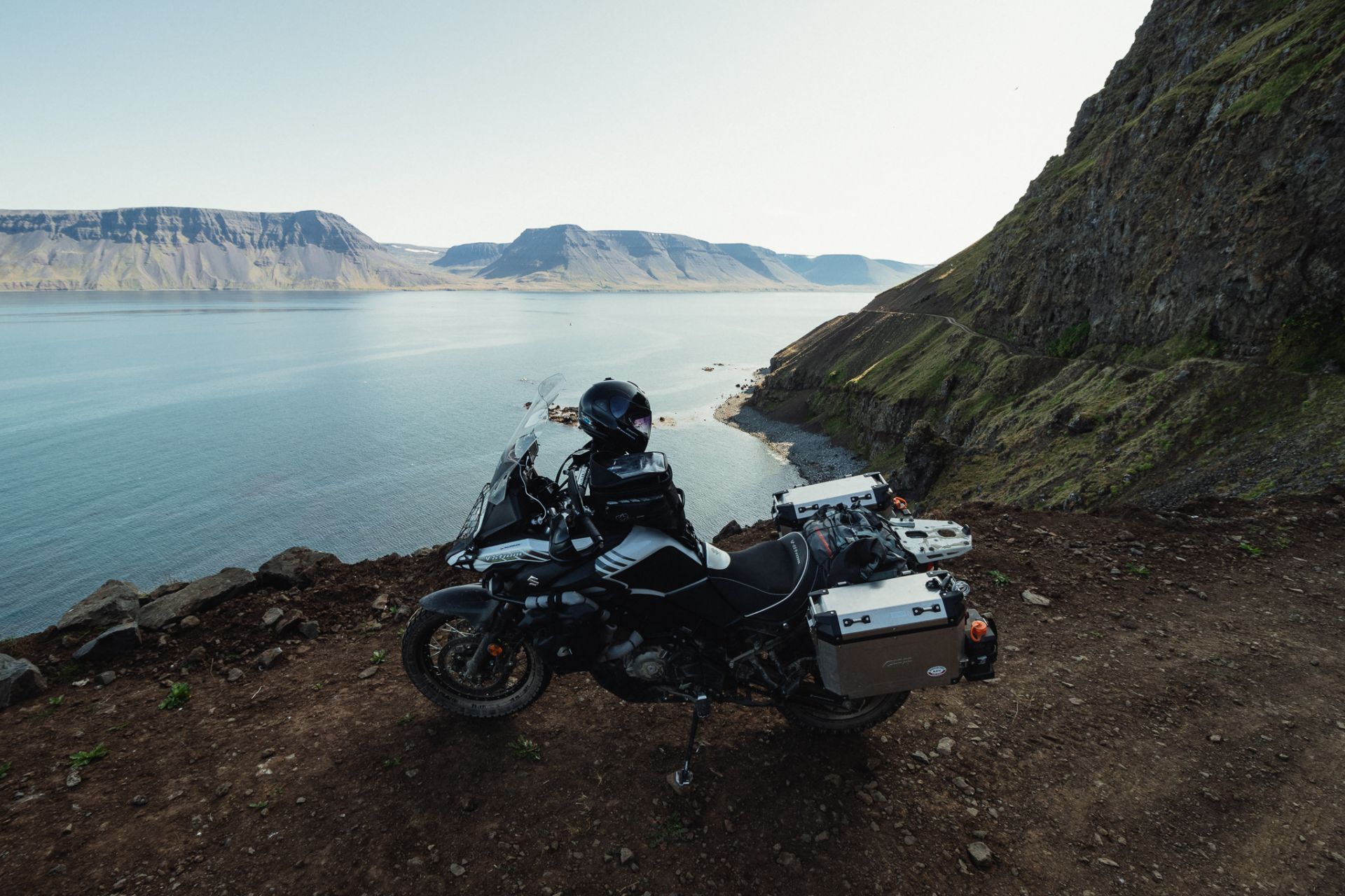
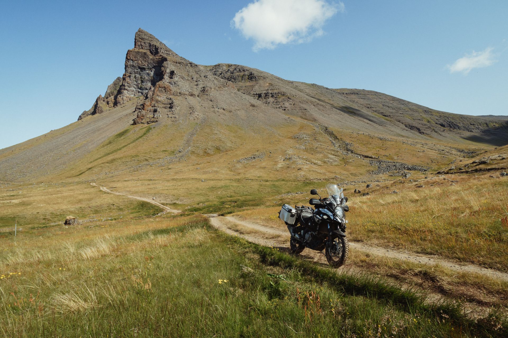
Route F622 (Svalvogavegur)
At first it’s easy. There are a few crossings over puddles and streams, but nothing I haven’t tried before. The first kilometres pass by slowly. I stop several times, enjoy the scenery, take photos and make some videos.
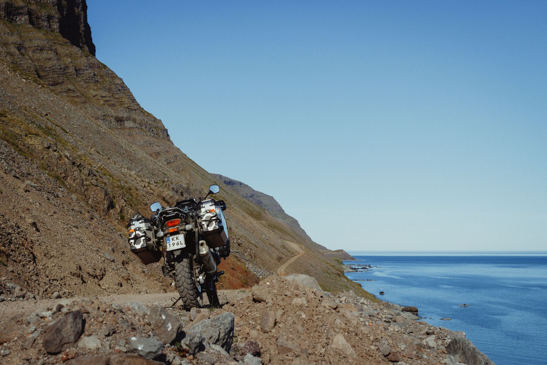
Later, the rocks on the road get bigger. I have to slow down. Time to watch out! From time to time a car comes from the opposite direction so I need to move out of the way. About halfway through I pass the Svalvogaviti lighthouse, built in 1920.
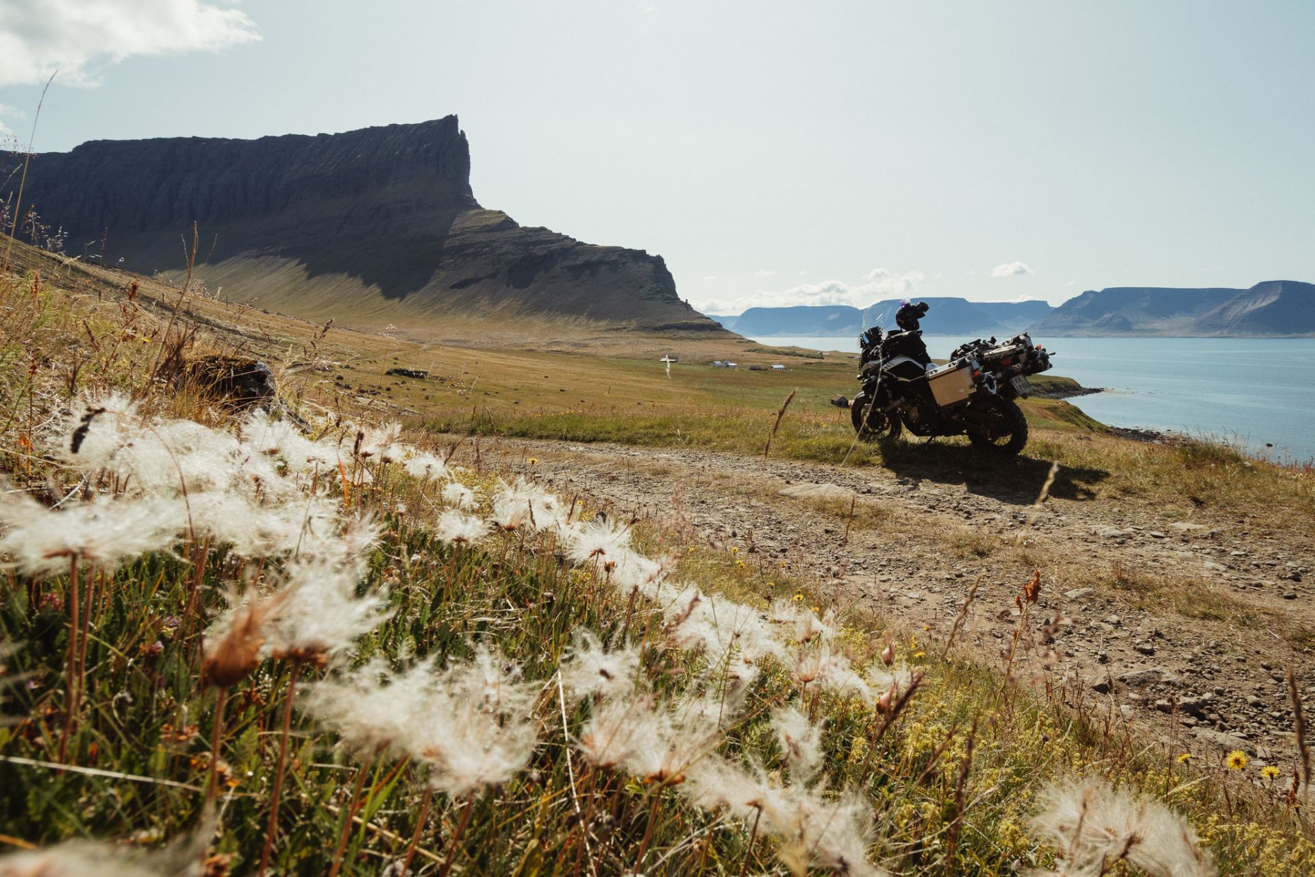
A while later I reach the turn leading to the lowest section of the route. The tide is out, so the road looks passable. You can’t really stop on the way down because it’s so steep that even with the brake engaged, the bike keeps sliding down. A Dacia Duster passes me, and if that car can do it, so can I!
This is where the hardest part of the route beginst, a few hundred meters of rocks and sea stones. They’re round and smooth, but very unstable. Going over them, I can feel the bike swerving to the sides, and I almost fall over.
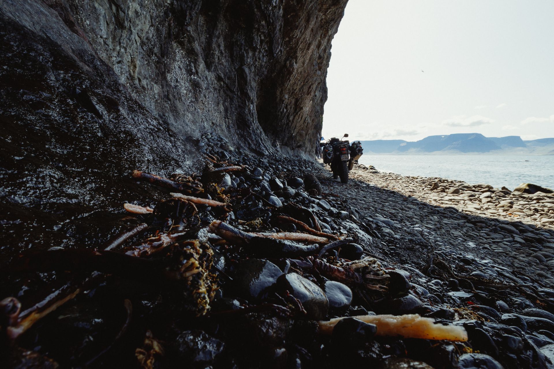
The rest of the route is easier, but equally picturesque. I pass some houses that look deserted. I can’t see any electricity posts around, or any other infrastructure. Whoever used to live here probably had no access to power or running water.
I return to the campsite at 3:30 pm. I pack my tent, take a shower, boil some water for tea, and set my satnav to the town of Grundafjörður. On the way there I’ll be passing through Hólmavík, so I have 450 km to go before I sleep.
It’s a fast ride from Þingeyri to Hólmavík thanks to the paved road. I don’t have much time, so I don’t take pictures, but the northern part of the Westfjords looks really pretty. On the way there are several spots where you can see the Dragnajökull glacier on the Hornstrandir peninsula which is an uninhabited part of Iceland.
Snæfellsnes
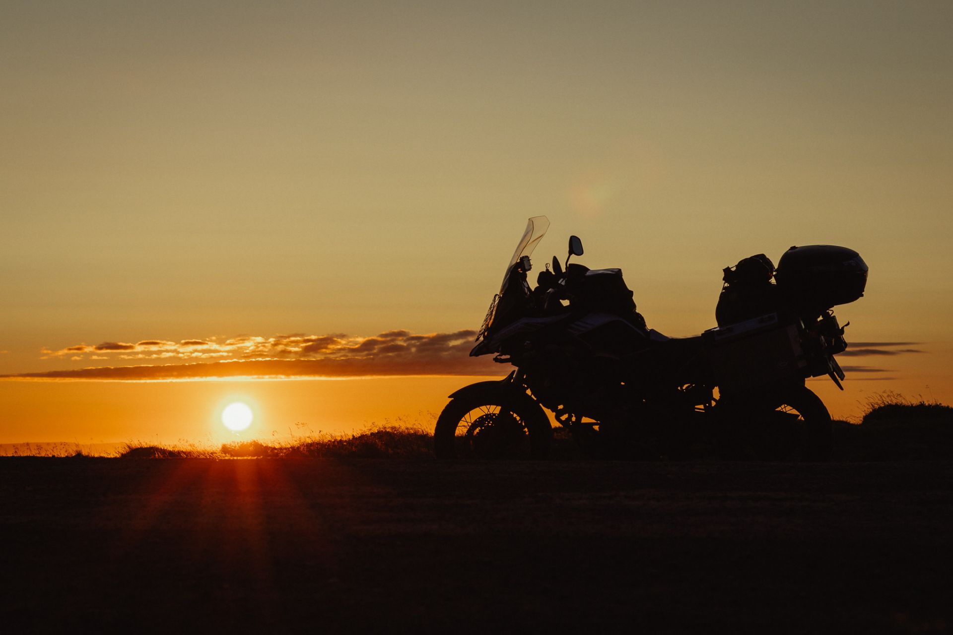
The sun is slowly setting, 10 minutes past midnight and it’s already low over the horizon.
Some 25 km before Grundarfjörður, the landscape shifts to a volcanic character. Lava fields stretch on both sides of the road, with green and grey rocks strewn about. It’s too dark to really get the views, but I already like it here.
Grundarfjörður
After more than 500 km on the bike I’m seriously cold and tired. I arrive at the Grundarfjörður Campground past 1 am, so I waste no time setting up my tent and slide into the warm sleeping bag.
Day 20: Kolgrafafjörður, Lake Hraunsfjörður, lava fields, Kirkjufellsfoss waterfall
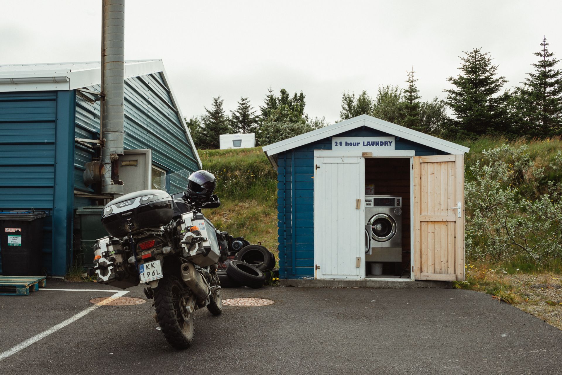
With a Campingcard, the price is 333 ISK for a night and 500 ISK for a shower. There’s no kitchen, nor laundry facilities. The campsite is poorly equipped. In the town itself there’s a laundry place that looks like a wooden shed, standing next to a dumpster and a pile of used tires. The washing machine seems clean and functions ok, so I do my laundry (700 ISK), do some shopping and fill up in the meantime.
On my way back from the laundromat I stop at a pharmacy and buy some cold medicine, because I’m feeling worse again. It’s almost 7 pm, so it’s time to finally take a ride around the area.
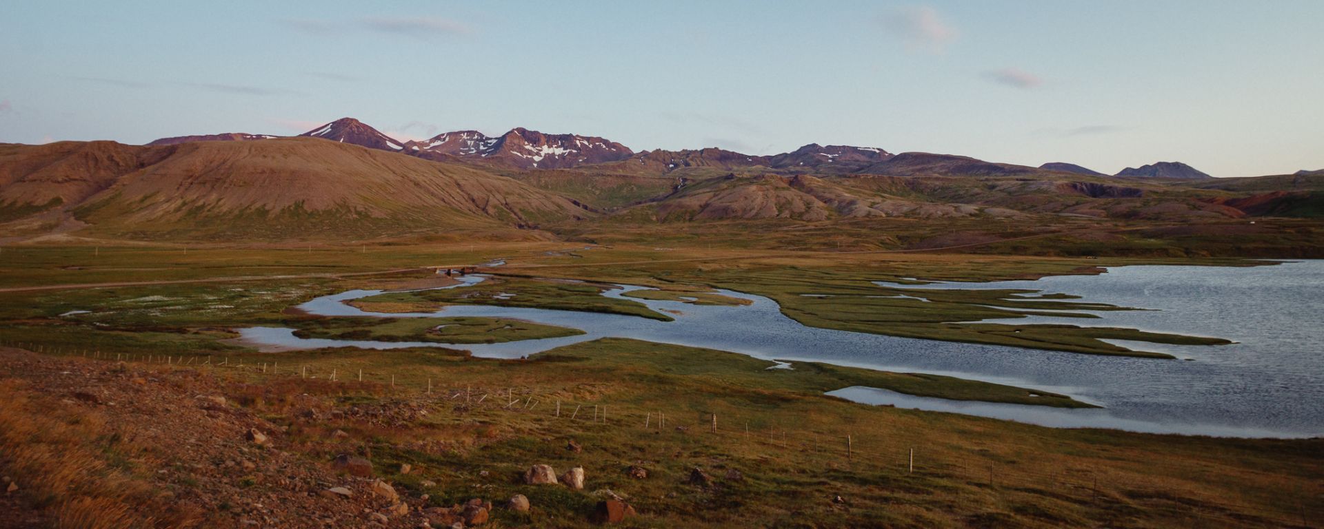
Kolgrafafjörður and lake Hraunsfjarðarvatn
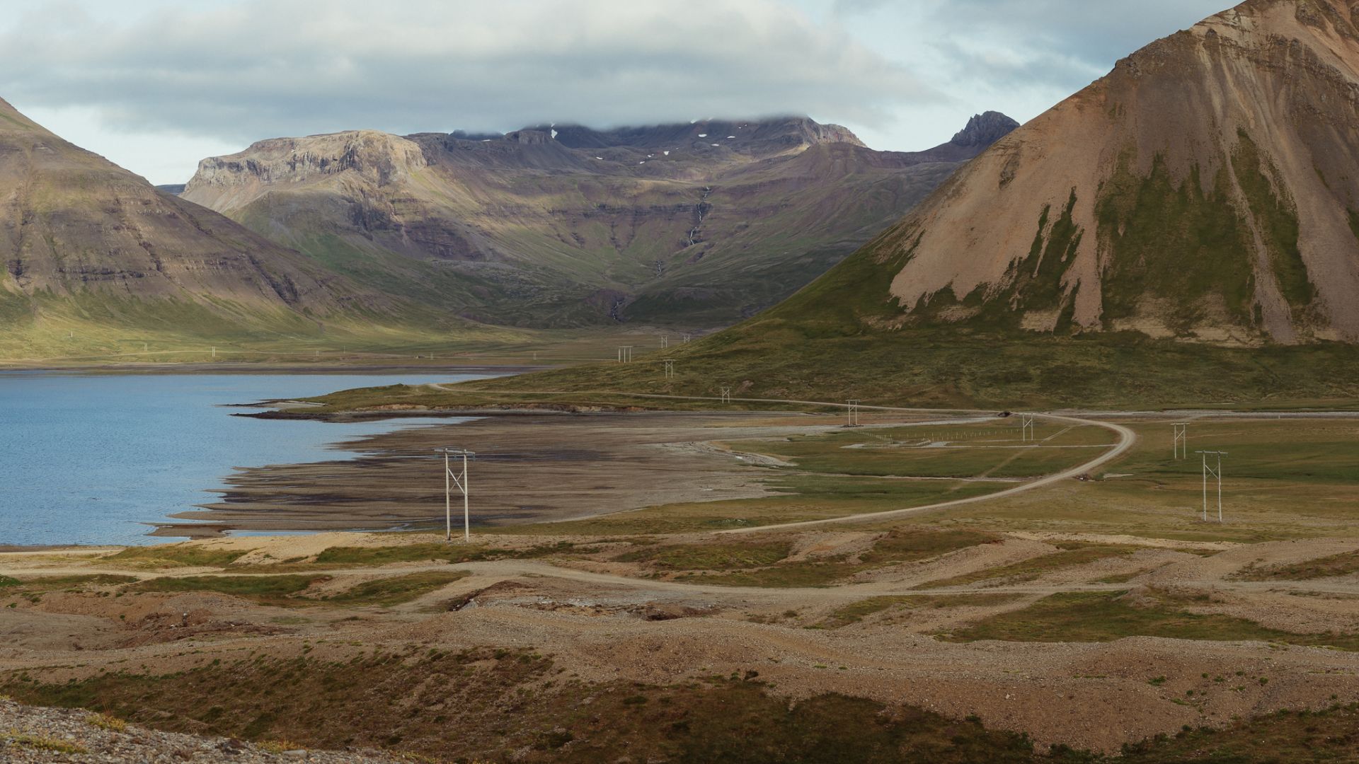
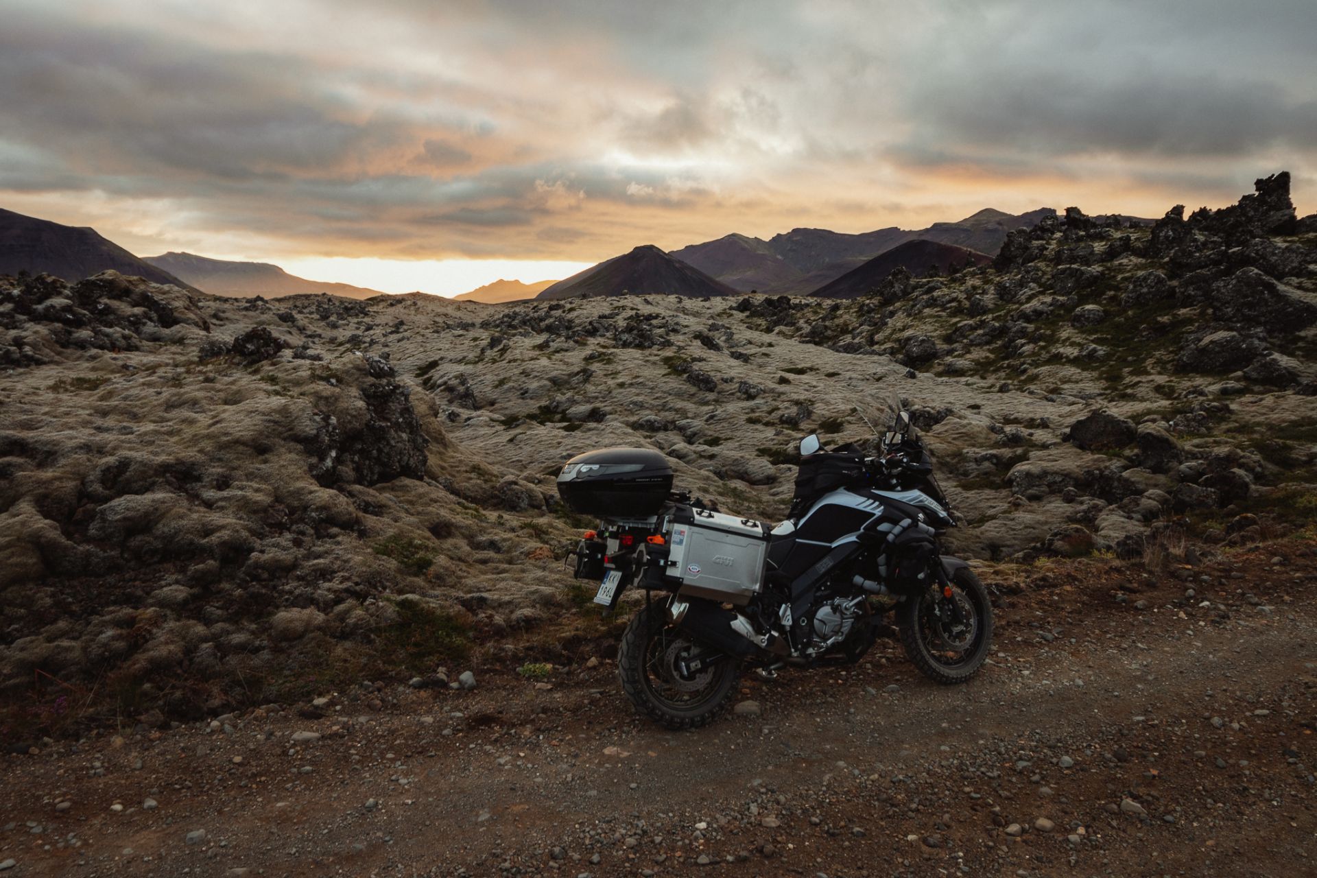
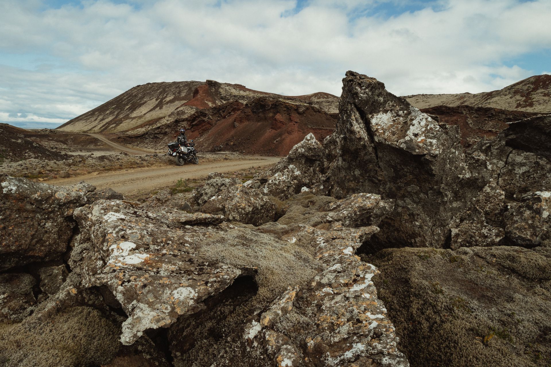
Lava fields
East of Lake Hraunsfjarðarvatn there are some volcanic cones with huge lava fields all around. Going through them feels like you’re on a different planet. It’s one of the cooler places I’ve seen in Iceland so far.
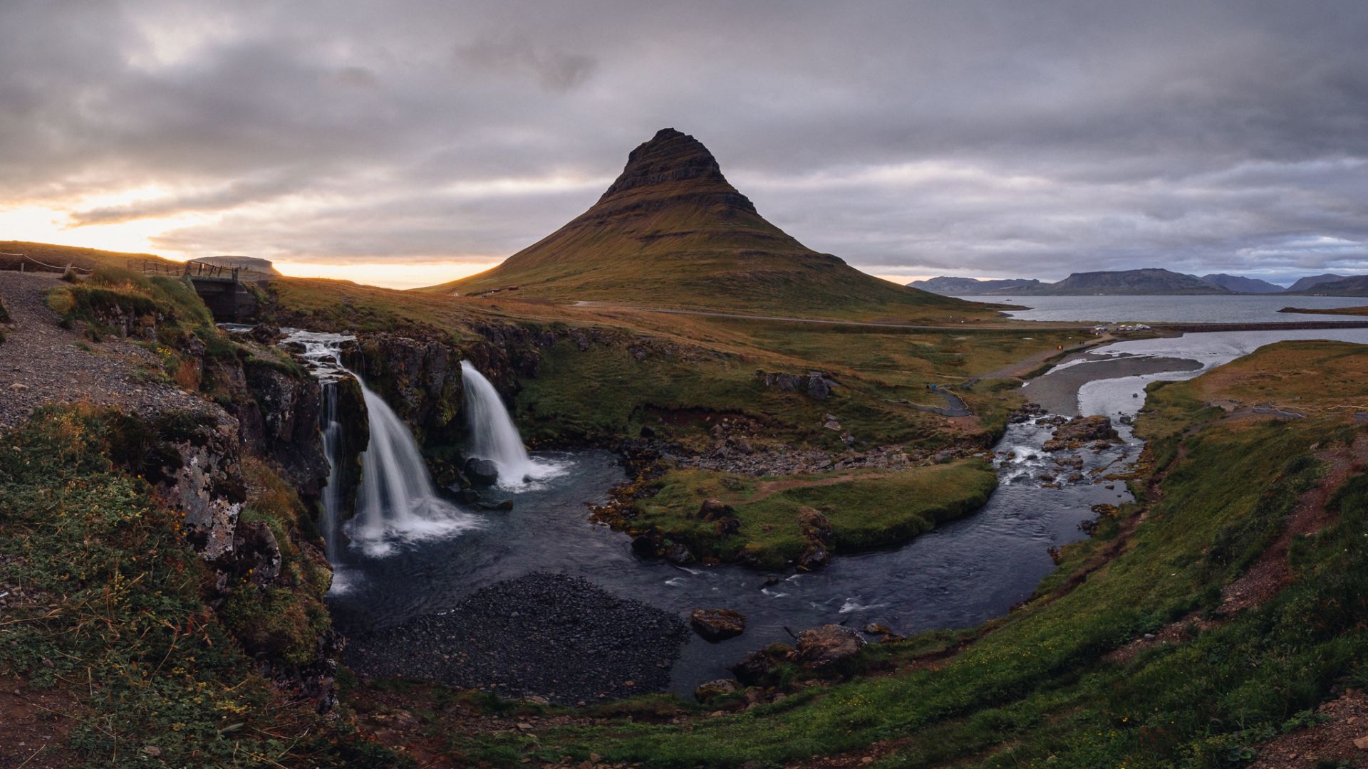
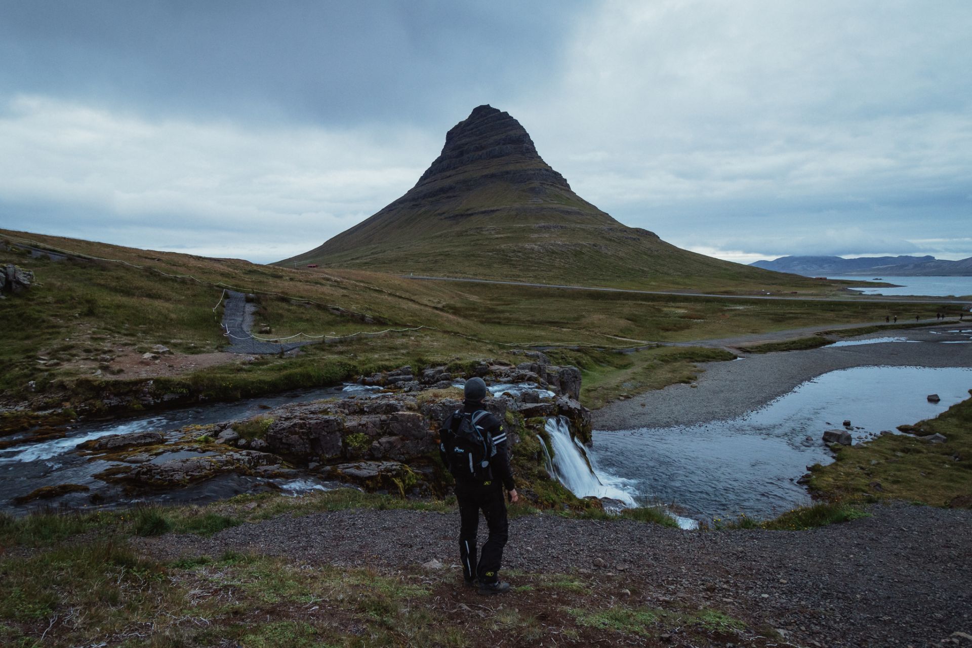
The sun begins to set at 11 pm, so I head towards the Kirkjufellsfoss waterfall, one of the most-visited and best-known spots in Iceland.
Kirkjufellsfoss waterfall
At the parking lot by the waterfall, I’m approached by a group of Poles who ask me about my trip, where I’ve been, where I’m going, where I’m from and how cool it is to ride a bike around Iceland. Photographers crowd the waterfall, so it’s easy to see, even from afar, where you should stand for a good composition. Sadly, the light isn’t great at this point, so it’s hard to take a good photo. I come back to the campsite around 1 am.
Day 21: Lava fields
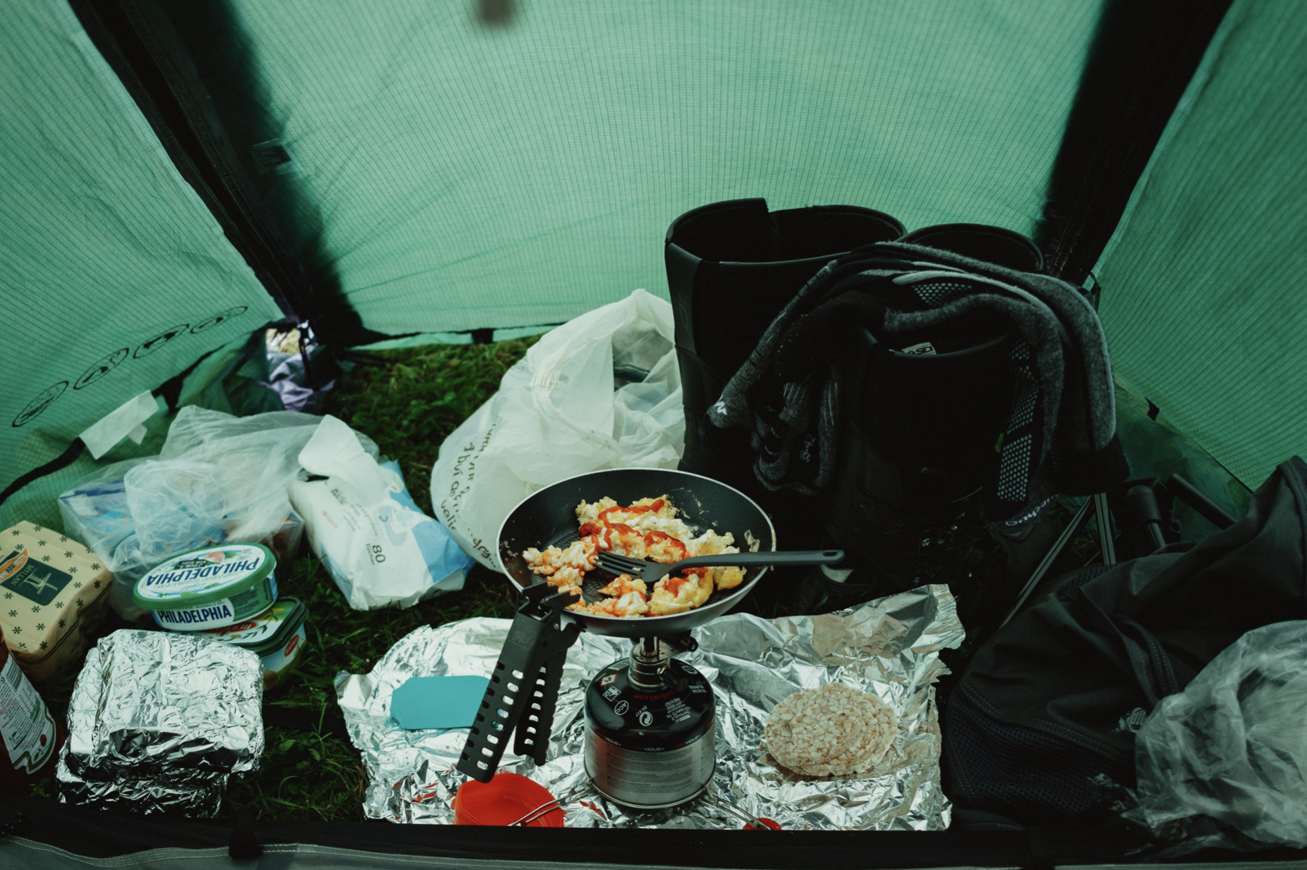
This is what breakfast in a tent looks like.
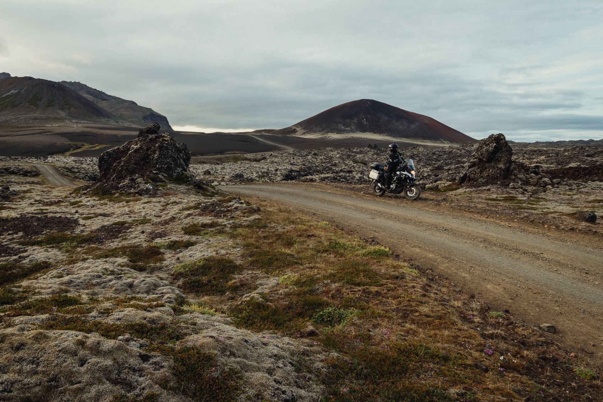
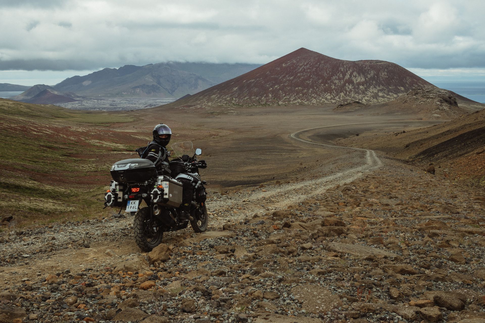
The plan for today is to spend the day riding around lava fields, take pictures and make videos. The wind is strong, so it won’t be easy.
Volcanic cones and moss-covered rocks make quite an impression.
At the end of the day, I find a gravel road that leads towards the mountains. Unfortunately, it goes through open areas where the wind is too hard, so after a few kilometres I turn back and head to Grundarfjörður.
I go shopping, drink coffee, and sum up my expenses. It turns out that so far, I haven’t spent more than 200 PLN per day, which is a pretty good result.
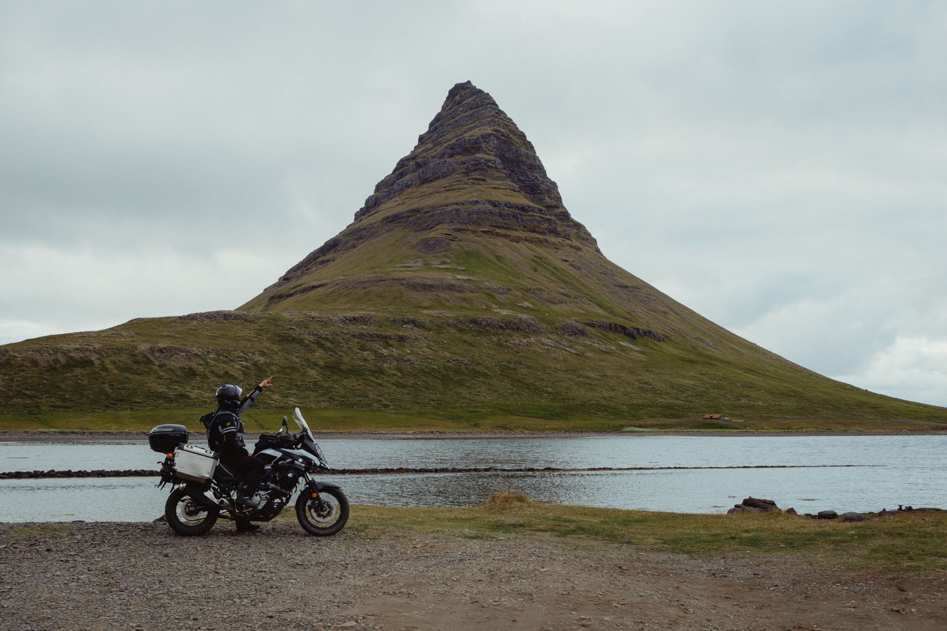
Kirkjufell and Kirkjufellsfoss waterfall
The sky is covered with clouds today, so it looks like I won’t catch a nice sunset today, either. But I’ll come back here!
Words & Photography: Damian Watracz
#FORYOURRIDINGPLEASUREONLY