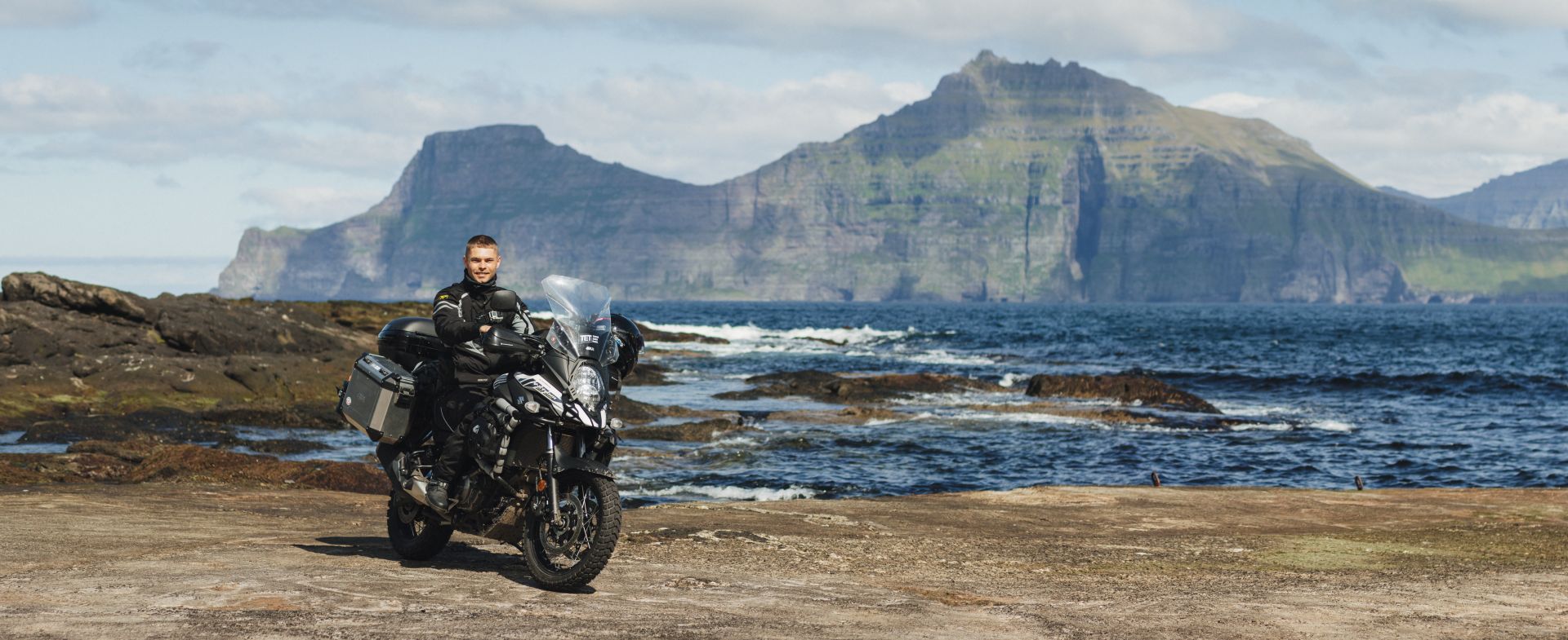
After breakfast I leave the Tórshavn campsite, get to the island of Eysturoy, and stop on the other side of the Fossá waterfall.
Iceland and Faroe Islands - part II
Motorcycle Diaries
Day 6: Eiði, Gjógv, Múlafossur Waterfall
Fossá waterfall
Eiði
There’s a nice campsite in Eiði, next to the soccer pitch!
Slættaratindur and lake Eiði
Slættaratindur is the tallest Faroe Islands’ mountain (880 m a.s.l.). I wanted to reach the summit last year, but the weather didn’t allow it. This year the weather’s great, but I’m not equipped for a hike.
Gjógv
I take a coffee break in Gjógv. I park next to a small cafe over the gorge, buy coffee, and walk down to the pier to sip it by the sea.
In the eastern part of the village there’s a road leading to the pier. The island of Kalsoy is visible at the horizon.
Funningur
At the pier I see an Italian guy I met back in Gjógv. When he sees me taking photos he photo bombs me by walking into the middle of the frame and smiling broadly for the camera.
Oyndarfjørður
I stop to rest at the pier. It’s already 7 pm, but it’s still bright out. Instead of heading back to Tórshavn I set my satnav to the island of Vágar. Maybe I’ll catch a nice sunset over the Múlafossur waterfall.
Múlafossur Waterfall
Some photographers who are waiting for the sunset have gathered next to the waterfall. It’s not easy to find a free spot, so I walk down to the cliffs where there’s not a soul in sight. I take a few test photos, adjust the camera settings and check the frames I can get using different lenses.
Suddenly I hear a strange noise. I turn my head and out of the corner of my eye I see my lenses rolling down the rocks and dropping into the sea… The backpack in which I kept the gear fell over, and the lenses rolled out straight into the depths below. Unbelievable! I can’t wrap my mind around how this could have happened. Such a loss right at the start of the trip. Upset, I pick up my stuff and return to the campsite in Tórshavn thinking about what I can do to salvage the situation.
Day 7: Faroe Islands → Iceland
In the morning I ride to an electronics store to check if they have any lenses for my Canon. They have a few, but nothing that really suits me. In order to get lenses like the ones I lost I’d have to wait for them to arrive from Norway, which would take a couple of weeks. I head to motorcycle forums to ask if someone could point me into the direction of the right store ... One of the users writes back that they’re available in Reykjavík. And that’s how I meet Gunnar.
Gunnar lives in Reykjavík. He calls all the photo stores there to help me find the lenses I need. Just to be sure, I call the store directly and ask them to keep the lenses aside. If things go well, I’ll manage to bring some more photos back home, thanks to Gunnar’s help.
Around 2 pm I leave the campsite and ride to the pier, where I find myself in the line of bikers waiting for the ferry to Iceland. We chat about our travels and our bikes. I meet a German couple who had visited Iceland 10 times before, and a Swedish man who’s back from a six-month motorcycle trip to the Himalayas. On the ferry, I settle in the sleeper cabin, then go to the gym, the sauna, and to dinner.
Day 8: Seyðisfjörður → Reykjavík
Around 10 am I leave the ferry at the Seyðisfjörður terminal in the eastern part of the island.
I set my GPS to Reykjavík, 670 kilometers away. I need to get there before 6 pm, because that’s when they close the store where I want to pick up my lenses today. In order to make it, I need to keep an average speed of over 83 km/h. That’s not counting the time for getting gas, resting, or any unforeseeable situations.
I pass the Gufufoss waterfall and take the Fjarðarheiði pass towards Egilsstaðir. The temperature drops to 7°C, so I put on my down vest and two pairs of gloves. On the way I pass several other waterfalls, hot springs, and geysers, but I don’t have the time to stop and enjoy them. And besides, everything looks greyer than in people’s Instagram photos, so I don’t feel like I’m missing out. The average road in the Faroe Islands is more interesting than the northern part of Iceland’s Ring Road.
I reach Akureyri frozen to the bone. Even though the thermometers show 15°C, it’s been a few hours on the bike, in wind and rain. I stop on the way only to get gas, and my only meal are two Snickers bars. I get to Reykjavík around 5 pm.
Reykjavík
At the photo store, I check out the lenses, pay up, and take a Tax Free receipt. I’m hoping to get the VAT return from the purchase. Now it’s time to get a local SIM card.
At a grocery store, I’m approached by a Polish guy who says “I know you from the internet!” Turns out he saw my post about my lenses sinking, and that’s how he recognized me. He tells me about living in Iceland, about where he works, where to check the weather forecast, and he helps me with buying the right SIM card (a prepaid one with 25 GB of data is 4,450 ISK). I’m considering exchanging currency, but there’s no exchange office nearby, so I need to wait until the next day for the banks to open. Nothing left to do but head to the campsite.
Reykjavík Campsite
Naturally, the receptionist at the campsite is Polish. I really didn’t think there’d be so many Poles here, which isn’t necessarily great — it means I won’t have the feeling of being away from home. The night is 2,400 ISK. The campsite is large and well-equipped. There is a laundry service and a kitchen.
Day 9: Kerið Crater, Strokkur, Gullfoss waterfall, Route F35
After breakfast I leave Reykjavík and head east towards the Strokkur geyser and the Gullfoss waterfall. It’s much warmer than the day before. At noon, the temperature reaches 18°C. On the way, I stop by the Kerið crater.
Entry is 400 ISK. The crater is 270 meters long, 55 meters deep, and it’s filled by a volcanic crater lake, about 12 meters deep.
Strokkur
Strokkur is the largest active geyser in Iceland. Every few minutes it erupts about 30 meters into the air. There are a few other hot springs near, but none of them are as impressive.
Gullfoss waterfall
Gullfoss, or the Golden Waterfall, has two levels. The first is 11 meters tall, and the second — 21. There are several pathways with viewpoints around.
Around 8 pm it starts to rain, and dark clouds cover the horizon; but shortly afterwards, the sun comes out and a rainbow spreads over the waterfall.
Route F35
I fill up my bike and ride northeast, towards the Langjökull glacier. A few kilometres on, the tarmac turns into a gravel road. The route is pretty easy, and rather boring, so I veer left towards the glacier. Maybe I’ll find something better that way.
Lake Sandvatn
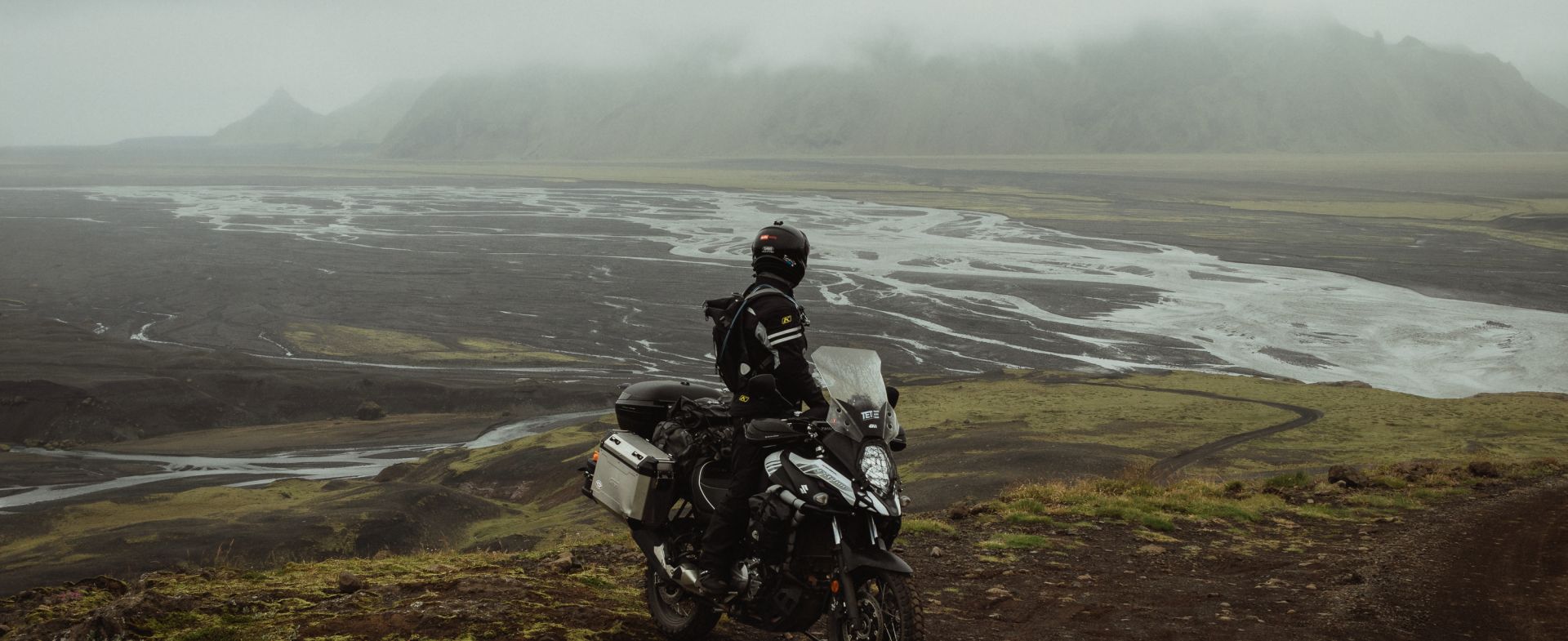
The light gravel quickly turns into deep sand and volcanic rock. I get to lake Hagavatn right by the glacier. The water is murky and flows rapidly. I wonder if I should try to cross it and keep going into the unknown; I wade into the water to see how deep it is, but as soon as I take the first step, it overflows into my boot. And the bottom of the stream is very muddy. Besides, there are no tire tracks around, so I guess no one passed through here recently. It’s 10:30 pm, and I wouldn’t want to get stuck in the stream this late, so I turn back towards the main road and ride to the campsite.
Skjól Campground
I buy the Campingcard at the campsite (20,000 ISK). It’s valid for a month, and it gets me discounts at many of the campsites around Iceland. I’m hoping that over the course of a month it’ll mean that a single stay costs me more or less 50 PLN (converted to my home currency), which makes it a really good price. I set up my tent, buy a beer in the campsite bar, sort out my photos and go to bed.
The plan for the next day is to ride through the F35 road that leads between the Langjökull and Hofsjökull glaciers, so it’s going to be a full day of riding on gravel.
Click here to read part I of this trip.
If you’re interested in following the story of Damian and his trip to Faroe Islands and Iceland, check out the story on our website or follow Damian direct on his site www.watraczistraveling.com
#FORYOURRIDINGPLEASUREONLY


