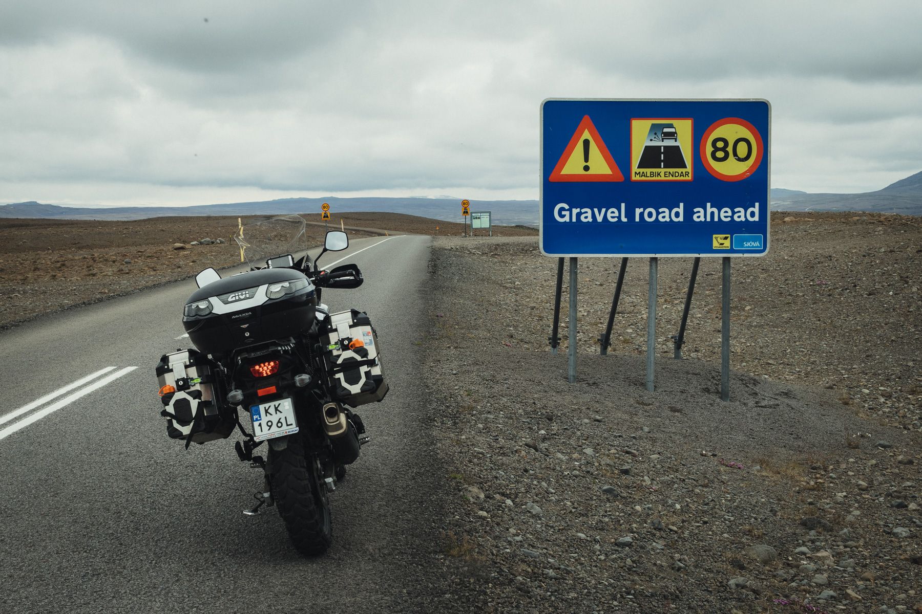
The tarmac ends about 25 kilometres in and becomes a gravel road.The ride is pretty easy and rather boring, so about 10 kilometres later I take a slight left towards the Langjökull glacier.
Iceland, part III
Motorcycle Diaries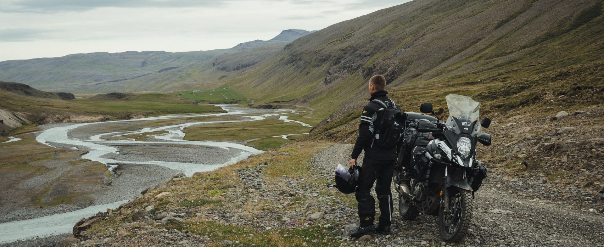
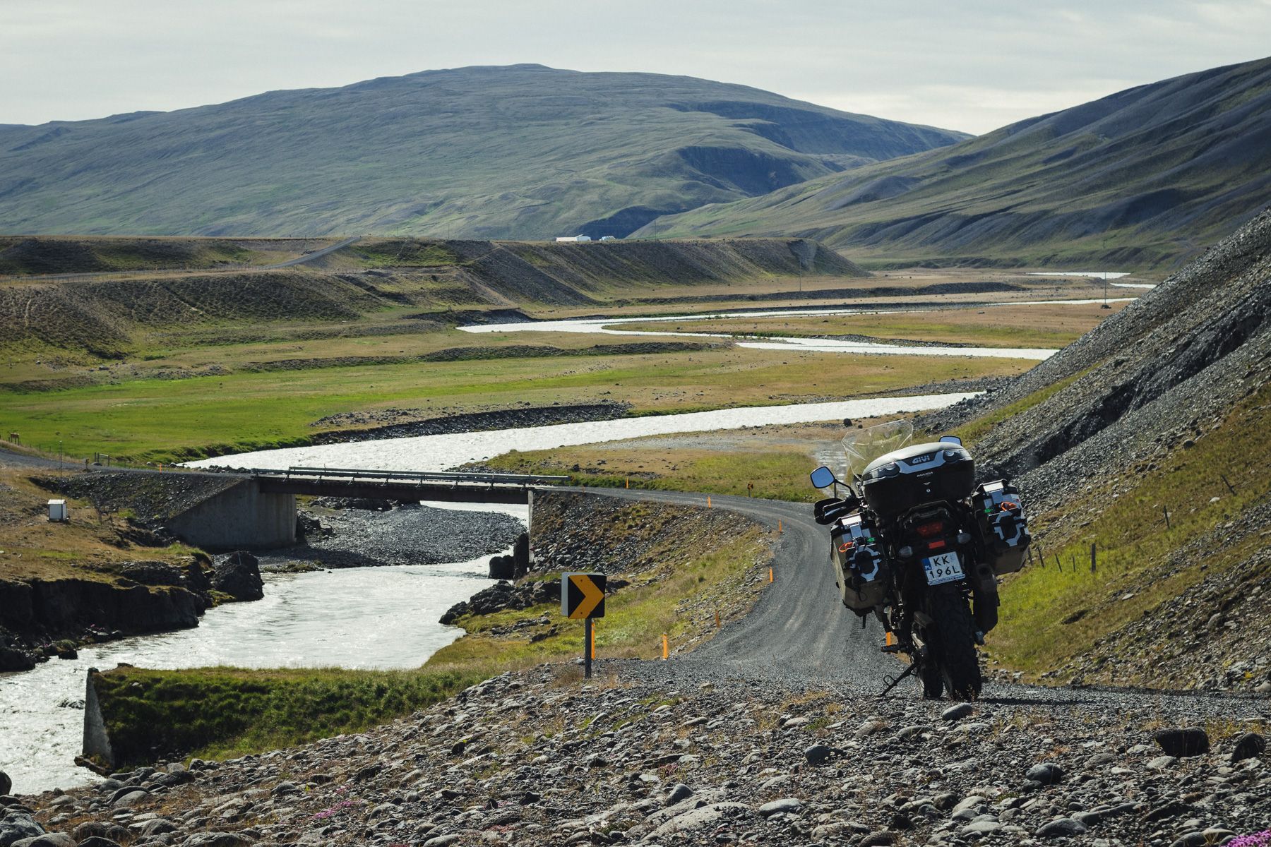
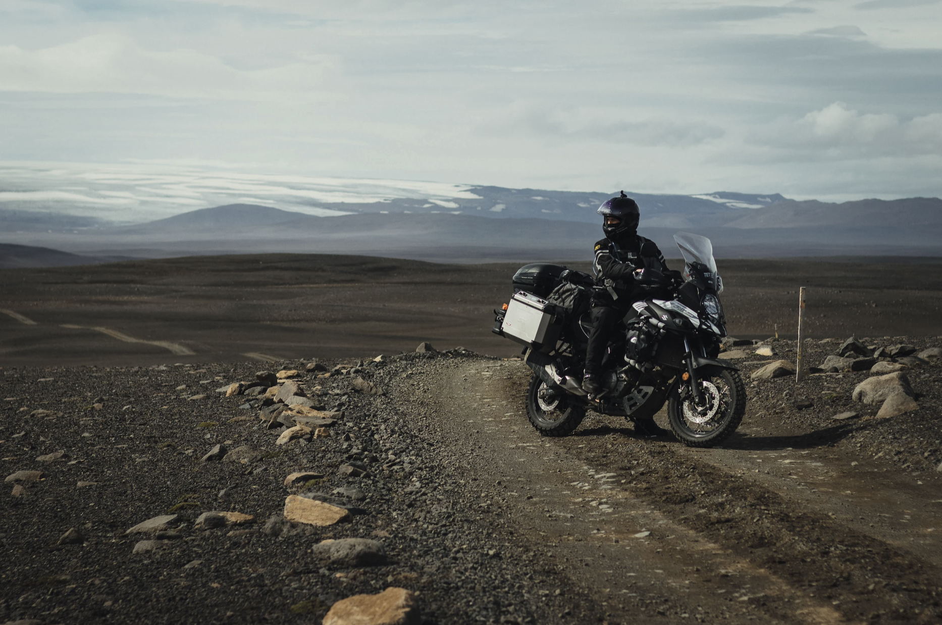
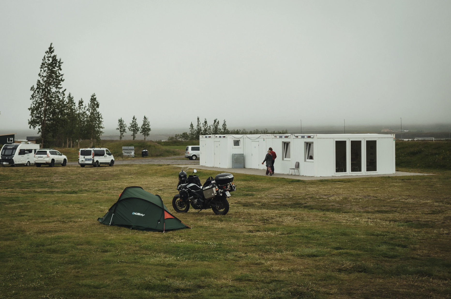
I leave the campsite around 11 am. I go back to the Strokkur geyser, fill up the bike and head northwest on route F35.
Route F35

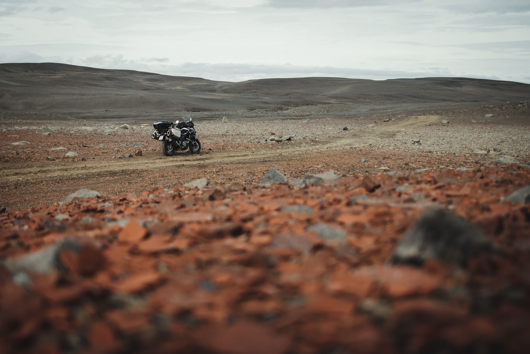
I stop by the Glacier Expeditions tourist centre, the starting point for glacier tours. An EMT starts a conversation and we talk a while about travels and motorbikes. He says he once took a BMW F650 GS through the route all the way to the glacier, and that it is a really challenging ride. The route looks very interesting so I decide to try it. And indeed, only a few hundred meters beyond the tourist centre I’m into serious off-roading. Huge rocks, sand, and high stony “speed bumps”. The only vehicles here are off-road buses and raised-undercarriage trucks with huge tires. I reach a spot where the rocky bump across the road is higher than the ground clearance on my bike; my engine guard would definitely get stuck there. Because I’m all by myself, and since I’m carrying a lot of luggage, I decide to turn back. But first, photos — the view is really impressive!
The later part of F35 is really picturesque, but it’s what I see on the horizon that seems to be the most appealing. There are several bridge crossings over the stream, a few spots where you can see a delta of the river flowing out from the glacier, but nothing spectacular. I’d love to take another side road and ride off into the unknown.
I arrive at the Hveravellir hot springs, where I plan to rest a bit in the warm water, but time’s too short so I cannot stop for long.

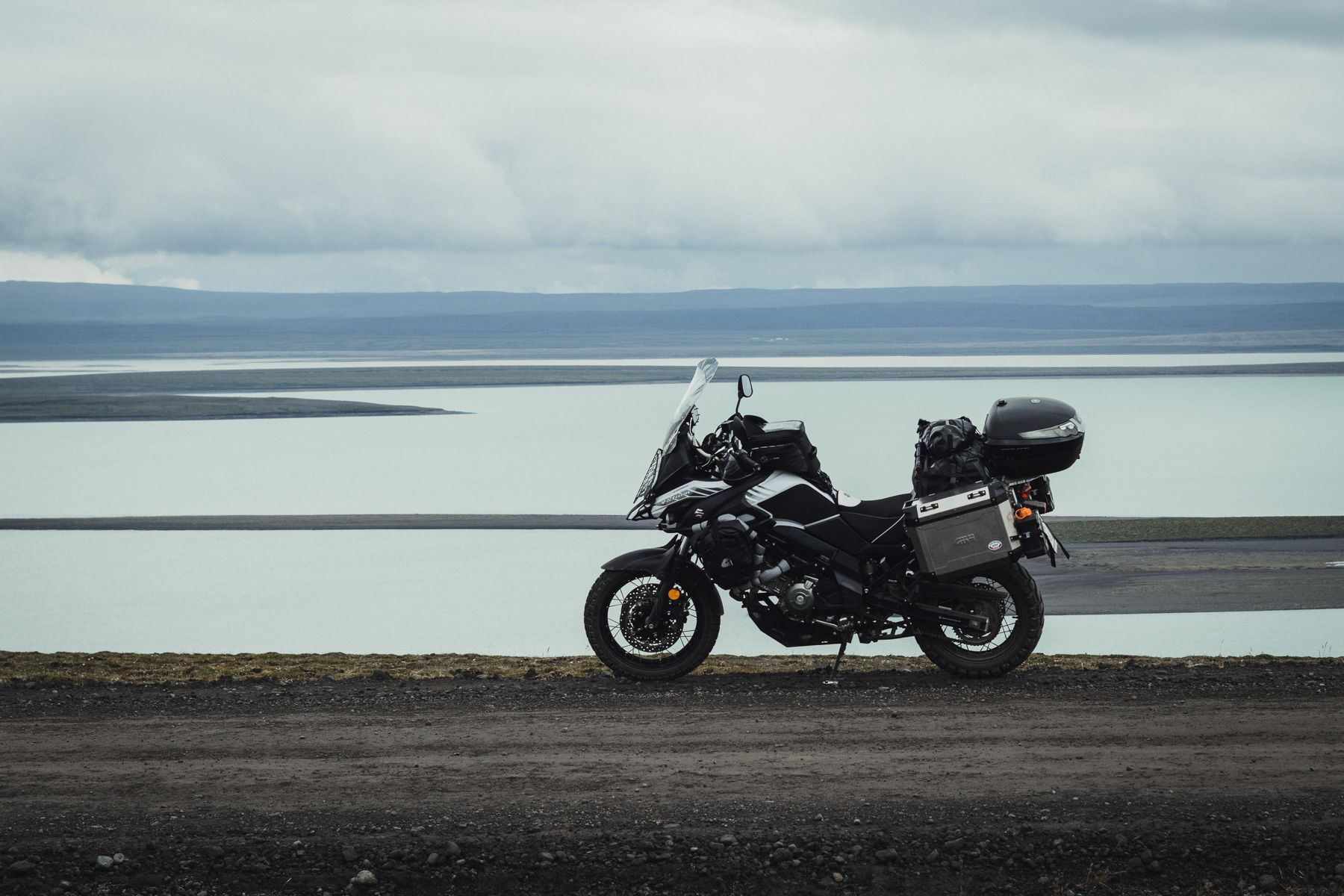
Lake Blöndulón
Around 8 pm I pass one of the largest lakes in Iceland: a reservoir created in 1984-91 to be used by the nearby power plant.
Sauðárkrókur
45 kilometres later, the gravel road stops and tarmac begins. I turn east towards Sauðárkrókur. The supermarket is still open, so I do some quick shopping (eggs, sausage, bread, skyr, and WD40 that I’m hoping to use to fix the sticky locks in the cases).
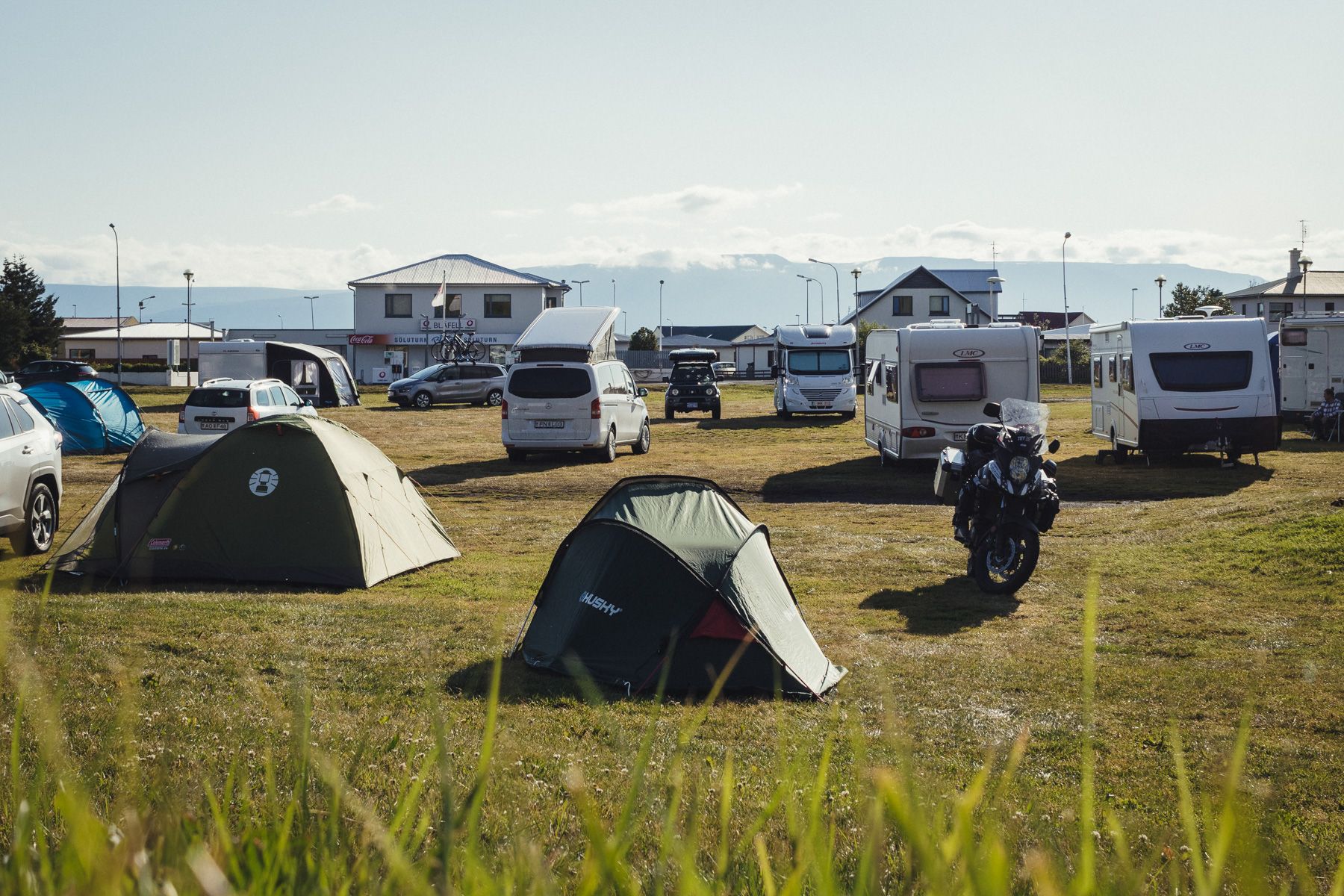
There’s a Campingcard-listed campsite here, but it doesn’t have a reception desk. I’m told that late in the evening or early in the morning a staff member is supposed to come to pick up the fees. There are toilets and showers, but no kitchen facilities other than a sink mounted under the sky. Luckily, I do have a camping stove, so it’s not a big deal. It’s still light out when I go to sleep around 11 pm.
Day 11: Route F752, Laugafell
The morning heat makes sleeping unbearable, so I open the tent to get some air. It looks like it is going to be a very warm day. No one has come for the camping fee. I call the phone number on the side of the building and the owner asks me to put the money into the box on the wall. I put in 500 ISK, shower, prepare some scrambled eggs and hit the mountains towards routes F752 and F821.
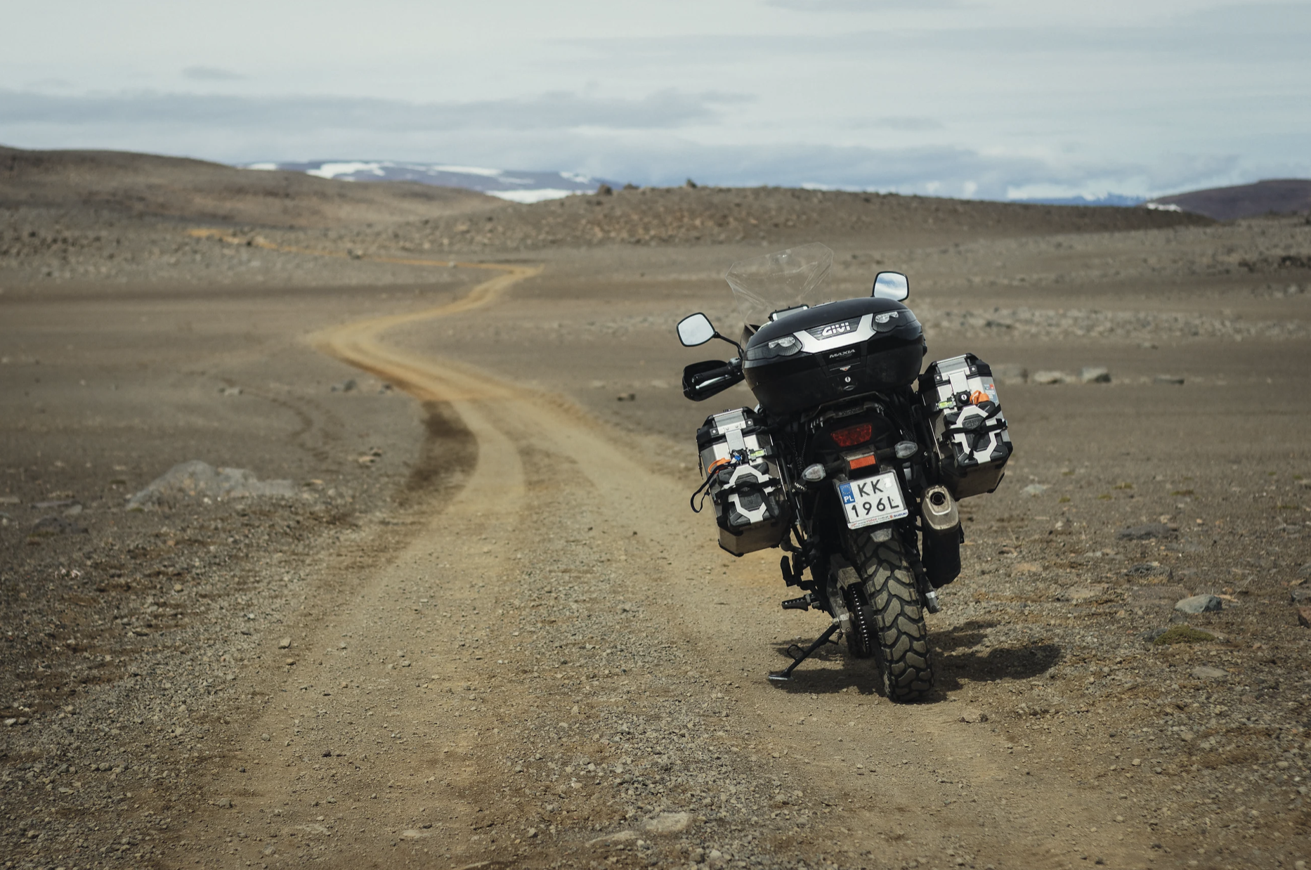
The section I have on my itinerary is about 180 kilometres long, most of which is gravel. I divided that into two parts, one per day. The first one takes F752 from Varmahlíð to Laugafell, where I’ll find a campsite and a hot spring, and the other part goes on F821 from Laugafell to Akureyri. Naturally, there are no stores or gas stations on the way, so I make provisions for 3 days (just in case) and fill up the tank. Because it’s the interior of the island, I’m not expecting to have mobile service, either.
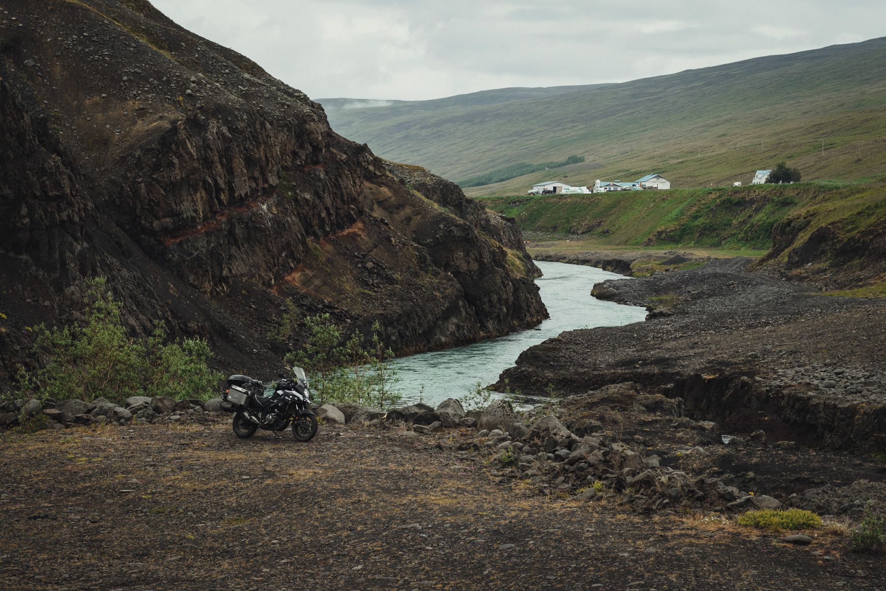
Route F752
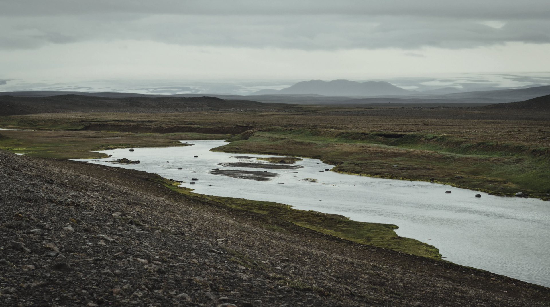
At first it’s pretty easy. The first 30 kilometres are on a straight, even, tarmac road. I reach a fork in the road and head towards the mountains. The terrain becomes more and more challenging. It’s steep, the road’s winding, there are streams, rocks, gravel. Finally, something interesting nearby, rather than off in the distance. I cross a wooden bridge, take a few photos and get back to F821.

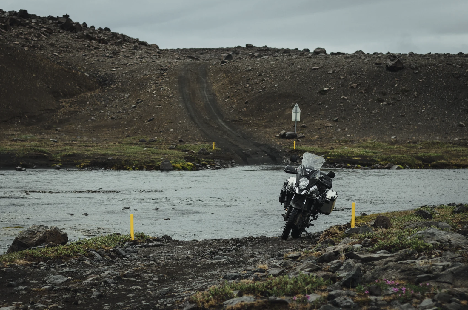
It is my first river crossing. The stream is shallow and narrow, but I take my time to get familiar with the experience. First, I walk it both ways, to check the depth and the floor. Then I take the cases off to make the bike lighter, and ride across standing. Finally, I carry the cases to the other side.
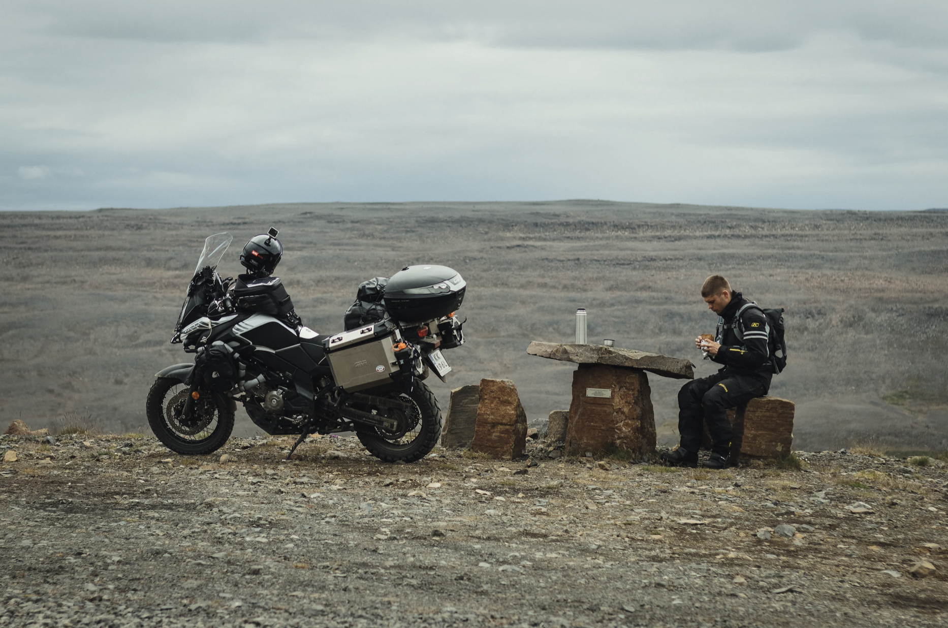
It’s almost 5 pm, time to take a break. A sandwich and hot tea on a stone table.
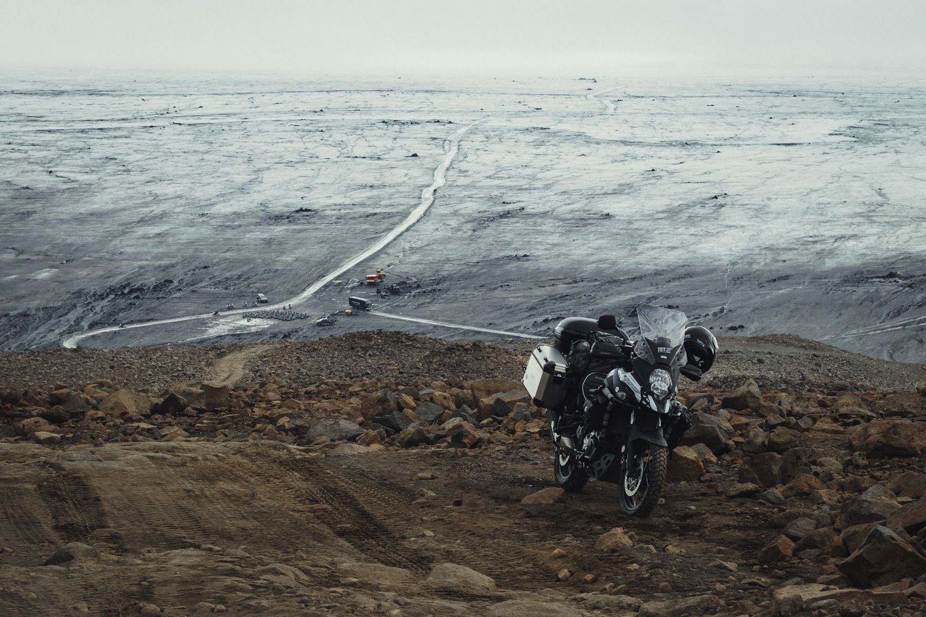
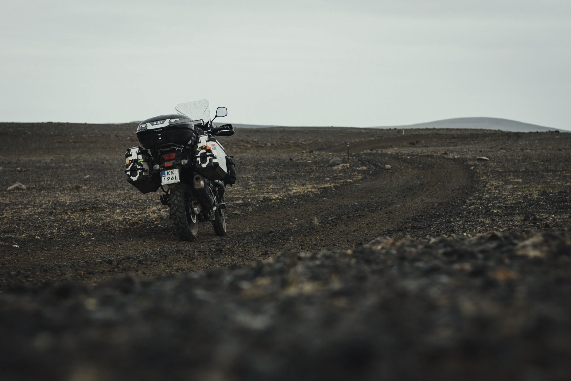
The landscape’s becoming bare and moon-like. Dark rocks, black sand, and grayscale everywhere. There’s added tension from the fact that I’m all-alone here, and I haven’t seen another human for several hours. The phone has no service, so if something should happen I’m not getting any help.
Another river crossing. The difficulty level is rising quickly. The river is more than 20 meters wide, I can’t see the bottom, and the current is strong. Like before, I first cross it on foot. There are a few deeper spots and there are large rocks on the riverbed. I decide to try a different technique and walk the bike rather than ride it, without taking off the cases or the luggage. I start the bike, put it in the first gear, lightly release the clutch, and walk into the water while walking the bike. I position myself so that the current pushes the bike towards me, not pull it away. A moment later I’m on the other side. It wasn’t as difficult as I thought.
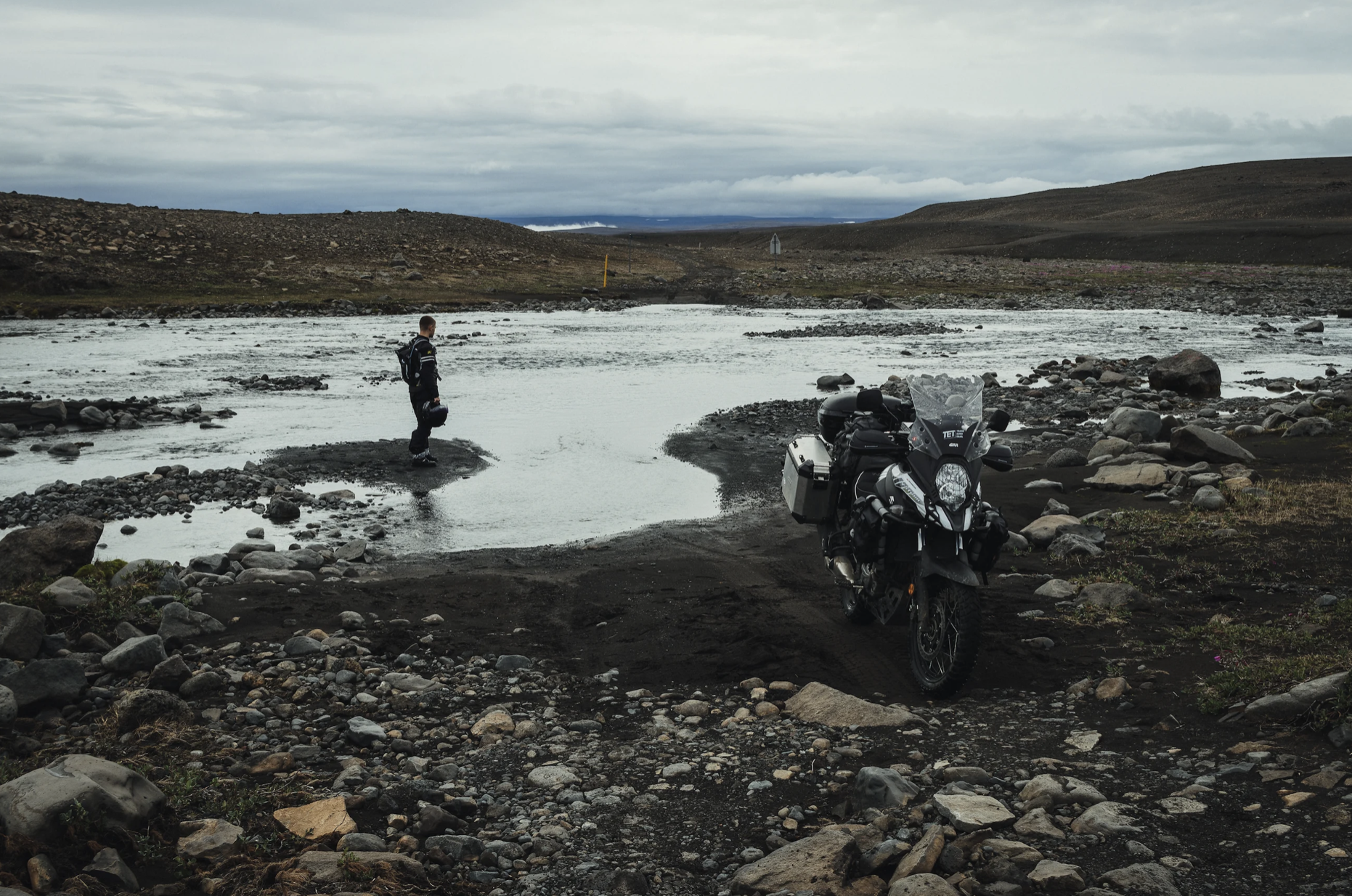
My third river crossing. This time it’s so hard-core I’m not certain I should do it. While walking across the river I can’t find a trail where water doesn’t flow down into my boots; I tape them around in two places: at the top to the leg, then I slide the pant legs down and tape them to the boots. The riverbed is deep and squelchy. It takes me two tries to find a good route across; it’s not straight, it curves from side to side. The time is 9 pm, so it’s too late to turn back now. I take the cases off and walk the bike across.
First, I take the left side over the stones; it’s shallower there. Then I veer right to get to the other side of the trough made by cars in the riverbed. One mistake and the bike could fall over, with water flooding the engine and ending the entire trip. About half way through the river it gets deeper, but there’s a shallow spot right after that. When I get there, the bike stops. A layer of small rocks covered cloggy sand — the wheels fell in and the bike hangs on the skid plate. If I accelerate, the wheel just spins above the ground.
I’m stuck.
I try to pull the bike back and forth, but it doesn’t get me anywhere. After all, it weighs 230 kilograms. I began to panic; I don’t know what to do. I haven’t seen a soul for the past several hours, and the chances of someone coming through at this time are close to zero. I wonder if I should wait, or leave everything here and walk to Laugafell, 5 kilometers away. Someone would help me there, for sure.
But I still have some strength left and I don’t want to give up. I’m holding the bike with one hand, and with the other I’m trying to dig out as much sand and rocks from under the engine and wheels as I can. One side first, then I walk the bike around and do it from the other side. The river current keeps carrying in more silt, so digging out isn’t easy. When I finally have some clearance under the engine, I start the bike, accelerate and begin moving. The tires get some traction and I ride out of the shallow onto the shore. I made it. Now it’s just a matter of three trips on foot this way and back to get the cases and I’m good to go.
My last crossing before Laugafell is easier. I take off the cases and ride across, standing.
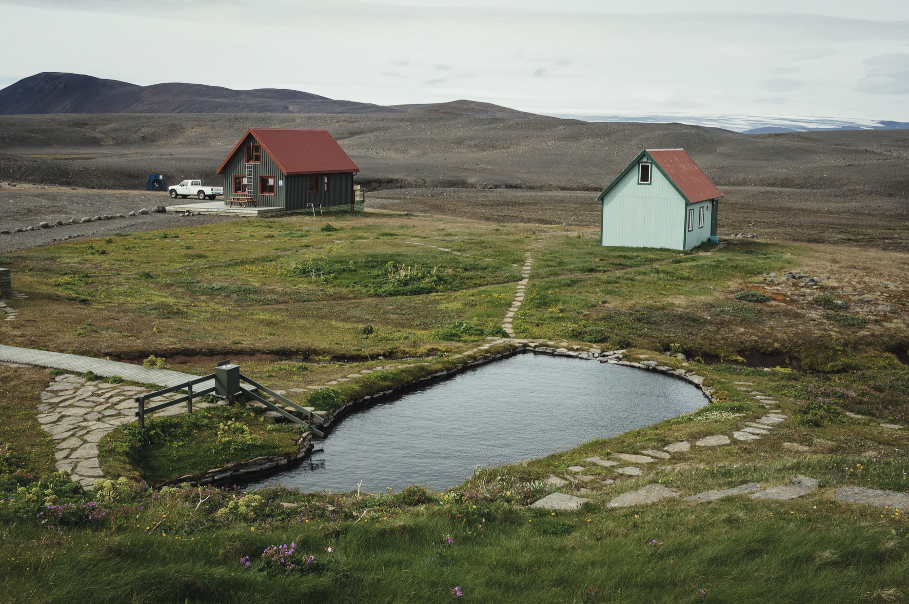
Laugafell
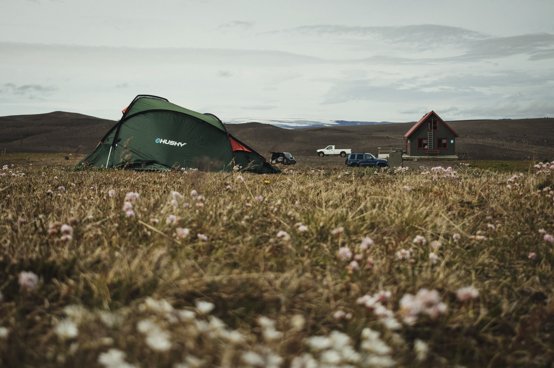
The Laugafell campsite is not part of the Campingcard network. One night is 2,000 ISK. There are a lot of empty spaces around the site, so nothing blocks the strong winds which make it hard to set up the tent. But there is a hot spring! It’s good to relax after a rough day. The water in the spring is about 38-40°C, but you don’t really feel it. I’d probably prefer it even warmer. There are a few other people in the spring; we’re having beers and talk about what we’ve already seen in Iceland, and what’s left to visit. After an hour I get cold, so I get out of the water and into my sleeping bag. I realize I saw no other bikers on the trail today.
Day 12: Route F821, Dalvík
In the morning I wake up tired and I don’t feel like getting up. One night was definitely not enough to recover. I leave the tent only around 11 am. I meet an older German couple who are on a five-week trip here in an RV. They invite me inside, show a map and recommend the places they’ve seen. I mark a few on my phone. It’s 12:30 pm by the time I leave the campsite.
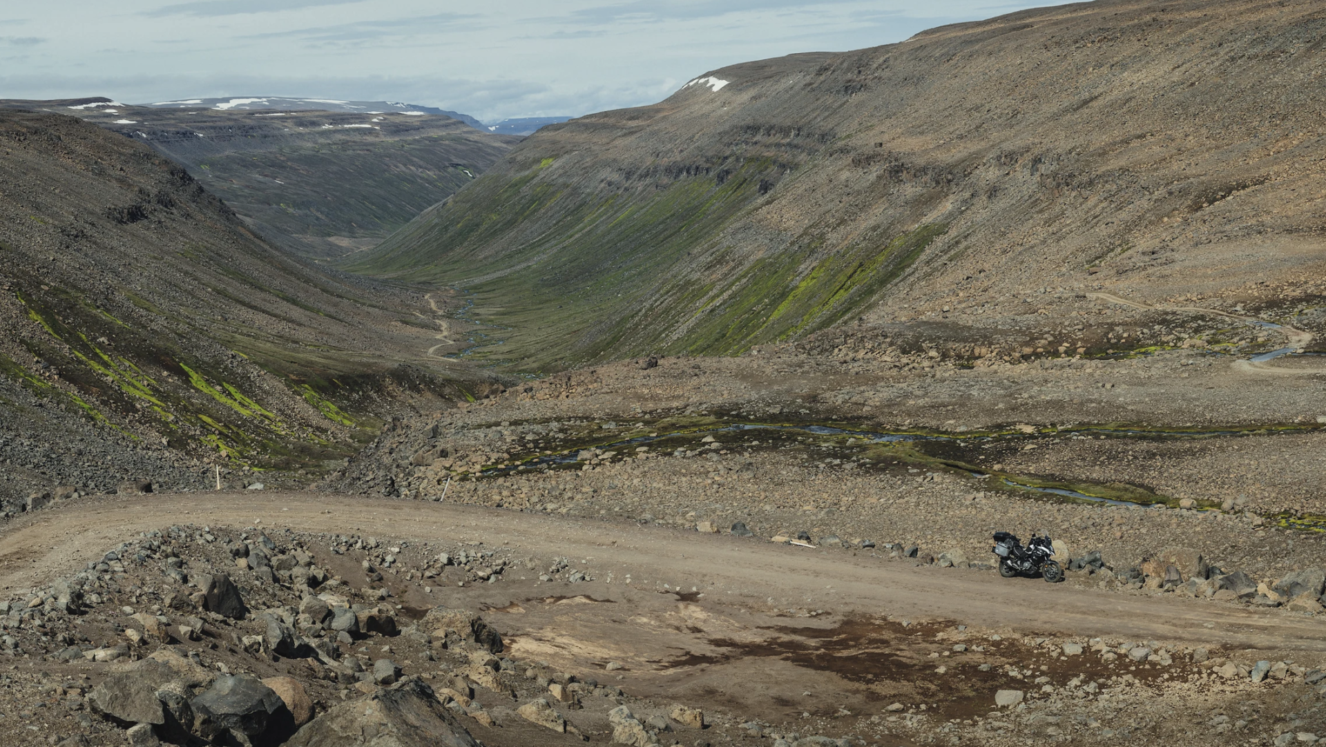
Route F821
There’s a river crossing right beyond Laugafell. Yesterday’s trials made me confident, so I don’t even take the cases off; I just cross the river standing. For the next several dozen kilometres I’m passing utter wasteland. Nothing but sand, rocks and gravel all around. Behind me, on the horizon, there’s the Hofsjökull glacier, Iceland’s third largest.
And this is what it looks like when you try to eat an apple in a strong wind in the desert.

Further on, there’s a steep ride down to a stream. There are three bikes riding the other way. In a group, they’ll have a much easier time crossing the rivers I fought the day before, and if something goes wrong, they’ll have each other to help. It’s good to see another single-track vehicle once every two days ...
The trail along the stream is interesting, but demanding. There are quite a few crossings, although none of them very deep. The rocks and gravel are the biggest problem. As I ride and enjoy the views, I pay less attention to what’s going on under the wheels, and I get into a thick patch of gravel, which ends in my front wheel slipping and me falling over to the right. Luckily, other than bumping the aluminium case, there’s no damage.
Late lunch break around 4 pm. It’s warm, over 20°C, so I take off my boots and cool off my feet in the stream.
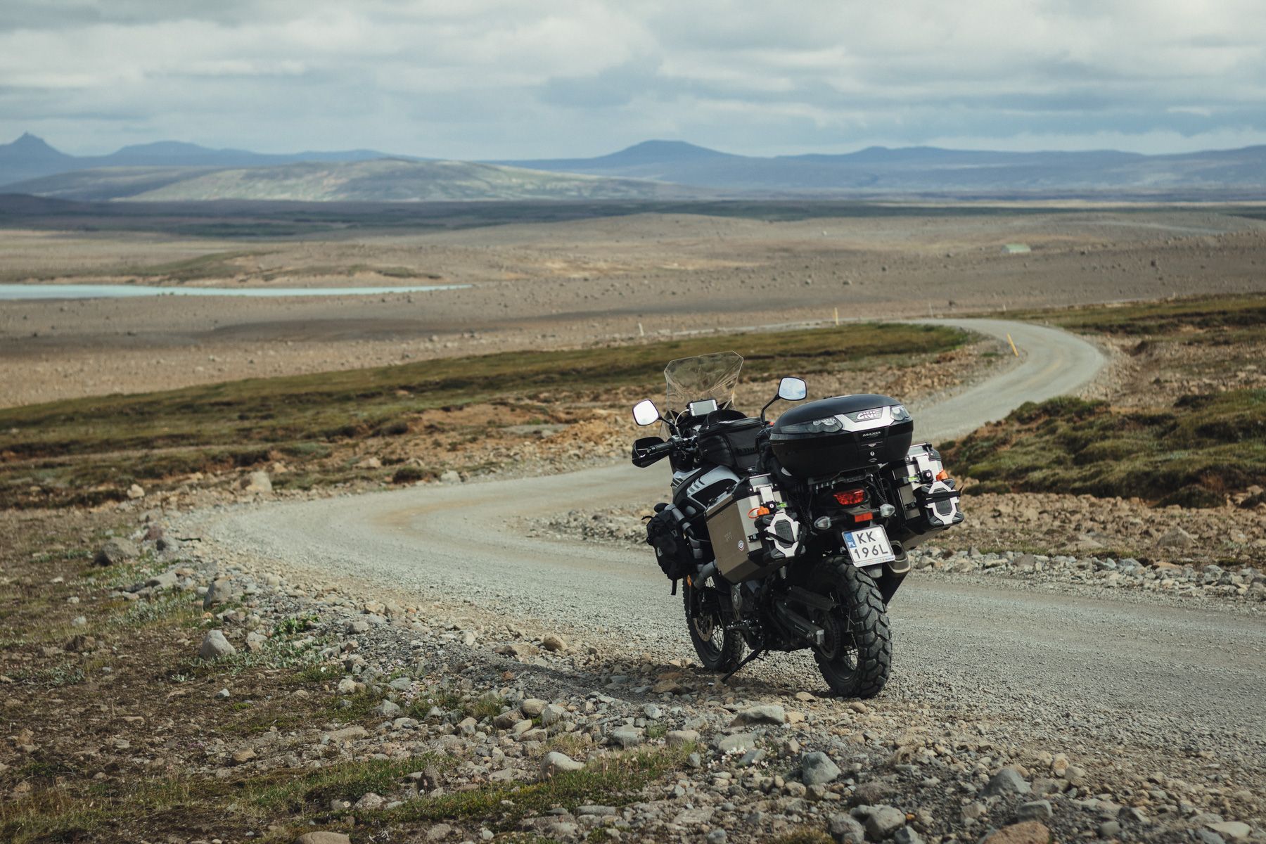
About an hour later I get back onto tarmac and start looking for a campsite. Route F821 was much easier than F752. I’m not far from Akureyri, but there are no Campingcard campsites, so I ride 45 kilometres further to Dalvík.

Dalvík
I meet a few Poles at the campsite. One of them has been living in Iceland for some years, and he tells me stories about extremely high speeding tickets and lots of speed traps, so I’m even more worried about getting a ticket for my sprint from Seyðisfjörður to Reykjavík. I spend a good part of the night reading articles on speeding tickets, and it doesn’t look too good.
My plan for the next couple of days is to take the northern coast towards the Westfjords, visiting some interesting spots on the way.
Photography: Damian Watracz
#FORYOURRIDINGPLEASUREONLY